Hot Start To Fall
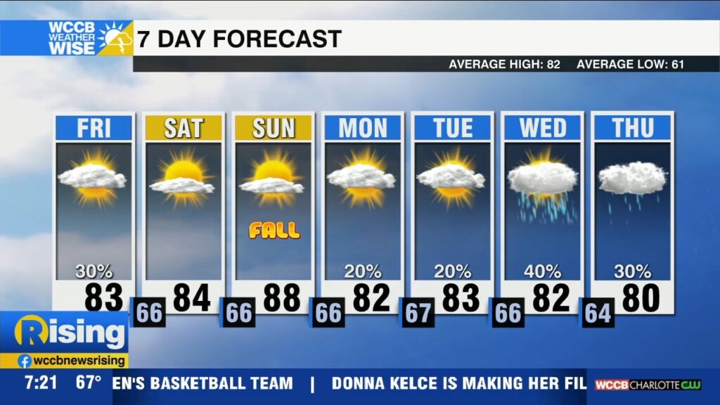
High pressure will lead to a dry, but much warmer weekend with highs pushing 90 by Sunday for some areas.

High pressure will lead to a dry, but much warmer weekend with highs pushing 90 by Sunday for some areas.
Starting the morning with patchy fog and drizzle, but clouds will begin to break this afternoon with a sunny and dry weekend ahead.
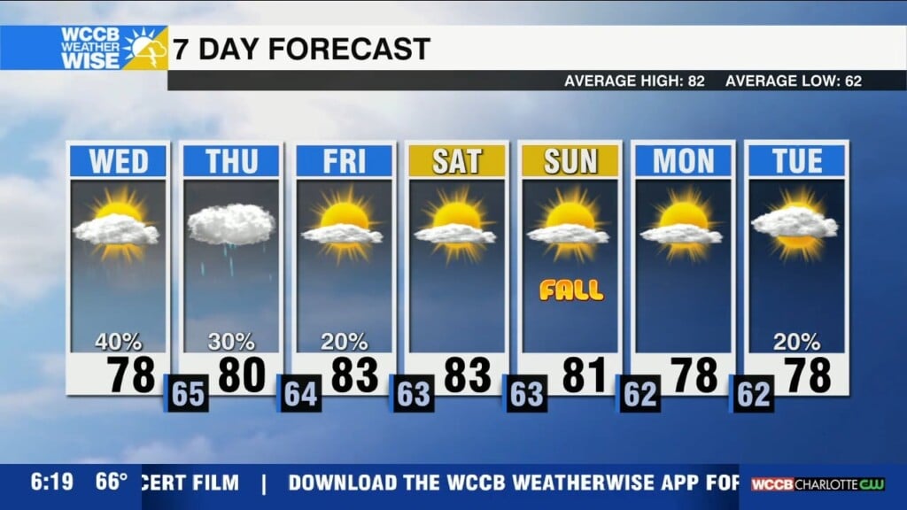
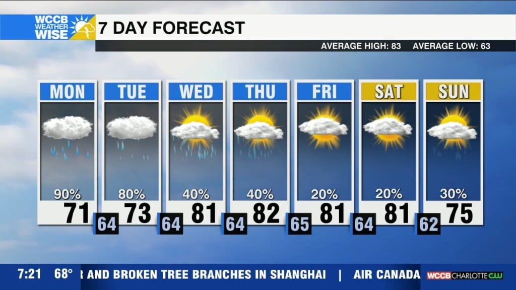
The pesky low pressure system will keep more clouds and a few showers in the forecast once again today. Changes coming late week with a sunny and pleasant weekend outlook.
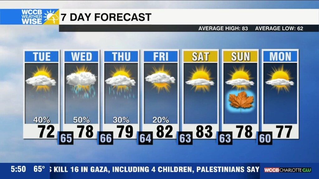
Flood Watch remains in effect until 8am for the Charlotte Metro area as the remnants of Potential Tropical Cyclone 8 hang over the region, bringing more scattered showers and keeping temperatures cool Tuesday.
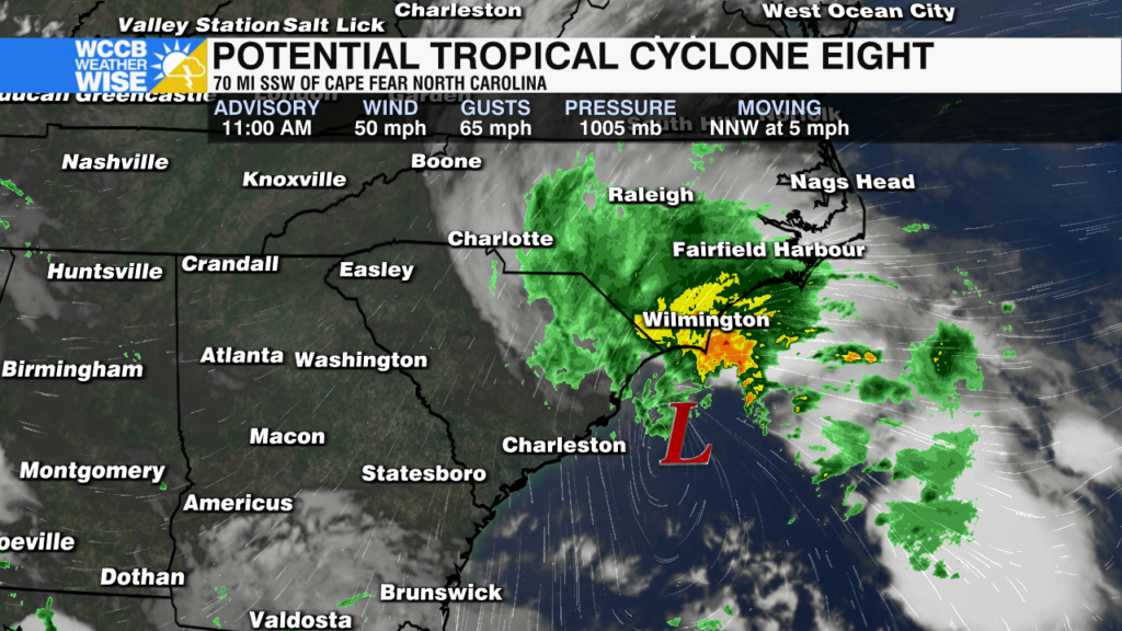
A disturbance off the South Carolina coast will likely lack tropical characteristics before moving inland. But, regardless of becoming a named storm it will bring heavy rain and gusty wind to the region beginning Monday afternoon.
A low pressure system off the Carolina coast could become Tropical Storm Helene today. But, regardless of development into a named storm, it will bring heavy rain, potential flash flooding and gusty winds through early Tuesday before weakening and dissipating over the region midweek.
Cloudy today with highs in the lower 80s. Shower and storms begin overnight through the start of the weekend as moisture from Francine pushes into the region.
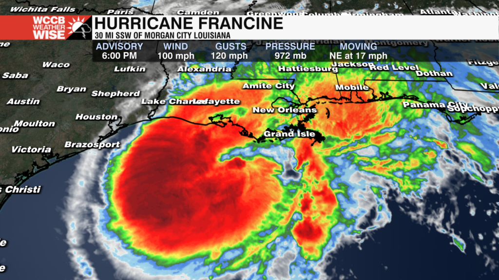
Impacts from hurricane Francine will continue to spread across Louisiana through Wednesday evening
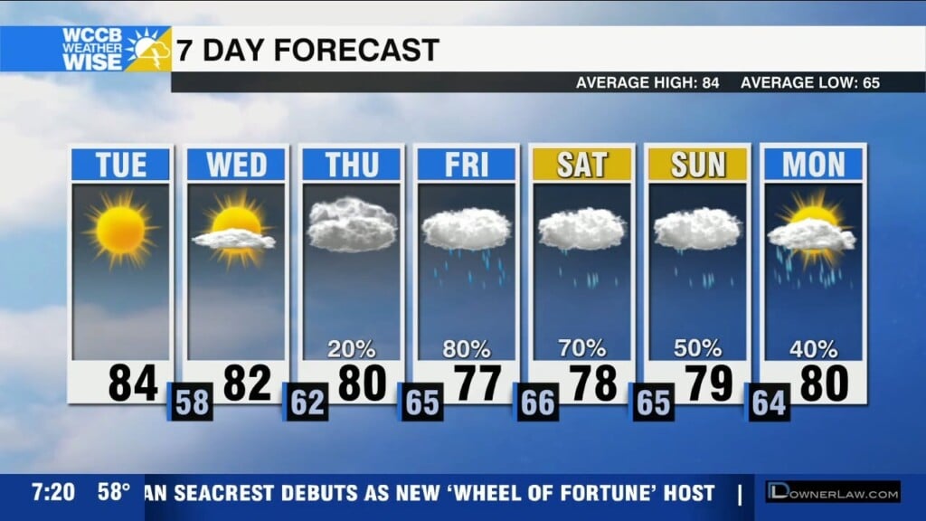
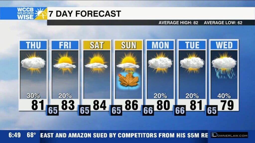
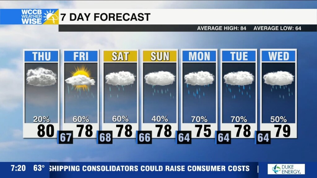
Pleasant and sunny through midweek. Rain and cooler temps arrive Thursday as tropical moisture from Francine moves into the region.
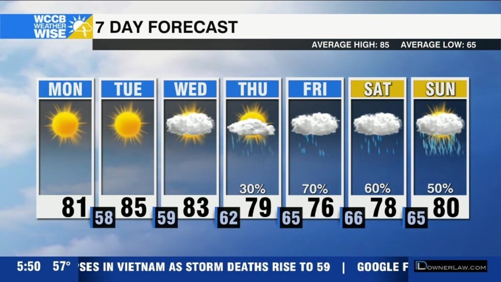
Cool and dry to start the week with highs below normal in the low 80s. Rain chances increase late week as tropical moisture moves in.
 Formerly Twitter