Unsettled And Cooler End To Week
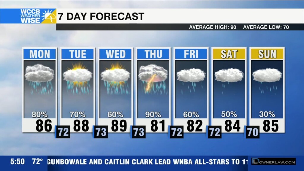
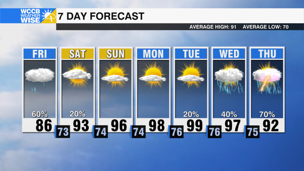
Scattered showers this morning, with more rain and storms this afternoon likely with highs in the low to mid 80s. Isolated flash flooding risk with rain chances continuing through early Saturday.

Scattered showers this morning, with more rain and storms this afternoon likely with highs in the low to mid 80s. Isolated flash flooding risk with rain chances continuing through early Saturday.
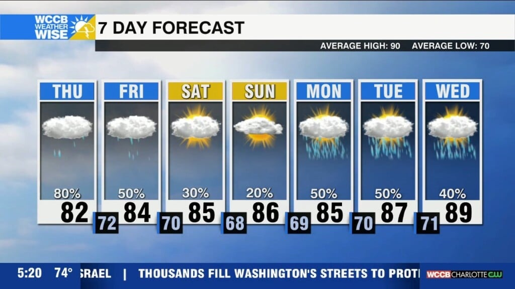
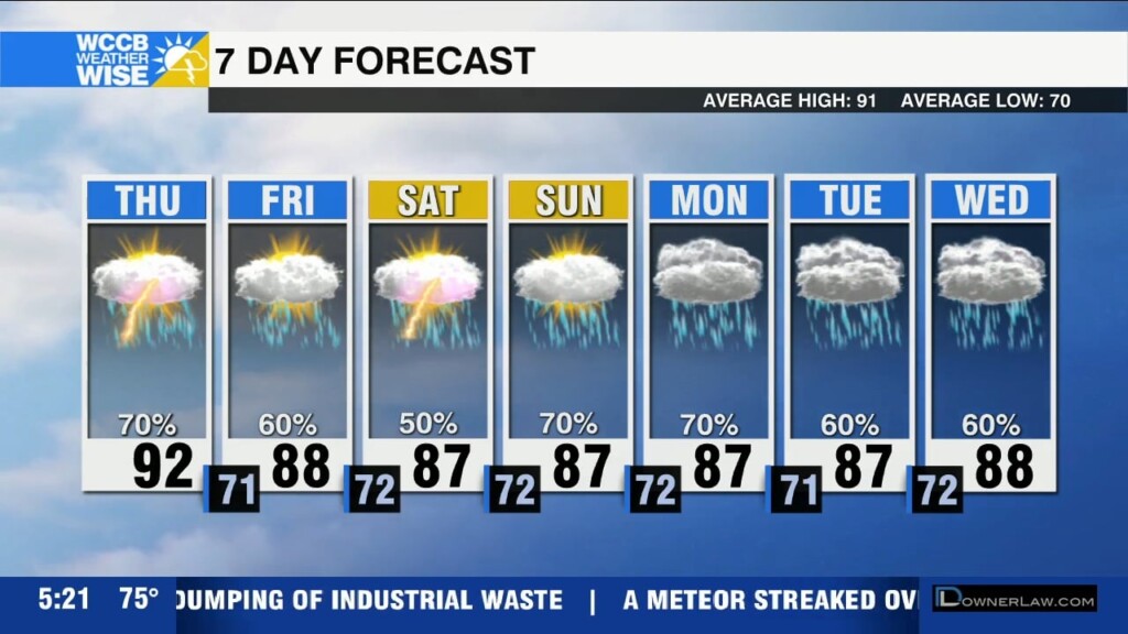
A stalled front will produce more scattered afternoon showers and storms with highs reaching the low 90s Wednesday. Flooding threat increases Thursday as an approaching front enhances the risk of strong storms and heavy rain.
A stalled front will lead to more rain and storms through the end of the week. Expect 2-3" of rainfall through the end of the week with the potential for flash flooding due to training storms or extreme rainfall rates.
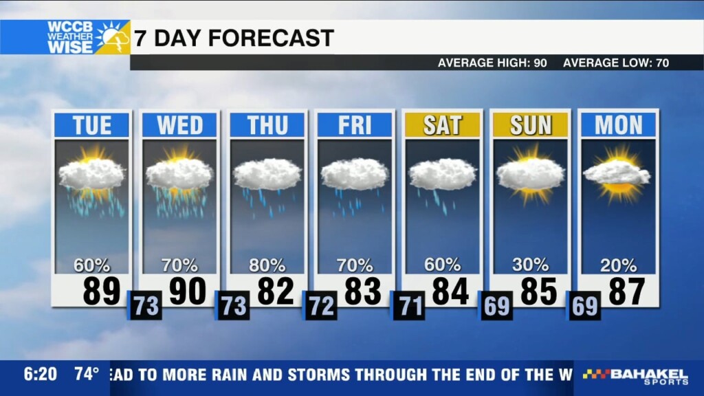
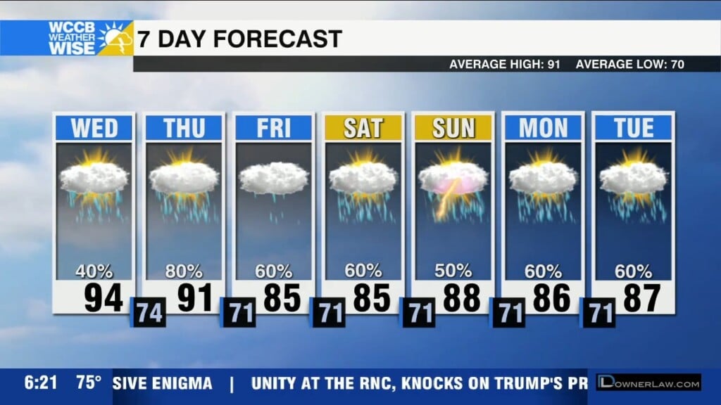
Scattered showers and storms today with temperatures a few degrees cooler than normal. Heavy rain and localized flooding possible through the week as the unsettled pattern pattern persists.
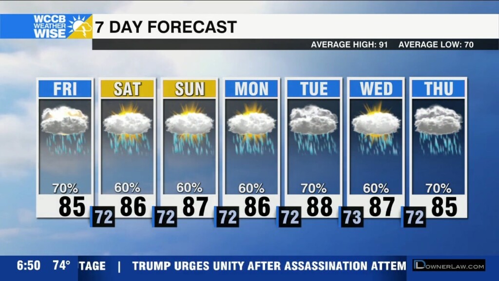
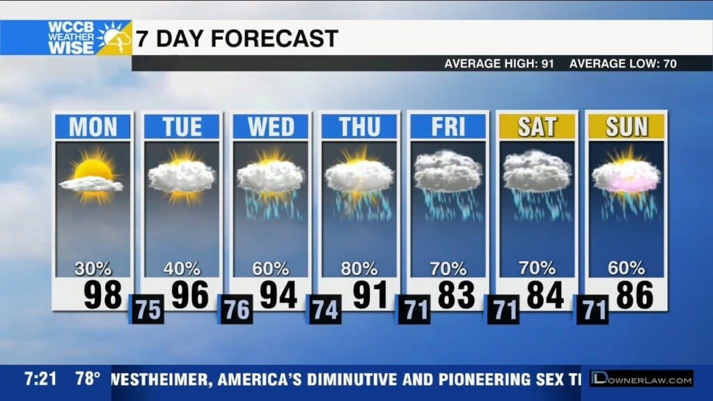
A stalled front will bring numerous showers and storms through the weekend and into early next week, along with cooler than average temperatures.
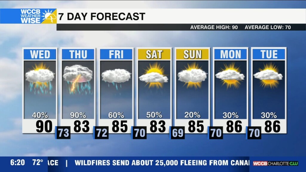
A cold front will bring widespread rain and storms to the region today. This begins an unsettled pattern as the front stalls out leading to numerous to widespread showers and storms through early next week.
Hot and humid with scattered afternoon storms, and highs in the mid 90s, but it will feel more like the triple digits. Changes coming with a cold front that will stall across the region leading to cooler temperatures and increased rain and storm chances.
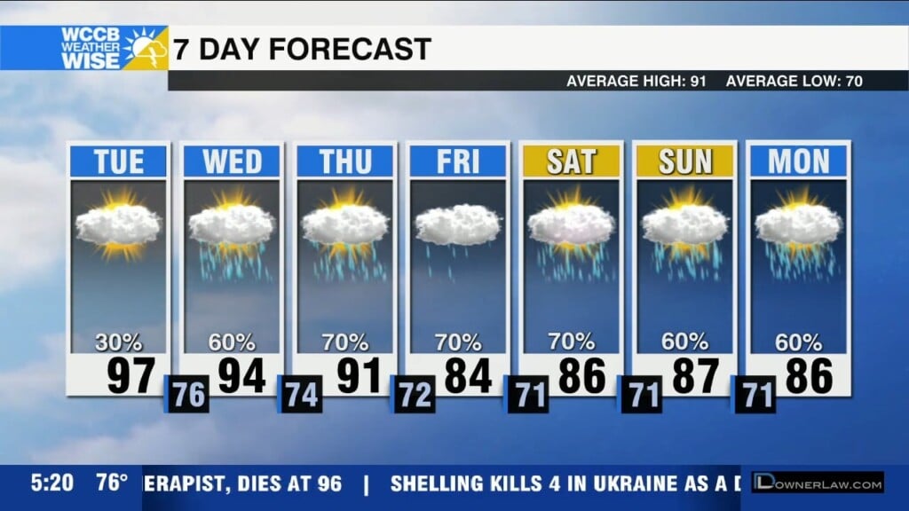
Hot and humid today as heat index values approach 105-107+. Scattered afternoon storms will also be possible. A cold front will bring relief to the heat and increased rain and storm chances mid-week.
Hot and humid start to the week with heat index values 105+ possible across the region with scattered afternoon storms. A cold front will bring some relief from the heat, but also more unsettled weather with showers and storms.
A weak tropical low brings showers and storms to the region today and a localized flooding threat possible for areas east of I-77. This weekend will be hot and humid with highs back in the mid 90s.
 Formerly Twitter