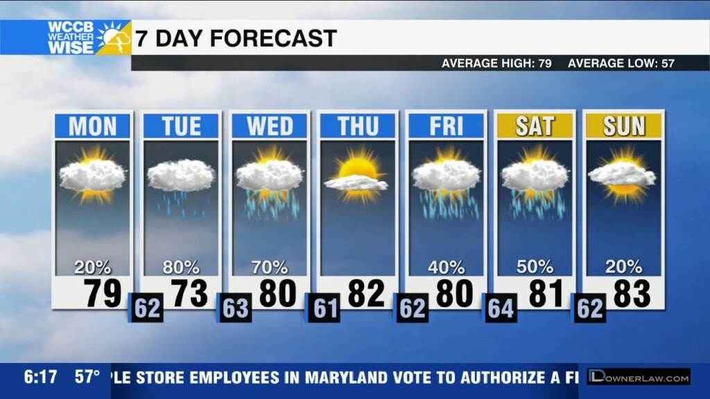
Heating Up
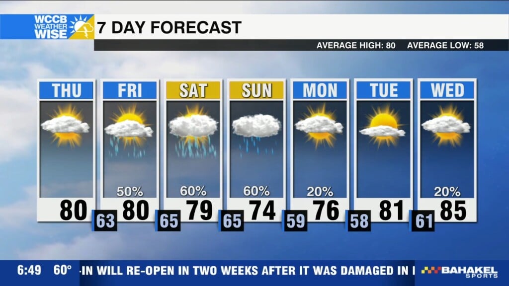
Heating up through the end of the week. Unsettled weather returns for the weekend with rounds of rain and storms.

Heating up through the end of the week. Unsettled weather returns for the weekend with rounds of rain and storms.
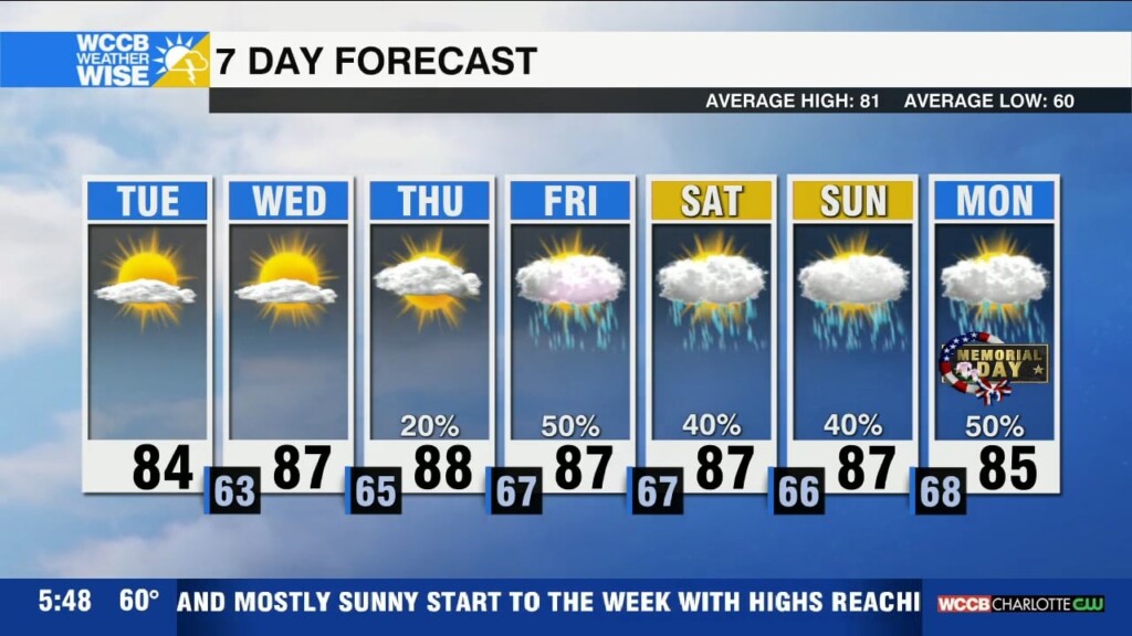
Warm and mostly sunny start to the week with highs reaching the mid to upper 80s by mid-week.
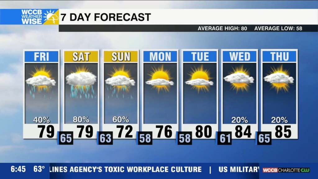
Unsettled weather returns for the weekend with numerous showers and thunderstorms. Isolated severe threat Saturday afternoon with damaging wind and flooding the biggest concerns.
A dense fog advisory is in effect until 10am for parts of the Piedmont. Once the fog lifts, we're in for a dry and warm afternoon, but prepare for more rain and storms this weekend.
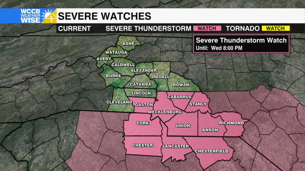
A severe thunderstorm watch has been issued for parts of the WCCB viewing area this afternoon. Potential threats include golf ball sized hail and damaging gusts of 60-70 mph.
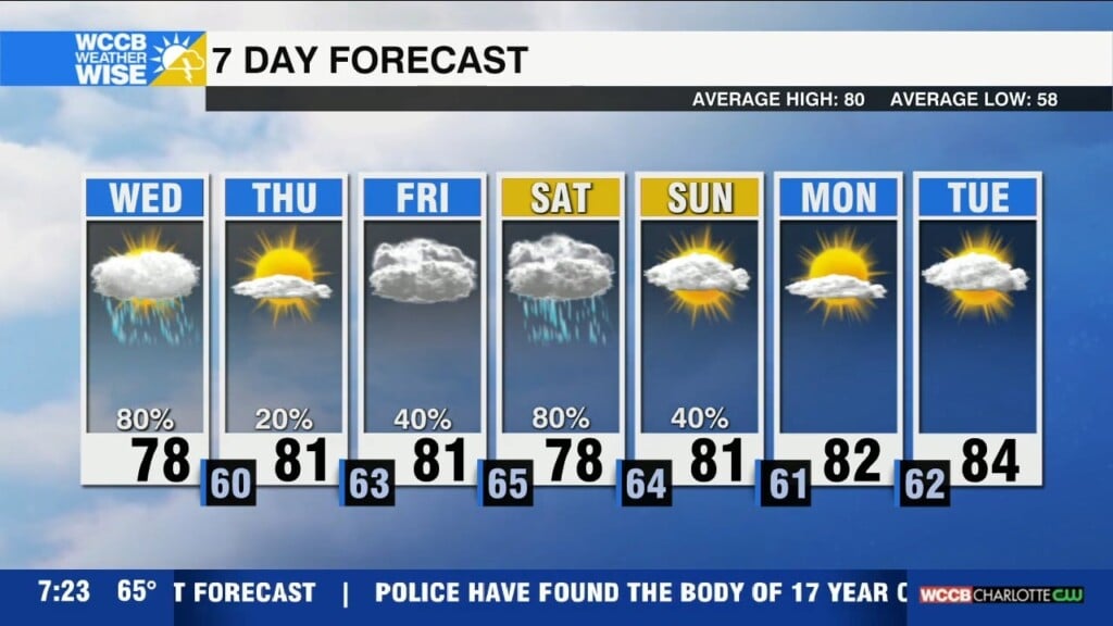
Expect fog and drizzle this morning with the potential for strong to severe storms this afternoon. Thursday will be dry, but more unsettled weather arrives Friday through the weekend.

These critical aid flights transported more than 45 tons of urgently needed items such as community water filtration systems, household water filters, blankets, hygiene kits, solar lights, and more to the flood-stricken country.
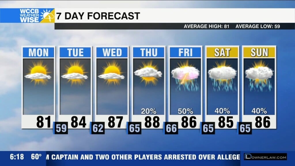
Scattered to numerous showers and storms through Wednesday. Isolated severe threat with damaging wind, large hail and localized flooding the biggest concerns.
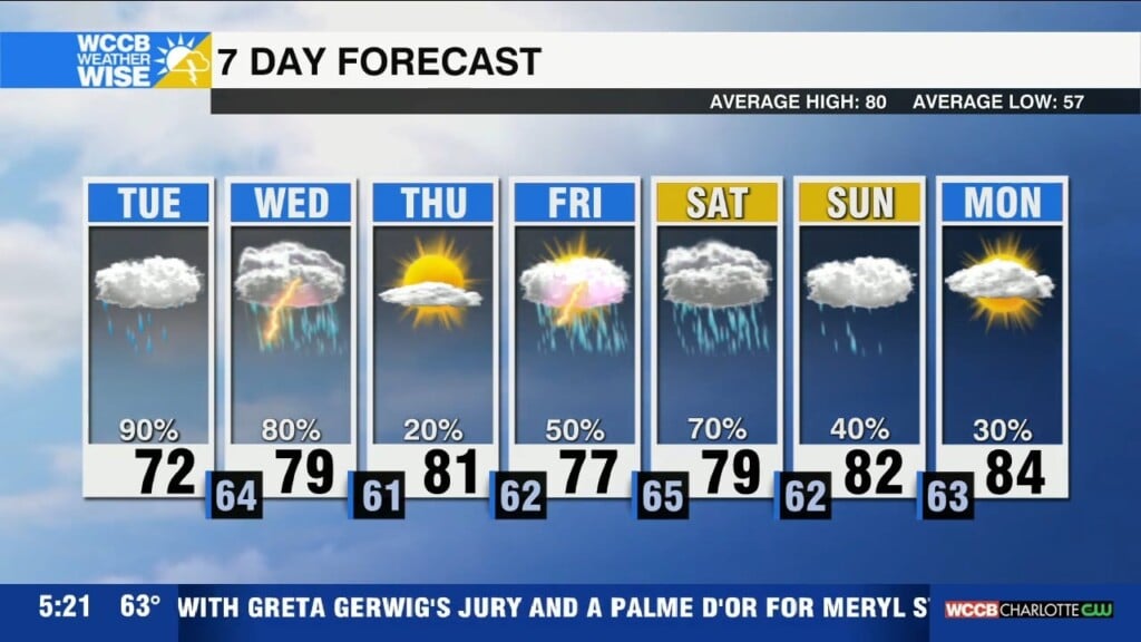
Prepare for a week of unsettled weather as clouds fill in throughout the day Monday. Strong to severe storms possible Tuesday and Wednesday.
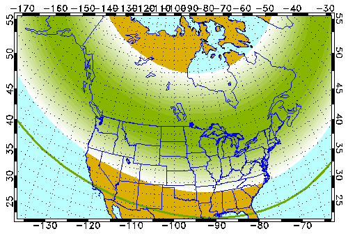
The aurora borealis may be seen as far south as the Carolinas Friday night.
 Formerly Twitter