Cooler and Breezy Thursday
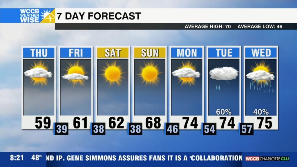
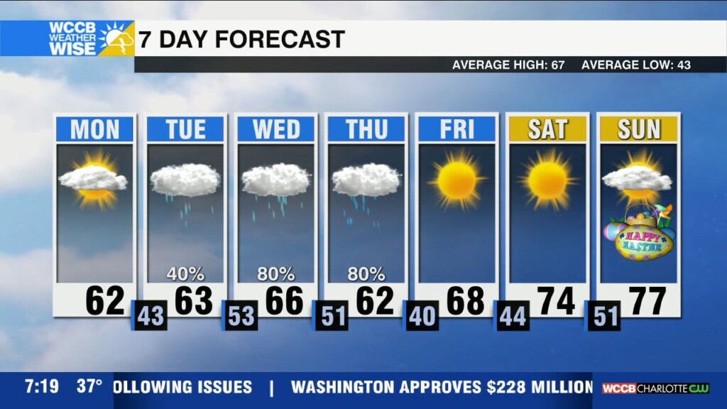
Today will be cooler and breezy with a chance for mountain snow showers, followed by a gradual warming trend leading into next week with temperatures climbing back into the 70s.

Today will be cooler and breezy with a chance for mountain snow showers, followed by a gradual warming trend leading into next week with temperatures climbing back into the 70s.
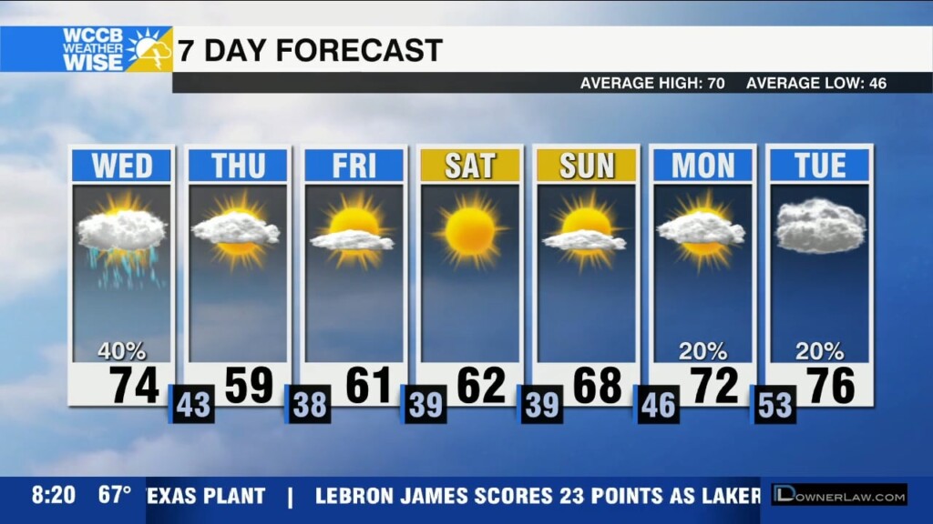
Much colder air will slide in with winds picking up through the day today after a strong cold front passes east of the area.
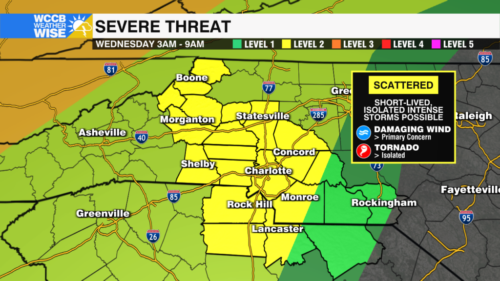
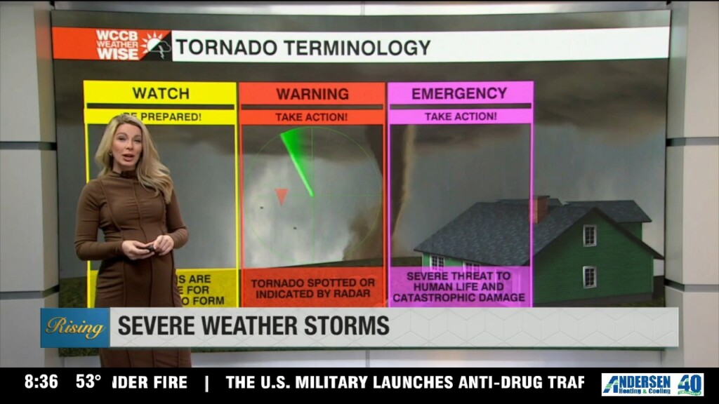
Brief severe storms possible overnight into early Wednesday morning ahead of a strong cold front.
WeatherWise Alert overnight into Wednesday morning for a few strong to severe storms capable of producing damaging wind, hail and isolated tornadoes. Much colder temperatures to follow.
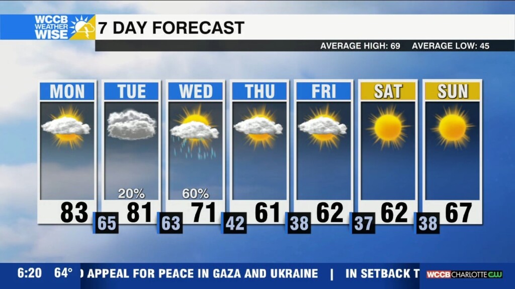
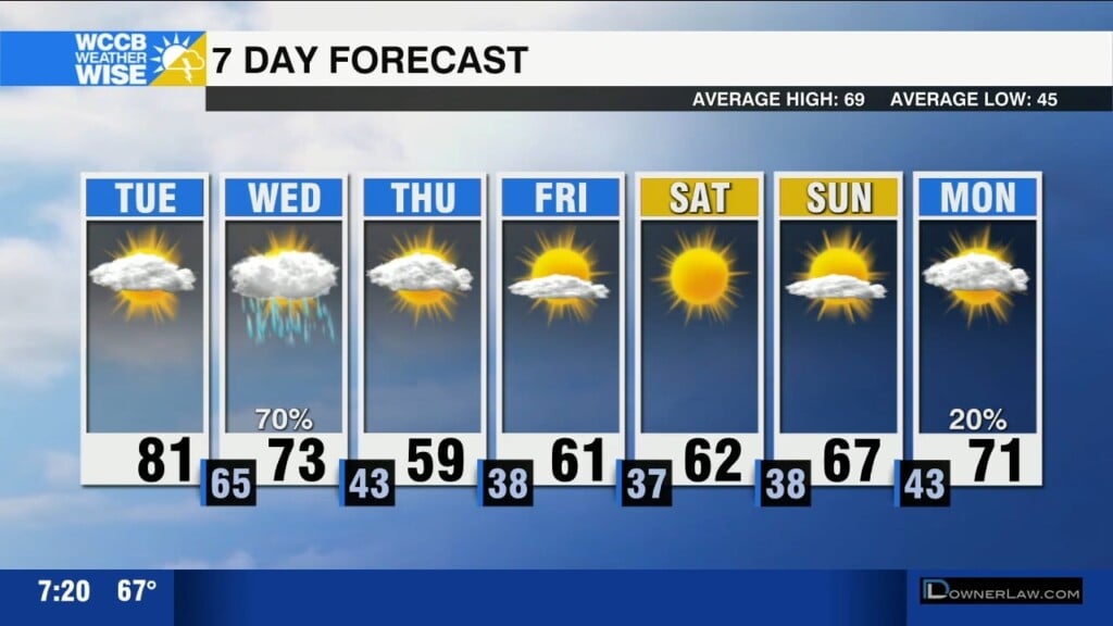
Expect a warm start to the week with temperatures soaring into the 80s before a midweek cold front brings showers, storms, and a significant cool down.
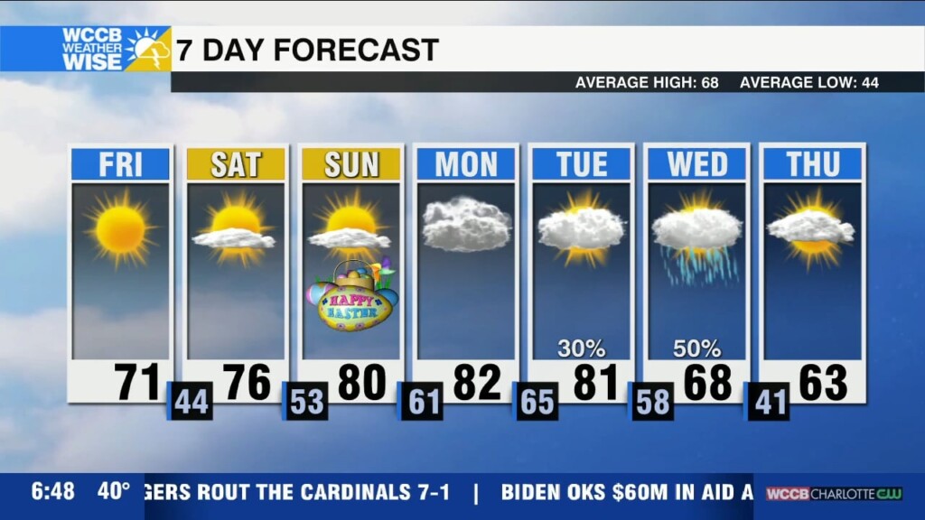
Warming up for the holiday weekend with temps reaching the low 80s by Sunday.

Rain clearing out this morning with a sunny and breezy day ahead. Warming up with a pleasant weekend forecast as temps climb into the 80s.
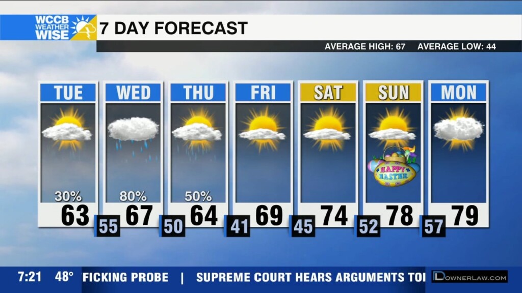
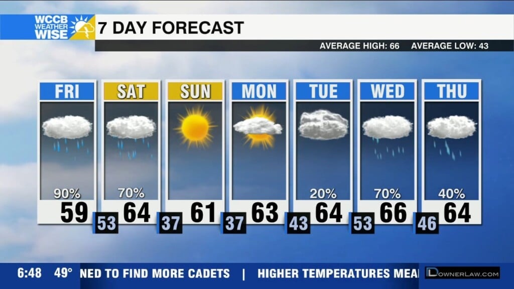
Rain will move in across the area from west to east through the afternoon and evening. Expect scattered showers through Wednesday with a drier and warmer forecast this weekend.
Increasing clouds with slightly below average highs today reaching the low to mid 60s. Increased fire danger possible for the NC mountains with drier air and SE winds 15-20 mph and gusts 30-40 mph. Unsettled pattern setting up mid-week.
WeatherWise alert today with widespread rain and cooler temps through Saturday. Drying out Sunday into Monday with unsettled weather returning early next week.
 Formerly Twitter