Flash Flood Watch Ahead of Ida
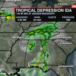
Ida will be tracking just north of the WCCB viewing area Wednesday, but that doesn’t mean there won’t be any impacts for the Carolinas. Ida has produced several flash flood emergencies over the last 48 hours, producing more than a foot of rain across portions of Louisiana and Mississippi.

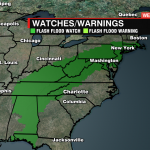
A Flash Flood Watch extends from the Florida Gulf Coast to Massachusetts as Ida eyes a more northeastwardly turn later this afternoon.
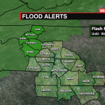
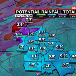
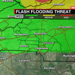
Locally, Ashe, Avery, Burke, Caldwell, and Watauga Counties are under this watch through Wednesday afternoon. Rainfall totals of 1-3″ will be possible for the higher elevations. Rain will begin late Tuesday afternoon with several rounds of storms possible through Wednesday.

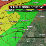
Although this watch does not extend south of I-40, anywhere that heavy downpours train could lead to localized flooding across the Piedmont, especially for poor drainage and flood-prone areas.
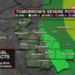
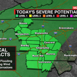
As with any tropical system, the severe threat will remain elevated with isolated tornadoes possible.


