Severe Thunderstorm Watch Issued For Parts Of The Region
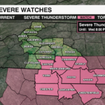
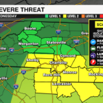
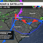
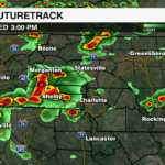

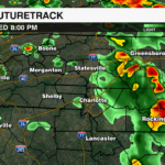

A Severe Thunderstorm watch has been issued until 8pm for parts of the WCCB viewing area. The area highlighted by the storm prediction center is for a region near and to the south of a warm front that is positioned near the NC/SC border. This is where we will likely see the most instability and therefore the greatest severe threat as a disturbance pushes east this afternoon.

WHEN: Wednesday 2-8pm
WHERE: Generally near and south and east of I-85
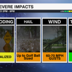
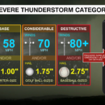
GREATEST THREATS: Damaging Wind, Hail, Localized Flooding

As temperatures continue to warm this afternoon, instability will increase. There is plenty of moisture in place and shear is sufficient to support organized storms and even the potential for supercells. The main threats will be for discrete cells capable of producing up to golf ball sized hail and large clusters of storms that could form into bowing segments that will be able to produce damaging wind gusts of 60-70 mph. These storms will begin to fire up from the west to the east over the next few hours.
The ground is saturated after heavy rain Tuesday. These storms will also be capable of producing heavy downpours that could also lead to a localized flooding threat.
Stay WeatherWise this afternoon. Download the WCCB Weather App for all the latest updates.


