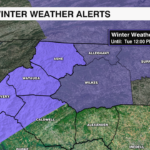
Winter Weather Advisory in effect tonight as freezing rain is expected across the mountains
The greatest impacts will be slick roads, especially on bridges, overpasses, walkways and sidewalks as 0.25'' of ice is possible.

BOONE, NORTH CAROLINA — An area of high pressure moves across the northeast Monday bringing the Carolinas a cold start to the week. At the same time, an area of low pressure will develop along a front off the Gulf Coast. This will put us in a cold air damming event, plus bring rain and freezing rain to parts of the area.
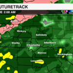
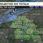
A Winter Weather Advisory is in effect from 7 pm Monday until 12 pm Tuesday. Moisture will move in late Monday night, overnight into Tuesday. A wintry mix could kick off the onset of precipitation across the mountains, but that will quickly transition to freezing rain for Ashe, Watauga and Avery counties along with the eastern facing slopes. Accumulating ice is possible between 11 pm and 4 am as surface temperatures remain below freezing. Ice totals as high as 0.25” are possible which could cause isolated power outages. The greatest impacts will be slick roads, especially on bridges, overpasses, walkways and sidewalks.
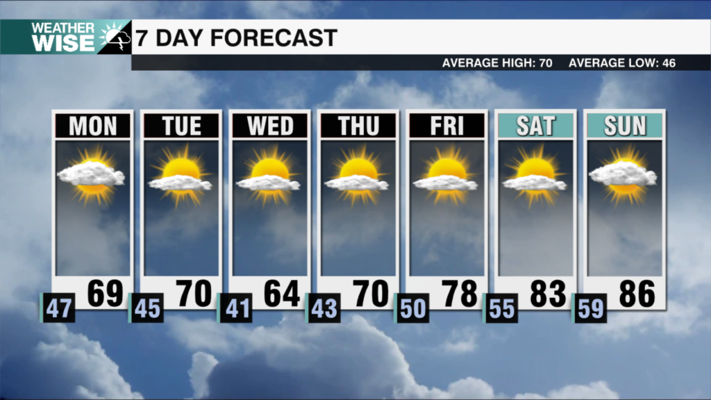
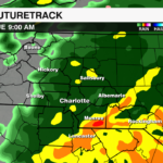
 This will be a cold rain event for Charlotte with moisture moving in around midnight and exiting the area by midday Tuesday. Some neighborhoods will pick up an inch of rain. Dry conditions will move in late Tuesday and stick around until our next system rolls in Friday.