CHARLOTTE, NORTH CAROLINA — The WCCB Charlotte weather team is watching a more favorable pattern for wintry weather in the Carolinas this weekend. Several inches of snow is likely across the Carolinas, but there are still uncertainties in exactly how much snow will fall.
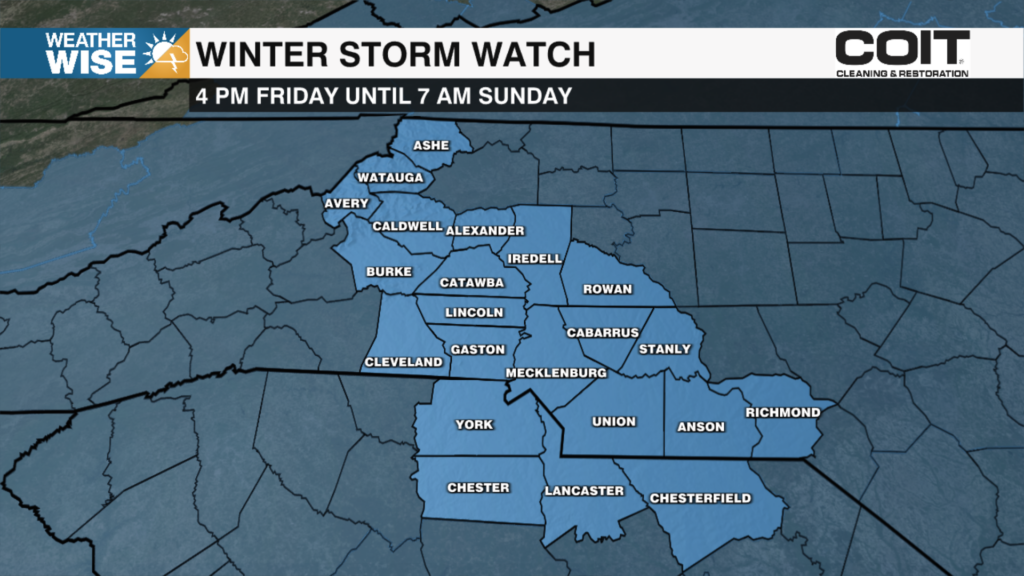
The National Weather Service has issued Winter Storm Watches across our entire area in effect from 4 pm Friday until 7 am Sunday.

THREE BIG THINGS
- Snow chances trending upward across Carolinas
- Where do heavy bands of snow set up? And where does dry air (dry slot) move in?
- Don’t put much stock into totals yet

TIMING
- All day Saturday
KEY POINTS
- Cold air will be in place top-to-bottom
- Highs in 20s for most Sat
- Farther NE one goes in Carolinas = better snow chances
- Snow “bullseye” is currently located over NE NC
- There are still uncertainties
- Storm system hasn’t even formed yet
- IF the coastal low tracks farther offshore, we will end up with low snow totals
- Someone in the Carolinas could get “dry slotted” meaning dry air will lead to lower totals

UNKNOWNS
- Track of the system – how far inland or offshore does the low pressure track?
- Minor shifts in the storm’s track will lead to major changes in the forecast
- Southeast trends in models are still very possible
- Strong Arctic ridge of high pressure & robust upper-level low could suppress the storm’s track out to sea
- Dry air could be an issue on the northwest side of this system
- Downsloping winds may keep the Foothills & western Piedmont drier than the rest of the Carolinas
- Accumulations
- Don’t put much stock in crazy model totals posted on social media
- The forecast will become clearer as short-range model data comes in
POSSIBLE TRACKS
- The low pressure tracks farther offshore and we stay dry
- The low pressure moves along the Carolina coastline and we get snow
- This is the more likely scenario right now

BOTTOMLINE
You’re probably going to see some wild snow totals on social media. Please ignore them. The storm system hasn’t even formed yet. What we can tell you right now is: a) this will be a mainly/all snow event for most & b) significant totals are possible, especially in NE NC.
The only thing you can constantly rely on in meteorology is change. There’s good model agreement between the American & Euro for now, but don’t be shocked if one or the other begins to trend in a less favorable direction for widespread snow across the Carolinas.
It’s better to play this conservatively right now. While the trend is definitely a snow-lover’s friend, it would be smart to temper down the optimism for now in the Foothills & western Piedmont. Dry, downsloping winds over the mountains could really cut into snow totals.
REMEMBER: Snow is hard to get in the Carolinas – especially in Charlotte. It’s been over four years since our last 1″ snowfall in the Queen City – EIGHT years since our last 3″ accumulation. While the trend looks very good right now, a lot can and will change. We’ll keep you weather-wise as we move into the weekend – look for our first-call forecast Thursday morning.