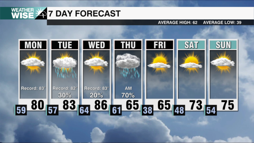
By Tuesday and Wednesday, the warmth really settles in. A surge of spring-like heat and humidity will build across the region as a storm system begins to organize to our west. Both afternoons will feel more like late April than early March, with highs reaching the low to mid 80s. If we get enough sunshine, daily temperature records will be challenged.
The pattern starts to shift on Thursday as a cold front approaches the region. That front will bring a noticeable cool down along with the chance for scattered showers during the day. Behind the front, a wedge of cooler air will settle in, keeping temperatures from climbing. Highs Thursday will struggle to get out of the mid 60s.
By Friday, the rain moves out and sunshine begins to return. Cooler and much drier air filters into the region, bringing temperatures back closer to what we normally expect for March. Afternoon highs will stay in the low 60s, and by early Saturday morning some spots could dip into the upper 30s.
Looking ahead to the weekend, the weather stays quiet and dry. Temperatures will begin another steady rebound, climbing back into the 70s with plenty of sunshine.
Spring officially begins Friday March 20th at 10:46 AM