PREPARING FOR PROLONGED HEAT MOVING INTO THE REGION
90s moving by Wednesday
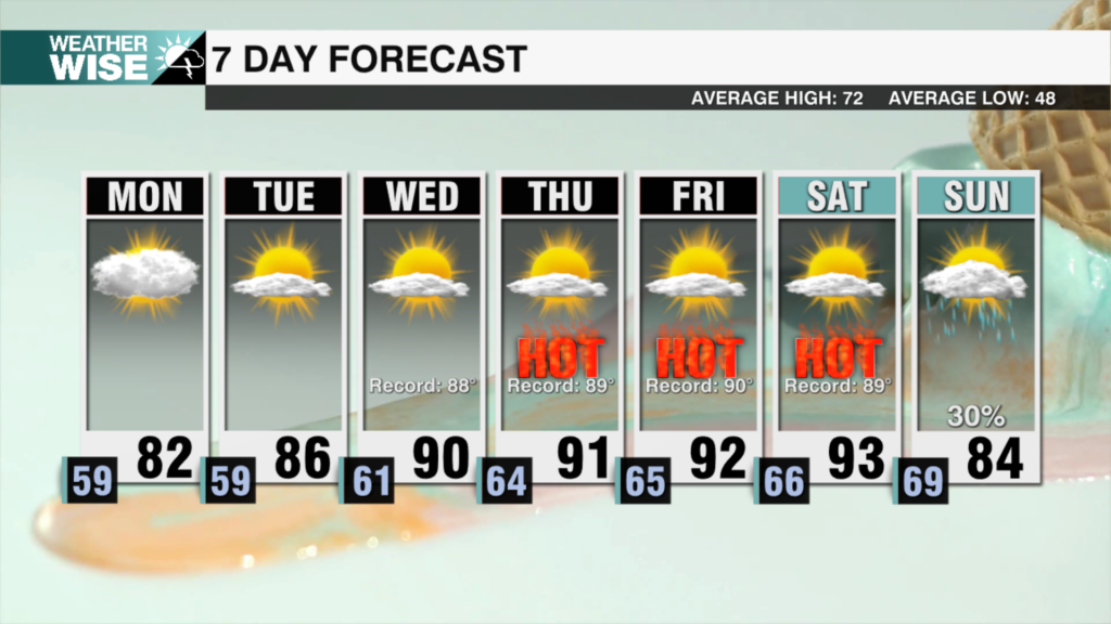
A strong ridge of high pressure will build overhead starting Tuesday, and that’s going to bring a noticeable and prolonged warm-up through the rest of the week and into next weekend. This isn’t just a brief spike in temperatures it’s an extended stretch of unseasonably warm weather.
Highs will climb into the upper 80s Tuesday each afternoon, with 90s expected Wednesday through Saturday. That puts us within striking distance of record highs on multiple days. Overall, it’s going to feel much more like the middle of summer than mid-April.
While 90-degree temperatures this time of year may seem early, it’s not without precedent. The earliest 90-degree day on record in Charlotte was March 17, 1945, so while we’re running ahead of schedule, it’s not entirely out of the ordinary.
Looking ahead to the end of the weekend, a cold front is expected to move through around Sunday. That should briefly bring temperatures back down into the 70s. However, early indications suggest the warmth may return quickly as we close out the month of April.