Strong Cold Front Arrives Late Friday Into Early Saturday
Strong wind, snow, rain and possible severe storms arrive to the region with a strong cold front late Friday into Saturday morning.
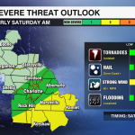

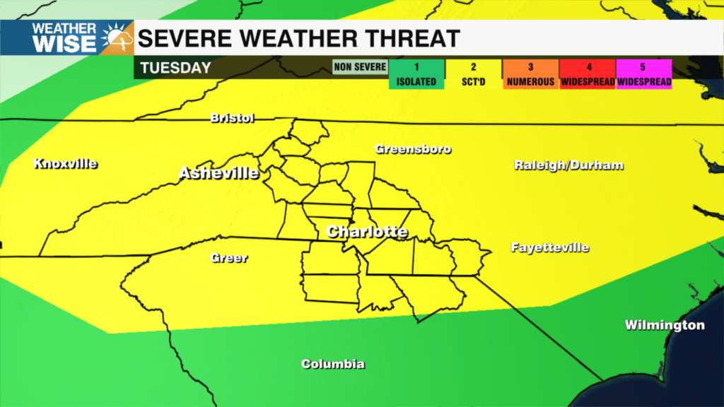
An intense cold front will bring an isolated severe weather threat to a portion of the WCCB Charlotte area Saturday morning. The severe weather threat is low, but not zero so be sure you have at least two ways to receive warnings.The big story after the cold front passes will be the widespread hard freeze on Sunday morning. People need to prepare to protect their plants and bring their pets inside.
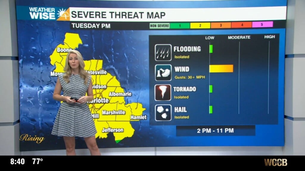
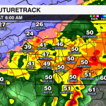
TIMING: The scattered showers will begin Friday evening, but the severe weather threat increases early Saturday morning. The timing of the heaviest rain and potential isolated strong storms is from 1 AM – 7 AM Saturday morning.
THREAT: The greatest threat for severe weather is southeast of I-85. Damaging wind is the primary threat. The tornado threat is low, but not zero. Localized flooding is possible especially in low lying and poor drainage areas. The overall threat is low.
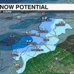
MOUNTAIN SNOW: Rain will transition to snow across the mountains early Saturday morning. Locations above 3,500 feet could see 2-4”+ with lower totals below 3,500 feet.
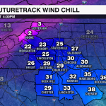
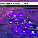
TEMPERATURES: Temperatures tumble in wake of the cold front. We will see a widespread hard freeze on Sunday morning with lows in the low 20s. Wind chills will be in the teens across the Piedmont and below zero in the Mountains.