Strong Front Saturday Morning Will Bring High Wind, Rain, Snow & Frigid Temperatures
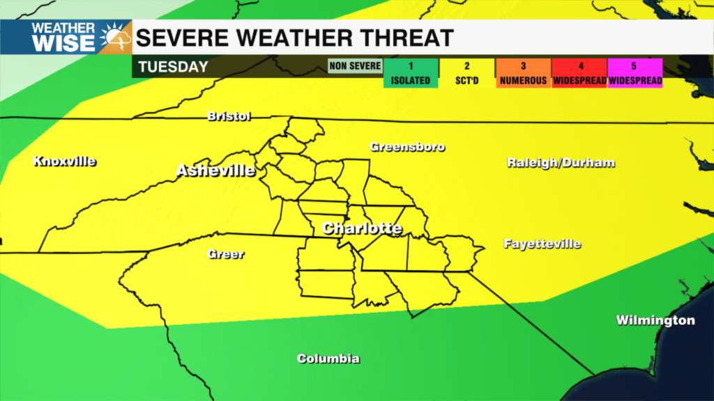
There is an isolated risk for severe storms early Saturday morning southeast of I-85.
A very strong front will move through late Friday into early Saturday bringing rain to the Piedmont, snow to the mountains, gusty winds and much cooler temperatures. There is an isolated chance for severe storms Saturday morning southeast of I-85. We wake up to low temperatures in the 20s on Sunday morning with wind chills in the teens across the Piedmont and below zero in the Mountains. An area of high pressure will build in behind the cold front which will dry us out through the second half of Saturday, Sunday and into the beginning of next week.
TONIGHT:
Scattered showers this evening. Overnight into early Saturday AM widespread rain and isolated storms. Cloudy. Overnight patchy fog. Lows: 40s.
SATURDAY:
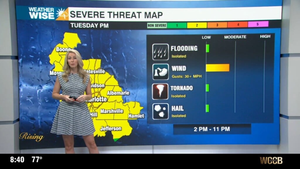
**Isolated strong storms possible SE of I-85 overnight into early Saturday morning**
A strong cold front will push a line of showers across the area between 1 am – 7 am. The precipitation type will start as rain everywhere, but change over to snow in the Mountains. As that line moves through it will likely strengthen south and east of Charlotte. That is where there is a chance for isolated severe storms (southeast of I-85) very early Saturday morning. Damaging wind is the primary threat, but there is still an isolated tornado threat. It is low, but not zero.
SUNDAY:
Sunday morning will be very cold with a widespread hard freeze. Lows bottom out in the low 20s with cooler wind chills. Sunday looks dry and cold with highs in the low 50s.
NEXT WEEK:
The first half of next week looks dry with a warming trend through the week.
Notes:
– It is severe weather preparedness week across the Carolinas. The WCCB weather team will have daily topics and information on how to stay safe when severe weather strikes here: https://www.wccbcharlotte.com/
– Spring forward on Sunday morning.
Have a great evening and weekend!
Kaitlin