Heat Continues Ahead Of Late Week Cool Down
Much cooler, but unsettled and humid beginning Friday
Discussion:
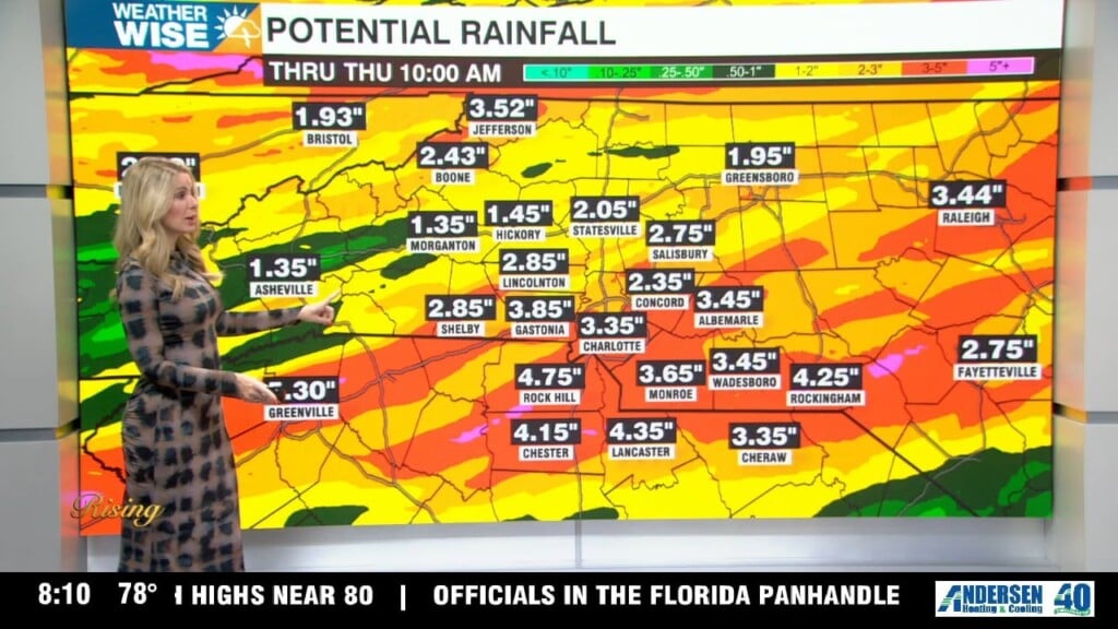
A ridge of high pressure will continue to bring high heat and high humidity to the area through Wednesday. A cold front will approach from the west of Thursday which will bring scattered to numerous showers to the area. That front will stall out over the Carolinas bringing an unsettled pattern through the weekend. The passage of the front will drastically cool us down, but with the moisture lingering, our humidity will stay elevated.
Forecast:
Tonight: Partly cloudy, mild and muggy. Scattered showers through 10 pm then isolated. Lows: Mid 70s.
WeatherWise Alert – Wednesday: Hot and humid with scattered showers and storms. Highs: Mid 90s.
Thursday: Numerous showers and storms as a cold front moves through. Still hot and humid. Highs: Low 90s.
Friday: The front will stall which will hold rain chances in the forecast, but temperatures will be cooler with highs in the low 80s.
Have a great week!
Kaitlin