Storm threat increases late week
AM Headlines
- AM Patchy Fog
- Warm & Muggy
- Pop Up PM Storms
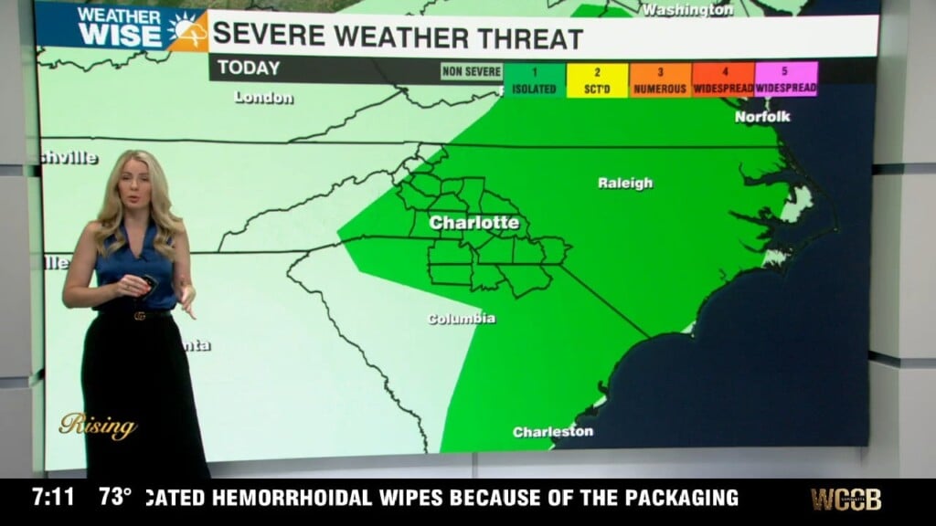
- Friday Severe Threat
- Drying out this weekend
- Getting hot next week
Discussion
We’re kicking off the day with patchy fog and low clouds as the last of the wedge breaks apart. Expect sunshine to return by late morning, helping temps climb to near 80 this afternoon. A few pop-up storms will be possible, but most of the area will stay dry.
A strong cold front will arrive during peak heating Friday. This setup is favorable for strong to severe storms across the area. The Storm Prediction Center has expanded the slight risk level 2 (out of 5) area to include the majority of the region. Damaging wind remains the main the concern, however large hail and an isolated tornado or two can’t be ruled out — especially with any discrete cells that jump ahead of the main line. The main window for the severe threat is 2pm-8pm, but timing could change, so it is important to stay weatherwise and prepare now.
After the cold front, the weekend will be pleasant. Highs will top out in the low 80s with slightly less humidity and sunny skies. By next week, high pressure fills in setting the stage for a big warm up as highs race into the mid to upper 80s by mid to late week.