Summer pattern sets up
- Back to Summer Mode
- Storms Bubble Up Daily
- Locally Heavy Rain Possible
- Muggy Mornings & Sticky Nights
- 90s Return Next Week
Discussion:
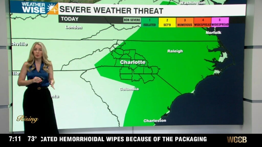
We’re shifting into a textbook mid-June pattern: warm, humid, and stormy in the afternoons. A warm front has lifted north across the area, putting us in deep southerly flow. Moisture is surging back in—dew points will push back in the 70s and PWATs are pushing near 2 inches. Expect scattered to numerous storms to pop this afternoon and evening across the region. Like a typical summer setup, storms will be pulse-type—brief but heavy with localized downpours, lightning, and possibly a gusty microburst. The severe threat is low but not zero.
Weak upper disturbances and a stalled frontal boundary to our north will keep storm chances elevated through the start of the weekend. Most active time will be late afternoon and evening. Friday might be a touch cooler due to extra clouds (upper 80s), but we rebound back into the low 90s Saturday.
A passing shortwave may spark more storms Sunday, especially across the northern zones. By early next week, moisture dips slightly, and we return to “standard” summertime conditions: daily pop-up storms with rising temps. Piedmont locations will likely see highs in the low 90s by midweek. Heat index values climb too—expect mid to upper 90s for “feels like” temps.