WCCB Weather

Latest Forecast

Weekend rain with a chill moving in next week

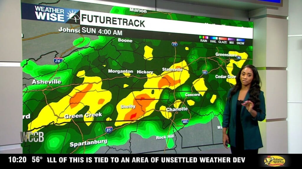
We'll start Saturday with mostly cloudy skies before the first pockets of rain begin moving into the region around midday. From there, expect the wet weather to become more widespread as we head into the evening. By Saturday night, some neighborhoods could see a pretty good soaking, with rain sticking around through Sunday morning.

WCCB Weather Radar

Track storms live.

Current Conditions

Hourly Forecast

Extended Forecast

Flash Flooding possible Wednesday night into Thursday morning

At this point, confidence is highest for the heaviest rain to develop first across the foothills, the Interstate 40 corridor, and the northern Piedmont before shifting farther south and east. The Charlotte metro and communities along Interstate 85 are currently trending toward seeing the most active weather during the early to mid-morning hours. Gusty winds and frequent lightning will also be a play.

100-Degree Heat Builds Across Charlotte This Week

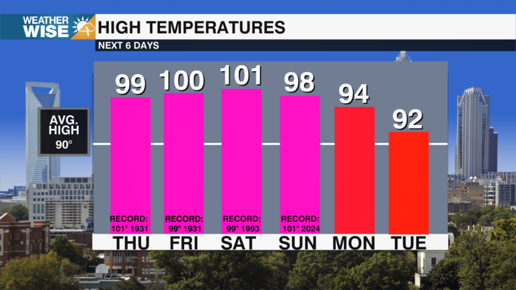
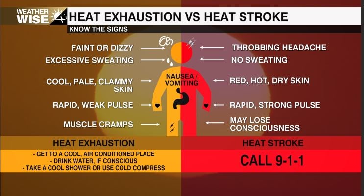
​The big story for the second half of the week is the heat. A strong ridge of high pressure will park itself over the Southeast beginning Wednesday, acting like a lid on the atmosphere and allowing the heat to build for multiple days. Afternoon temperatures will climb into the upper 90s to around 100 degrees through the holiday weekend, with Thursday, Friday, and Saturday coming very close to record highs. Add in the humidity, and it'll feel even hotter outside, so if you have holiday plans, be sure to take the heat seriously.

WCCB Weather Team

𝕏

X Wccbcharlotte Follow 370x70 Formerly Twitter