
Fire danger increasing
The threat of wildfires is increasing across the area as ongoing drought and low humidity bring fire weather warnings.

The threat of wildfires is increasing across the area as ongoing drought and low humidity bring fire weather warnings.
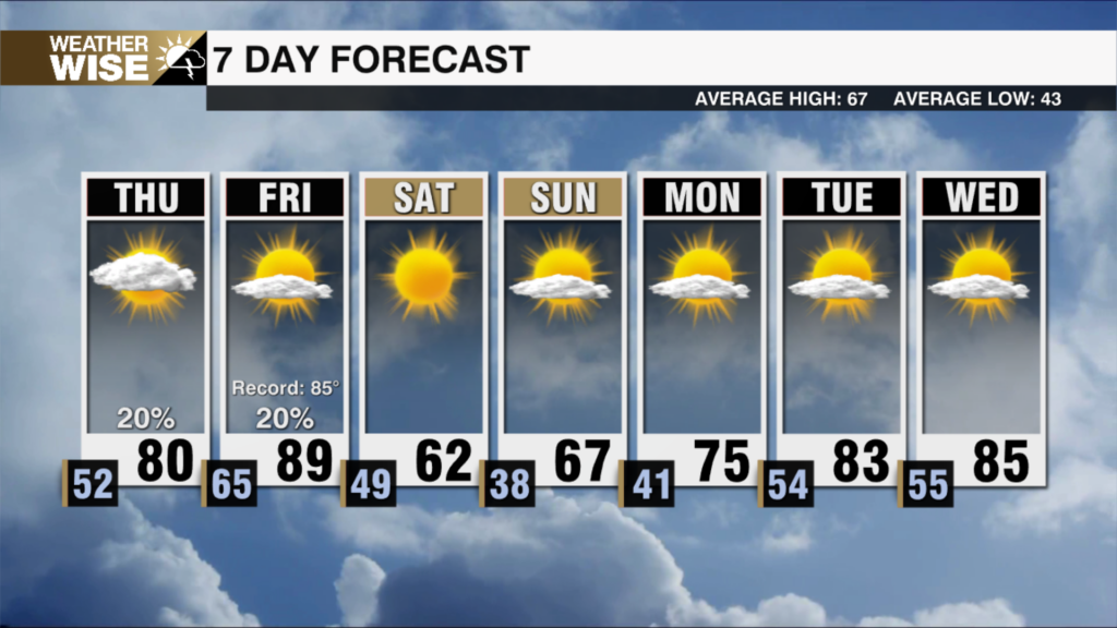
Record breaking highs return on Friday before another major temperature drop. Fire weather risks rise through the week ahead.
After record-breaking heat today, cooler weather will make a return early this week. Fire weather risk will also increase this week.
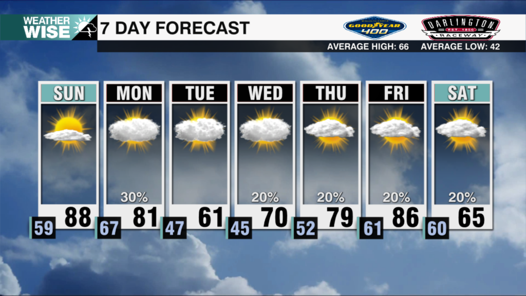
Scattered showers and storms this evening will clear overnight. Record high temperatures are likely across the area Sunday afternoon.
Spring weather has returned to the Queen City just in time for the first day of spring. Highs approach record territory by Sunday.
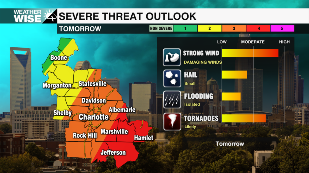
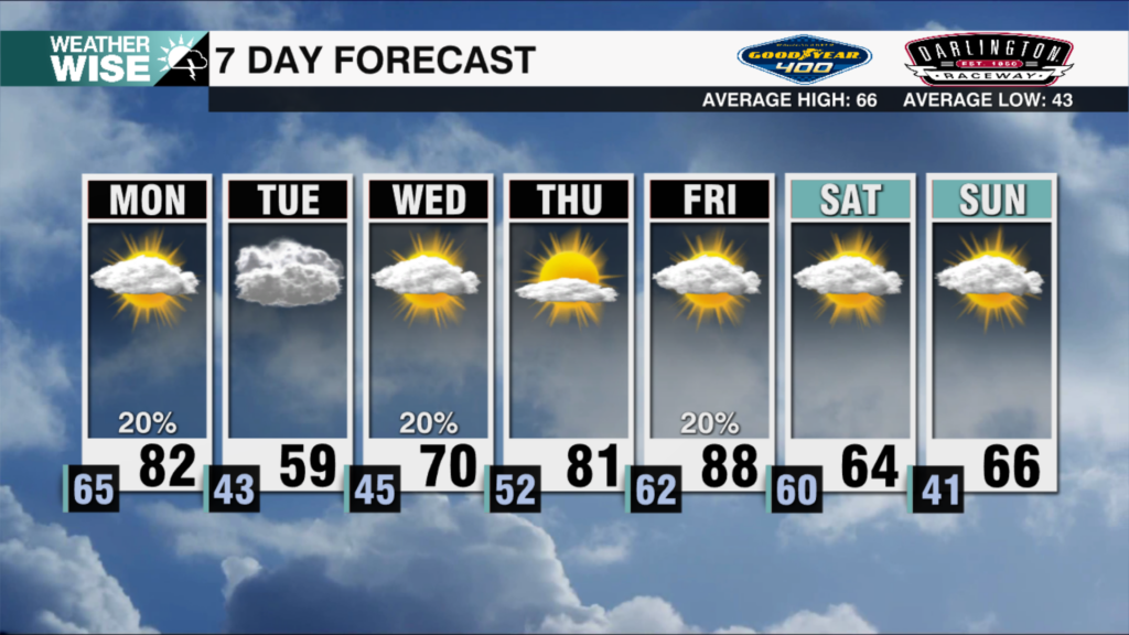
The severe weather threat is continuing to build across our region late tonight into Monday. The primary threats are damaging winds and even a few tornadoes, especially for locations south of I-85 and along and east of the I-77 corridor.
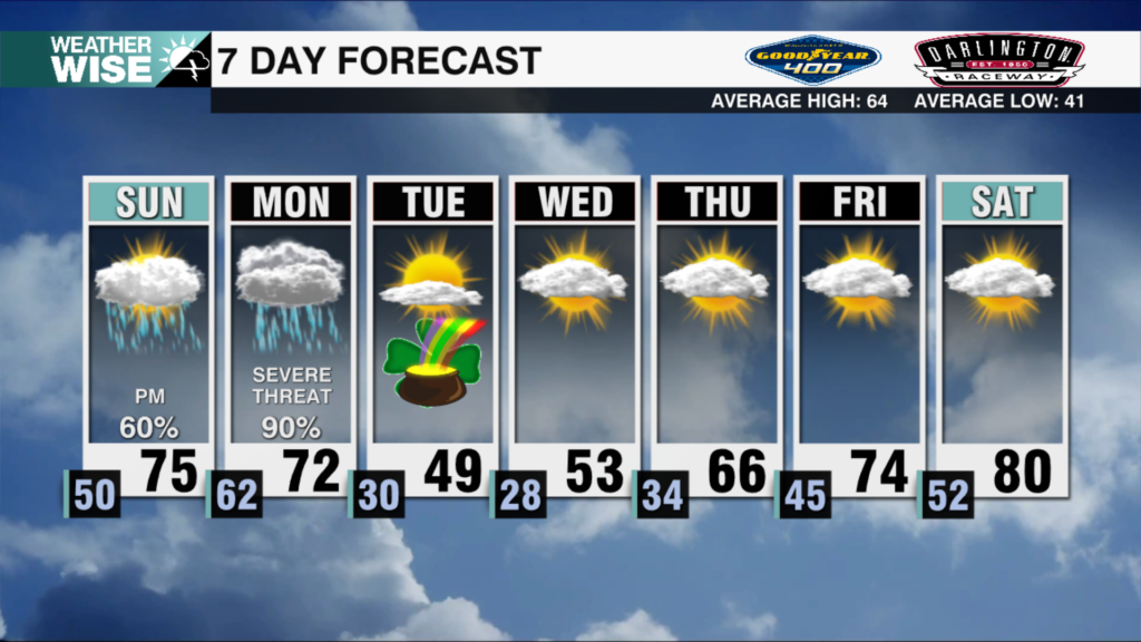
Unsettled weather moves in Sunday evening. Severe weather is possible through Monday, including the threat of tornadoes.
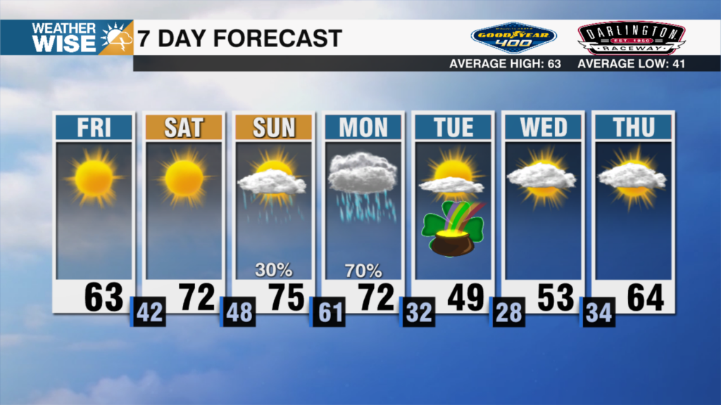
Sunshine and average March temperatures have returned to the Queen City. Another storm system arrives to start next week.
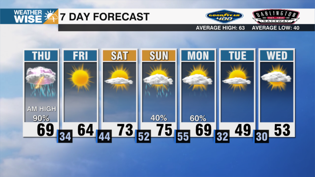
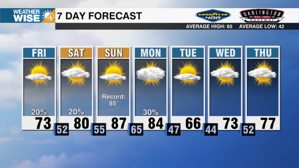
A rough morning commute is ahead as a line of showers and storms push through. Temperatures plummet back to winter levels by this afternoon.

More record highs are likely across the area today. A rough morning commute arrives for Thursday.
 Formerly Twitter


