Record heat before Thursday storms
More record highs are likely across the area today. A rough morning commute arrives for Thursday.

More record highs are likely across the area today. A rough morning commute arrives for Thursday.
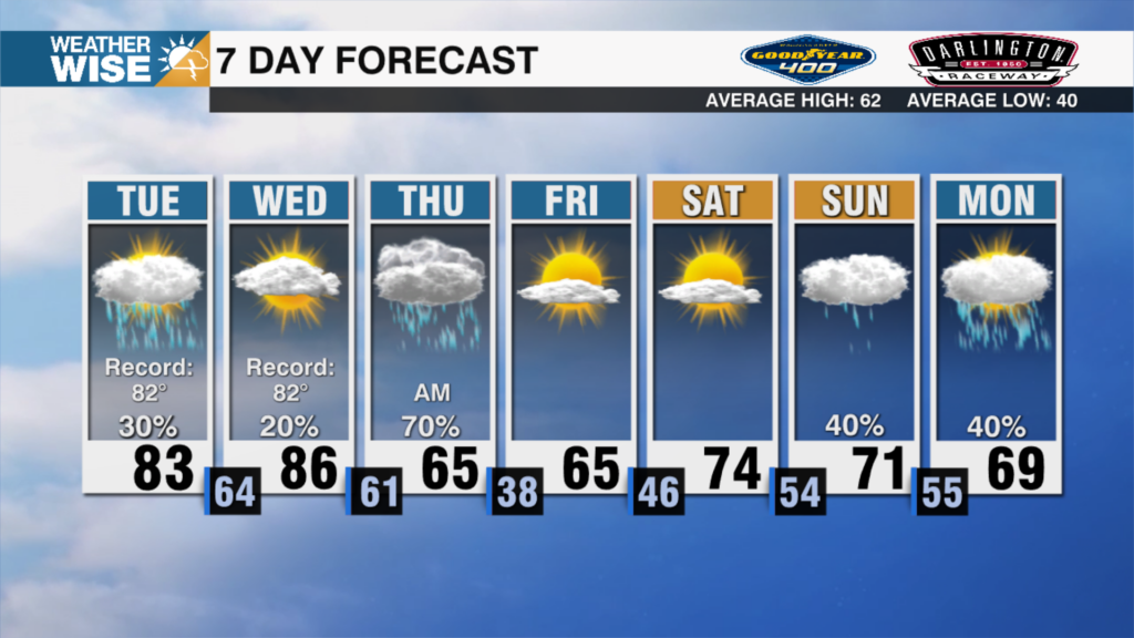
Record highs will likely be broken in the Queen City over the next 48 hours. Rain and storms arrive on Thursday.
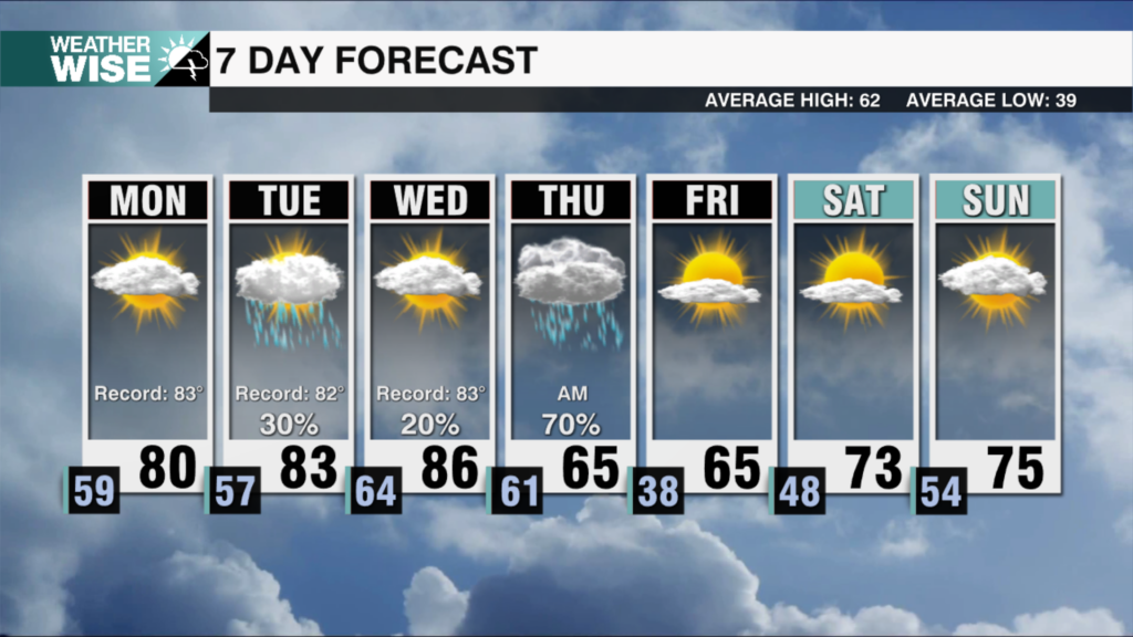
Rain is beginning to work out of the area as record-breaking heat is expected early this week.
The chance of showers and storms is rising, plus record temps approach next week.
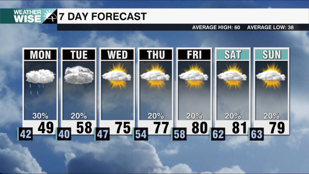
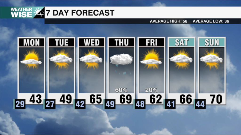
Isolated showers and chilly temperatures return on Monday. Spring fever takes over by the middle of the week.
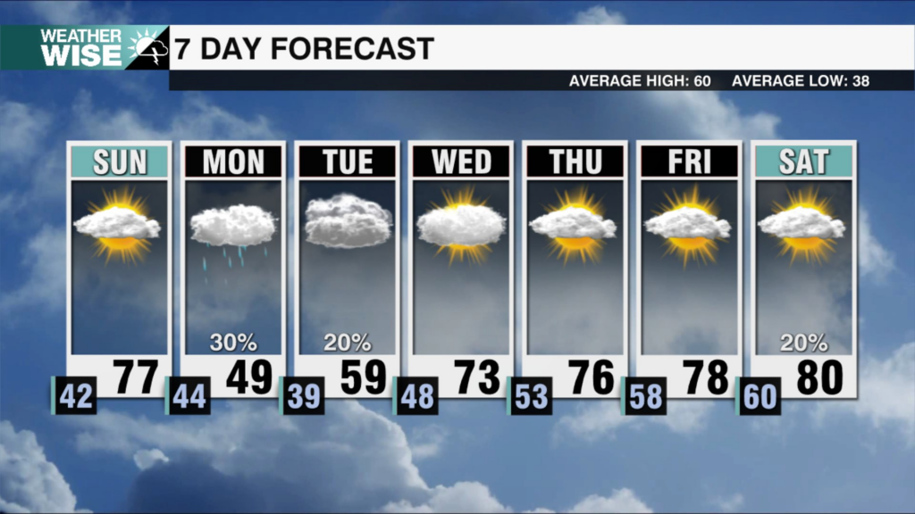
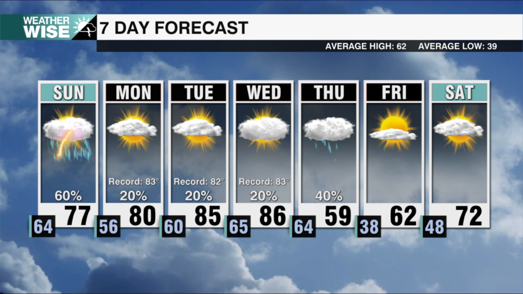
A major warm-up is on the way Sunday before another temperature drop to start next week.
High Country snow is falling as an arctic airmass moves in. Wind Chills drop into the teens tonight in the Queen City.
We are about to be reminded February is a winter month as a major temperature drop moves in. High Country snow is also likely.
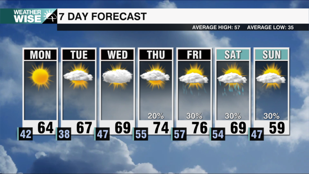
Rain is beginning to wind down across the area. Sunshine returns tomorrow with a major warm up following throughout the week ahead.
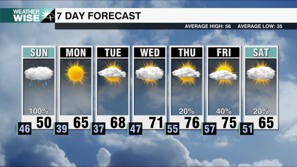
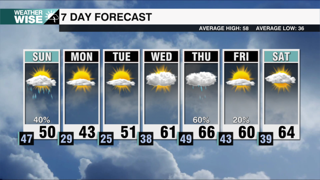
Much-needed rainfall spreads across the area all day Sunday. A major temperature warm up follows suit next week.
 Formerly Twitter