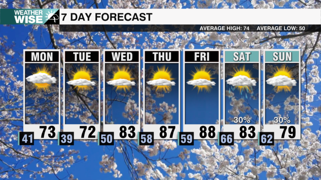
Warmer temperatures to start the week
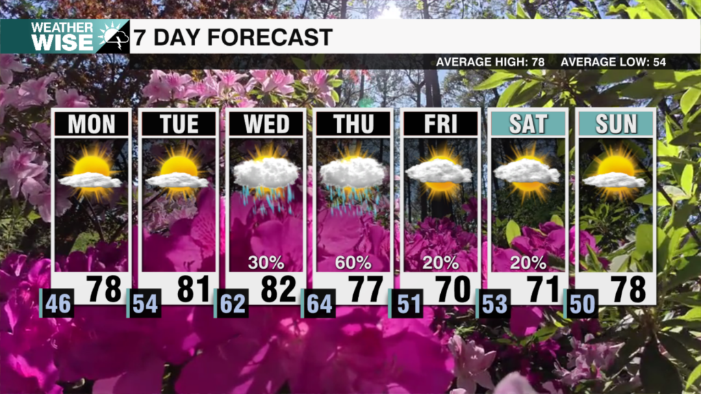
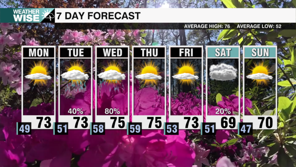
A trend back to warmer temperatures begins to start the week. The next chance of rain and storms arrives by the middle of the week.

A trend back to warmer temperatures begins to start the week. The next chance of rain and storms arrives by the middle of the week.
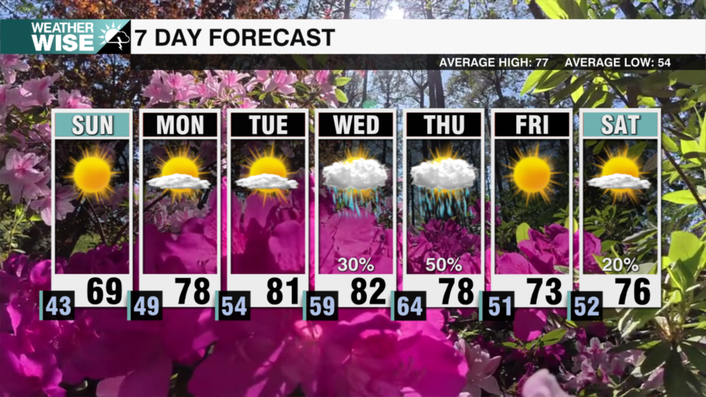
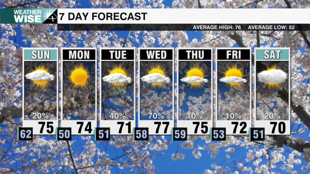
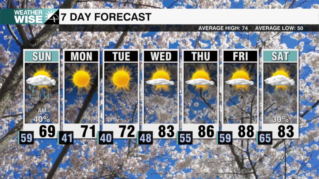
Below average temperatures dominate Sunday as sunshine returns. The next chance of rain arrives by the middle of next week.
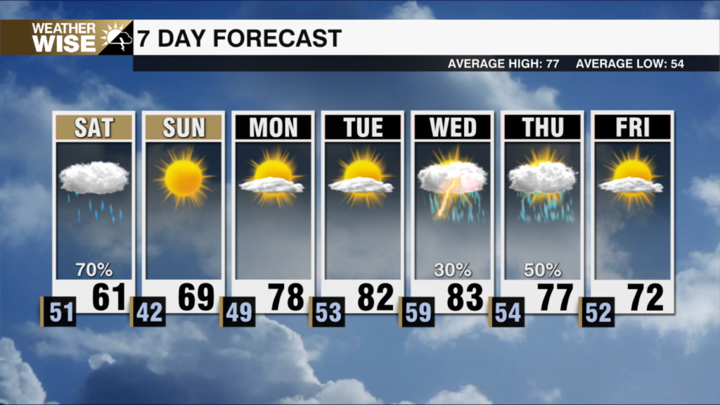
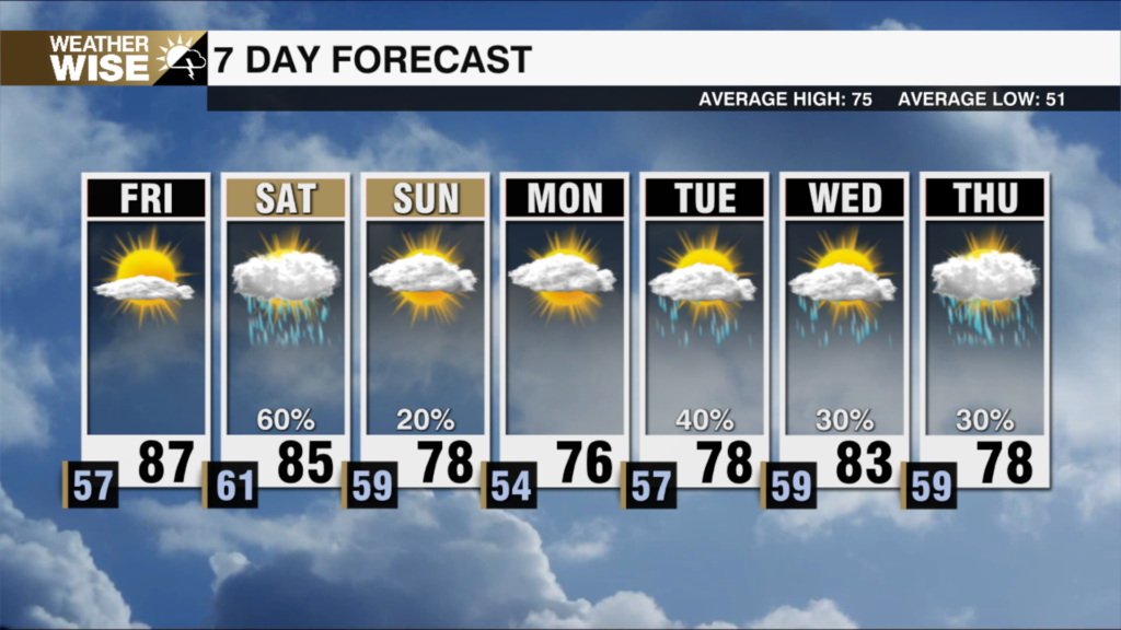
A cold rain is likely south of I-85 on Saturday. Sunshine with chilly temperatures return on Sunday.
The worst drought in nearly 20 years roars on in the Carolinas. Weekend rain could bring temporary relief for some.
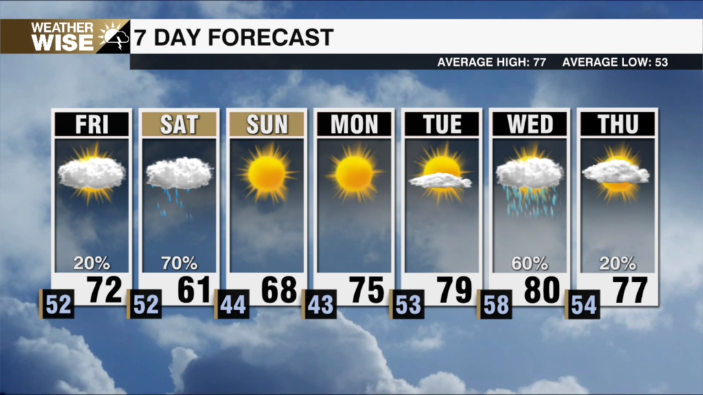
The new week looks to start dry and cool with a sunny Monday. Tuesday and Wednesday more drought relief arrives.
Overnight rain is expected for most for the first time in nearly three weeks. Near average temperatures dominate the week ahead.
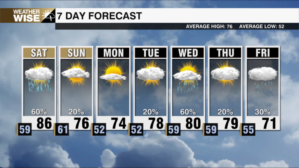
Showers and a few storms will move into the area on Saturday evening as the Carolinas look to mitigate the ongoing drought. .
Wildfire smoke and summer temperatures will lead to a hazy and hot Friday. Much needed drought relief chances rise.
Much more typical April highs with chilly mornings are on the way to start the week. A return to summer temperatures by the end of the work week.
A strong cold front is about to bring a major temperature drop to end the week. The first chance for scattered rain in a week arrives tomorrow morning.
 Formerly Twitter


