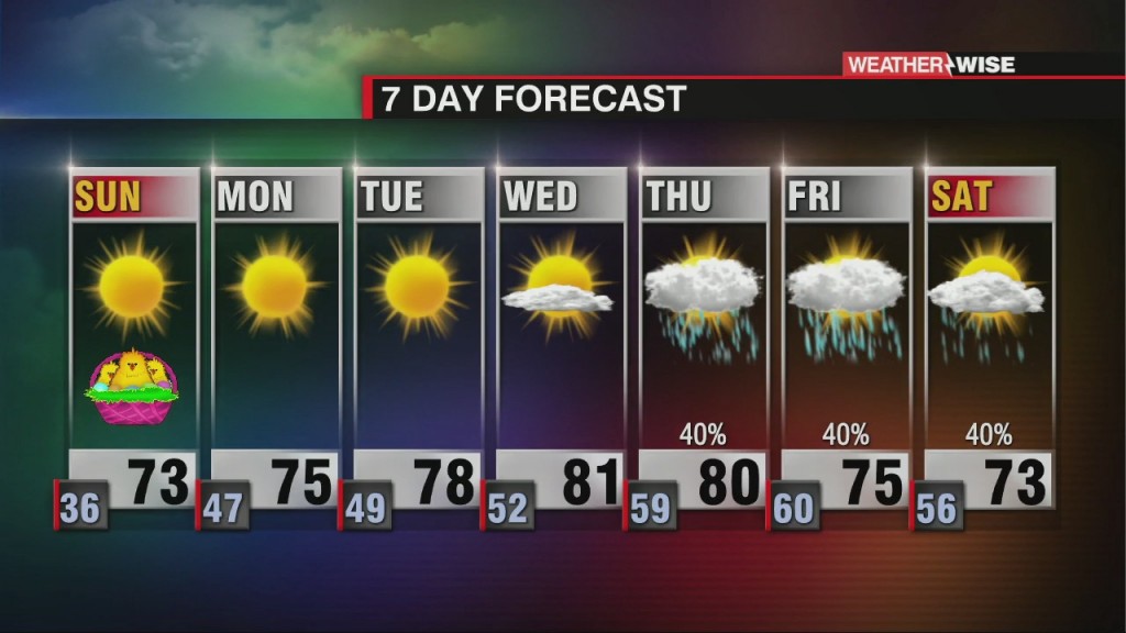
Excellent Easter Weekend & Beyond
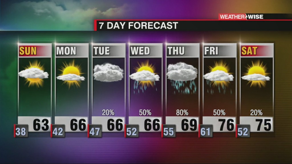
Sunny skies and warmer highs will lead us through the first half of the week ahead.

Sunny skies and warmer highs will lead us through the first half of the week ahead.
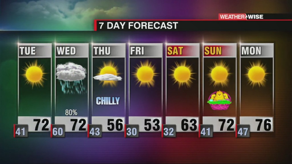
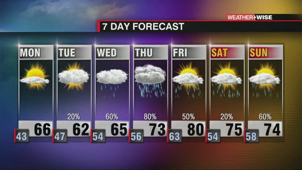
Gorgeous weather will persist through much of the week ahead, but Wednesday could be a glaring exception.
After a messy weekend, we look to get back on track as we close out March. Another round of storms could move in by midweek.
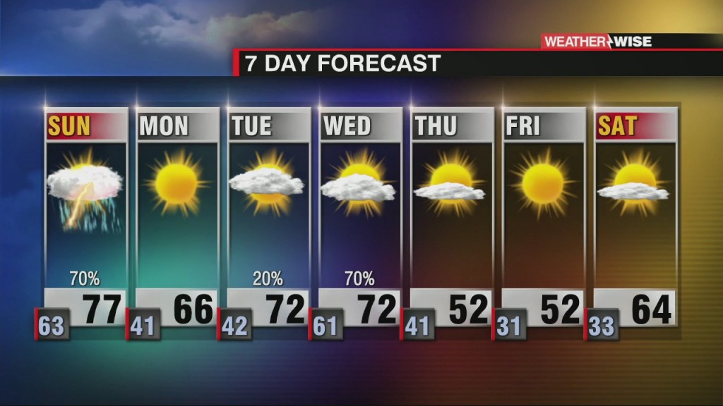
A robust rainmaking system will bring strong-to-severe thunderstorm chances through the weekend.
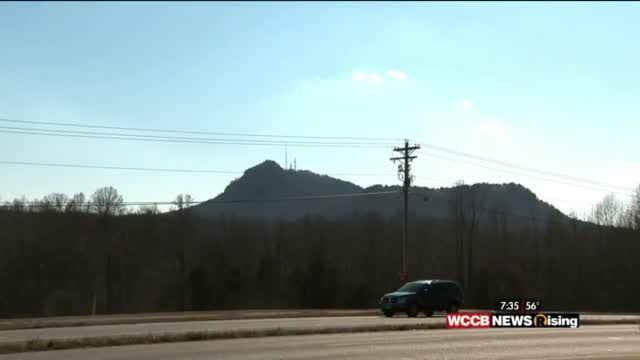
After a yearlong hiatus, On the Road with James is finally back! This week, James took a trip to nearby Crowders Mountain State Park in Gaston County, North Carolina. With 20 miles of…
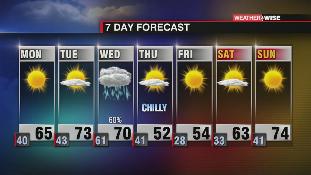
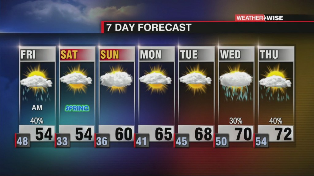
After a chilly start to the season, more seasonable conditions return to the forecast for the week ahead.
We'll be waking up to near-freezing temperatures for the second half of the weekend, but warmer temperatures are on the way.
Severe storms rolled into the Carolinas Thursday afternoon, but the forecast ahead looks a lot tamer.
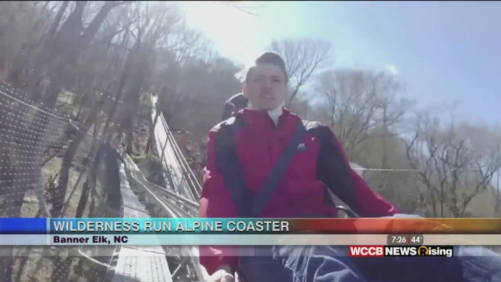
When thinking about the North Carolina High Country you probably picture serene mountain views, hiking, and skiing, but rollercoasters are probably not high on your list. James meets with friends at Wilderness Run Alpine Coaster in Banner Elk, North Carolina who plan on changing that.
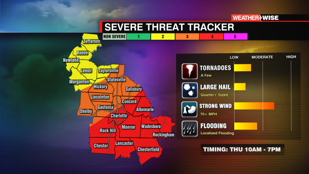
Severe threat increasing for Thursday morning and afternoon across the WCCB Charlotte viewing area.
 Formerly Twitter