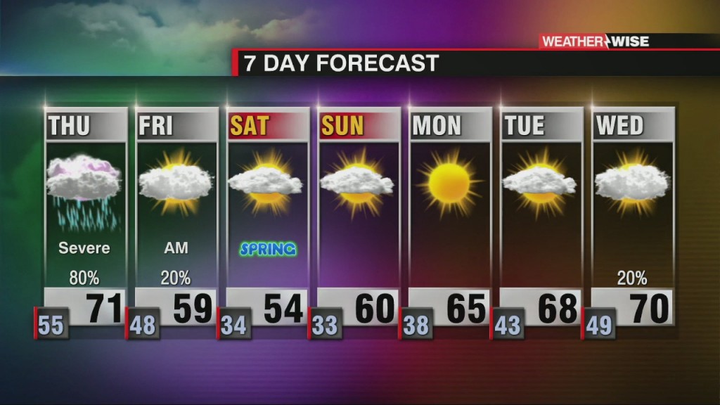
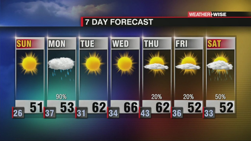
Severe Storm Threat Across the Carolinas Thursday
Cloudy and cool today. Severe threat increases Thursday.

Cloudy and cool today. Severe threat increases Thursday.
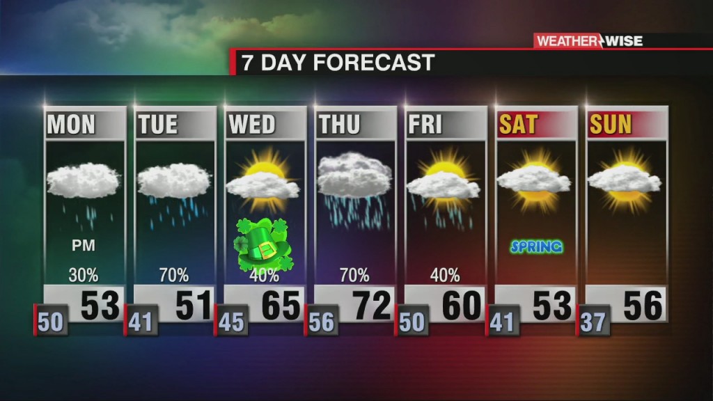
It may be Pi Day, but the week ahead will be anything but a cakewalk.
It's been a lovely stretch of weather to start out March, but the good times come to an end by the start of the workweek ahead.

With the arrival of spring comes not only warmer temperatures, but also dangerous thunderstorms. Your WCCB Charlotte weather team is here to keep you weather-wise as we head into severe weather season.
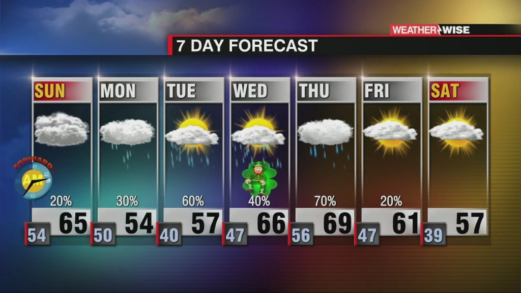
Despite the abundant sunshine, temperatures will end up below average this weekend. Warmer weather isn't far away, though!
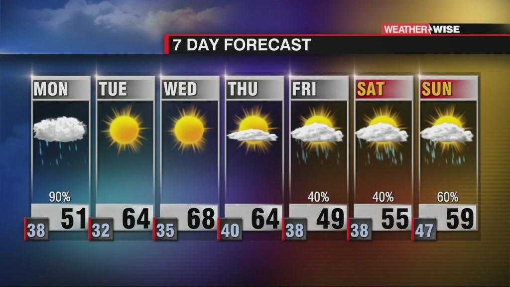
March will be starting off on a wet note as a cold front arrives from the northwest.
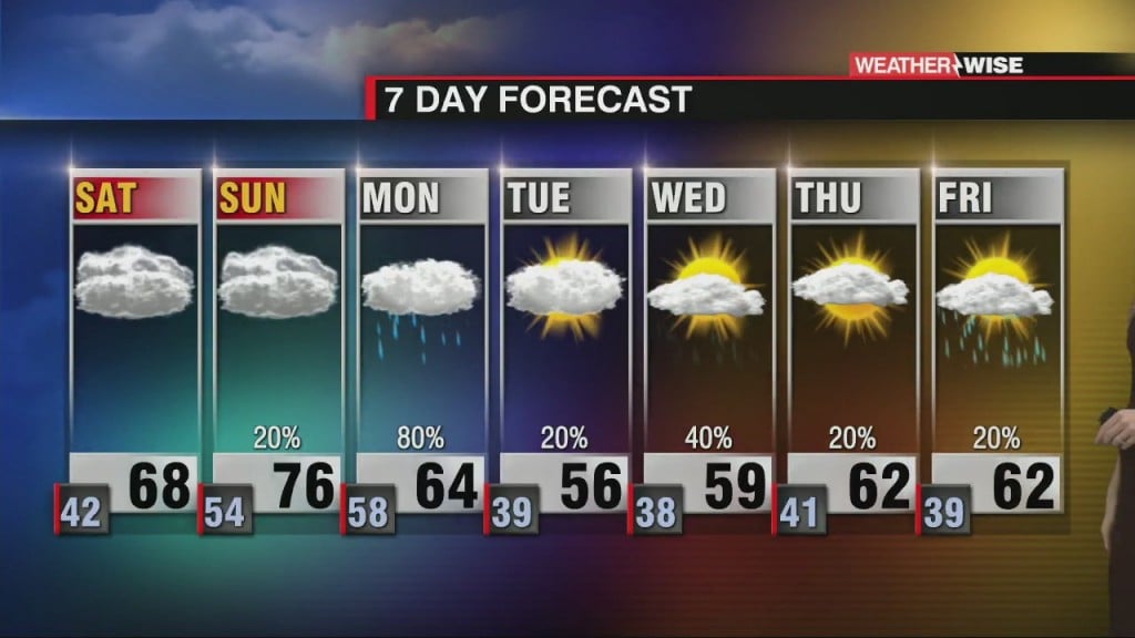
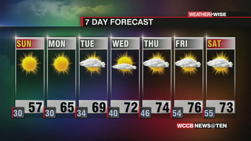
We'll be jumping from 70s for highs to near-freezing lows in a mere 36-hour period Sunday afternoon into Monday night.
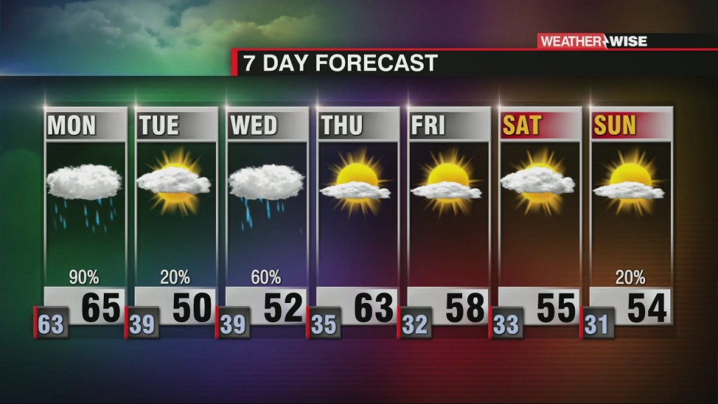
We'll kick off the final week of February on a wet note, but sunshine with some staying power arrives by Tuesday.
Despite the sunshine this weekend, temperatures will remain 5-10º below normal through the start of the workweek.

While there has been a general warming trend across the globe for nearly two centuries, cold snaps such as the one seen in the heart of the US over the past week are not uncommon.
 Formerly Twitter