Sunny Skies Remain, Tracking Approaching Rain
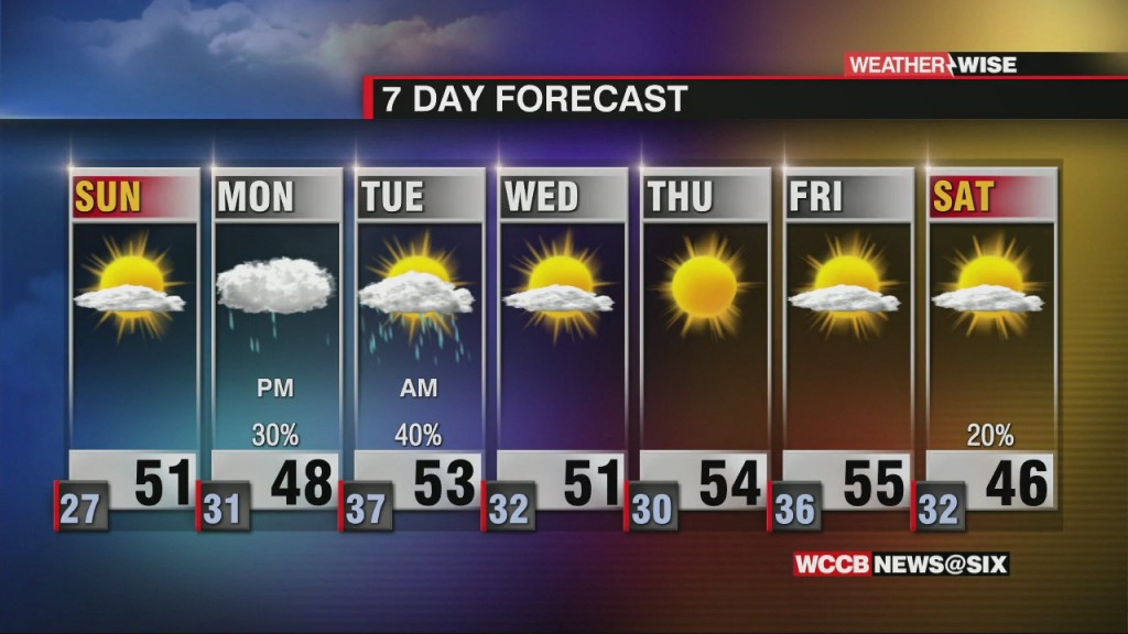
While bright skies should carry through the majority of the weekend, the workweek ahead will start on a wet note.

While bright skies should carry through the majority of the weekend, the workweek ahead will start on a wet note.
Enjoy the sunshine while it lasts! Wet (and even wintry) weather will arrive for many of us next week.
While bright sunshine continues for virtually every community outside of the High Country, temperatures will remain below average for the time being.
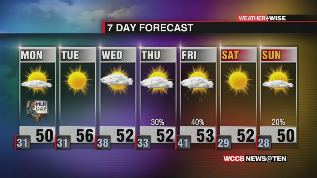
Despite sunnier skies on the way by MLK Day, temperatures will remain 5-10º below normal.
Two climbers were rescued Thursday afternoon, one of which fell approximately 100 feet. While the climber did survive, his current condition is unknown.
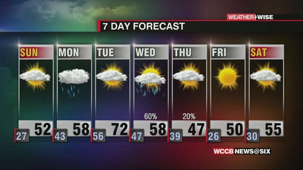
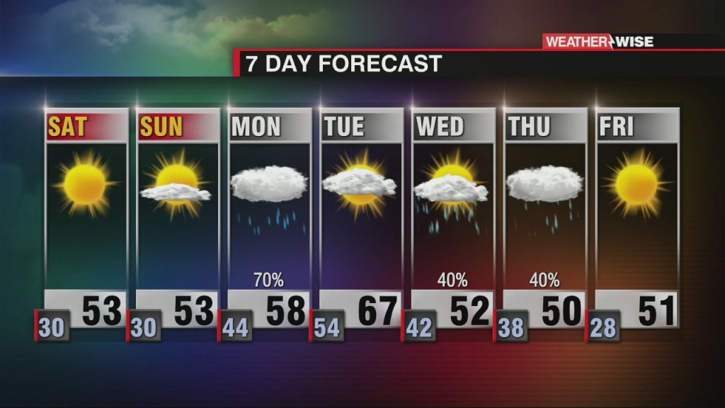
A weak area of low pressure will pass to our south, bringing isolated rain chances mainly south of the Metro late Monday into Tuesday.
Sunny skies and near-average highs last through the start of the workweek before rain returns late on Monday.
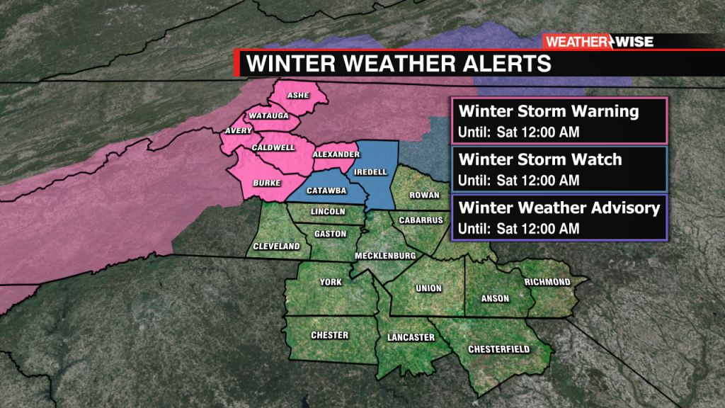
Timing out snow chances and winter weather late in the week.
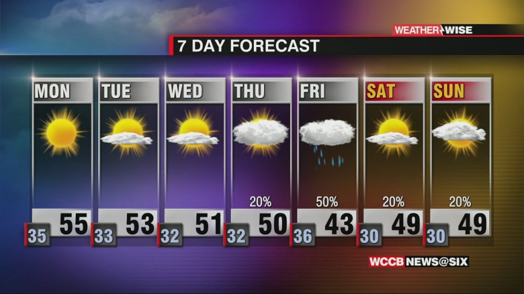
Sunshine and near-average temperatures return for the first full week of 2021.
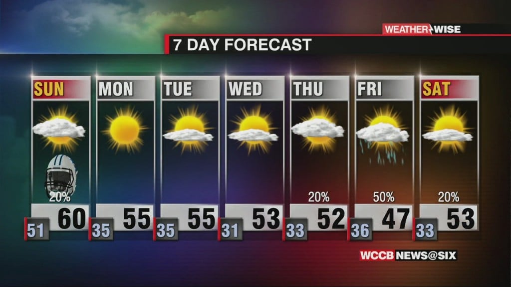
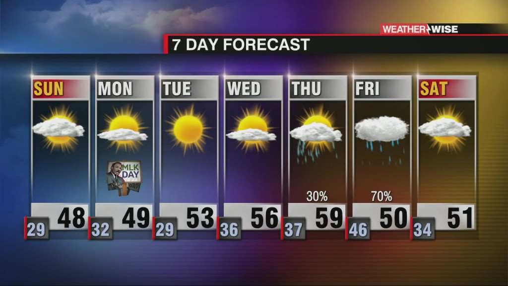
Expect rain, mainly east of Charlotte, overnight Saturday into Sunday before sunshine returns for the week ahead.
 Formerly Twitter