Warm and dry, increased fire danger Wednesday afternoon
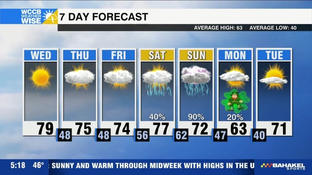
Sunny and unseasonably warm today with highs topping out near 80, but low humidity and breezy conditions will also increase the fire danger this afternoon.

Sunny and unseasonably warm today with highs topping out near 80, but low humidity and breezy conditions will also increase the fire danger this afternoon.
Sunny and warm through midweek with highs in the upper 70s - elevated fire danger today, due to dry air and low humidity.
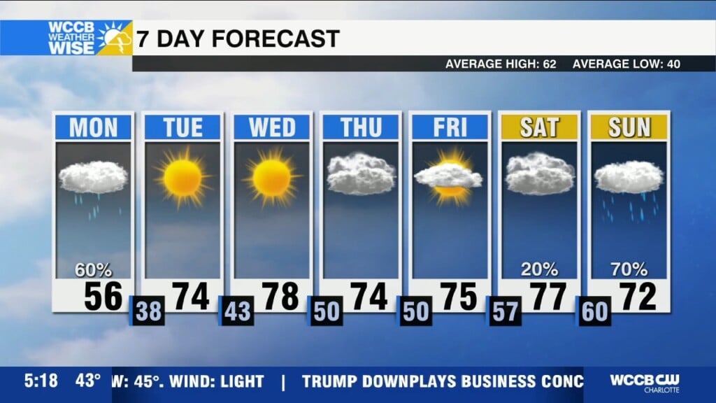
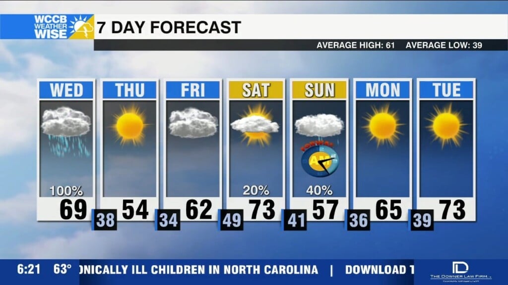
Cloudy and cooler with rain south of I-85 today, before a warm and pleasant trend midweek.

A few small upgrades to your home now, could make all the difference this severe weather season.
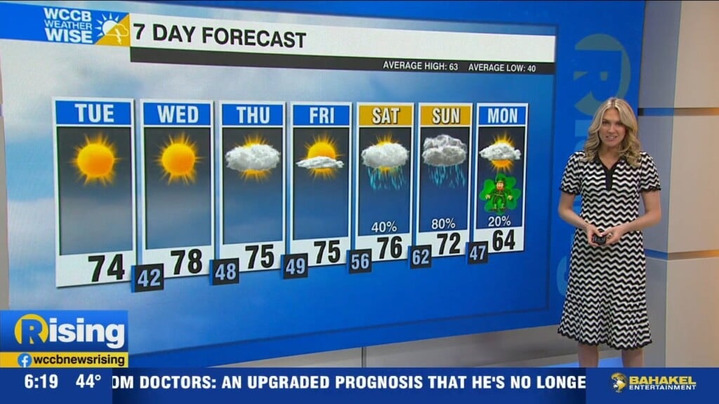
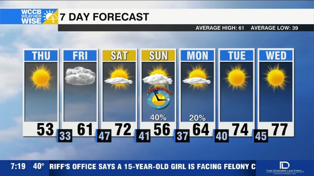
Temperatures will be warming up this weekend with highs in the 60s today and 70s Saturday, before chance showers return Sunday.
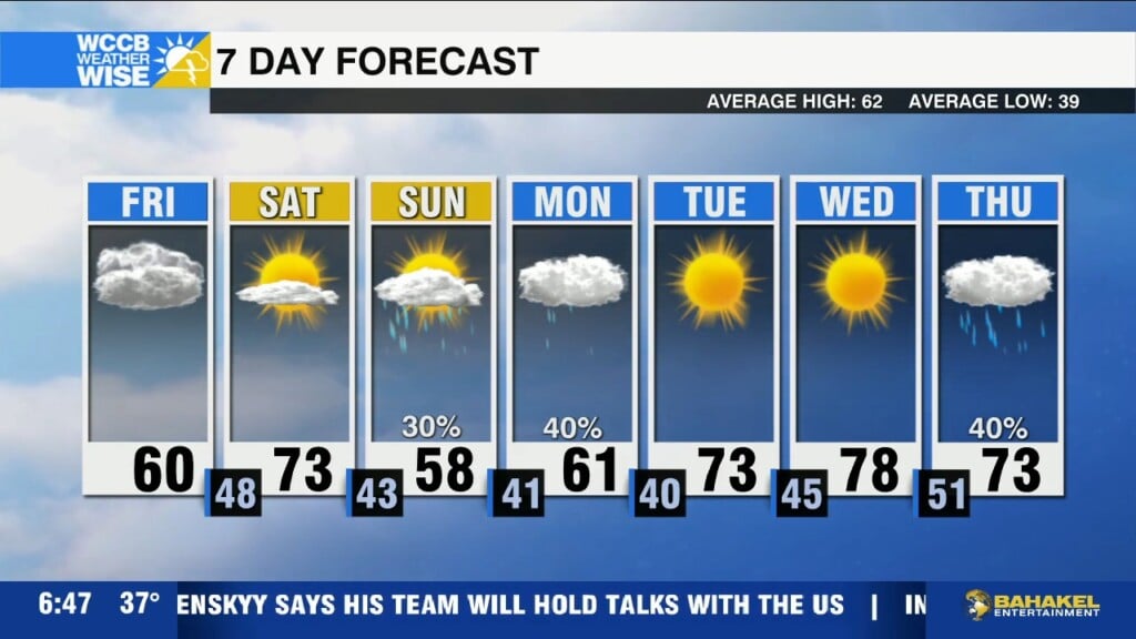
Breezy and cooler today for the Piedmont, while a high wind warning remains in effect for the mountains through this evening.
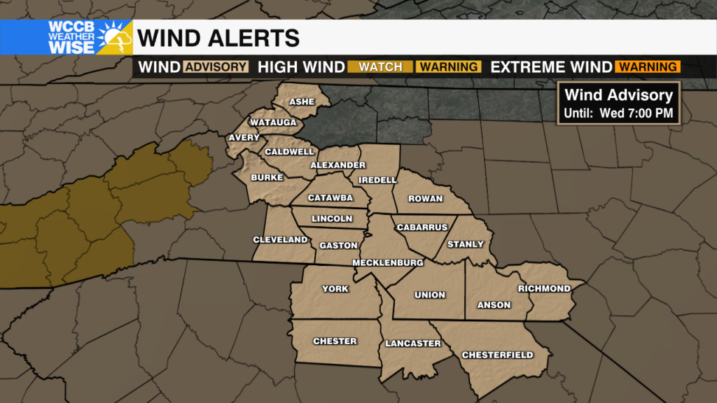
The severe threat has ended for the region, but a wind advisory remains in effect as 30-40 mph gusts remain possible through the evening.
Severe threat is winding down, but winds will remain gusty through the day.
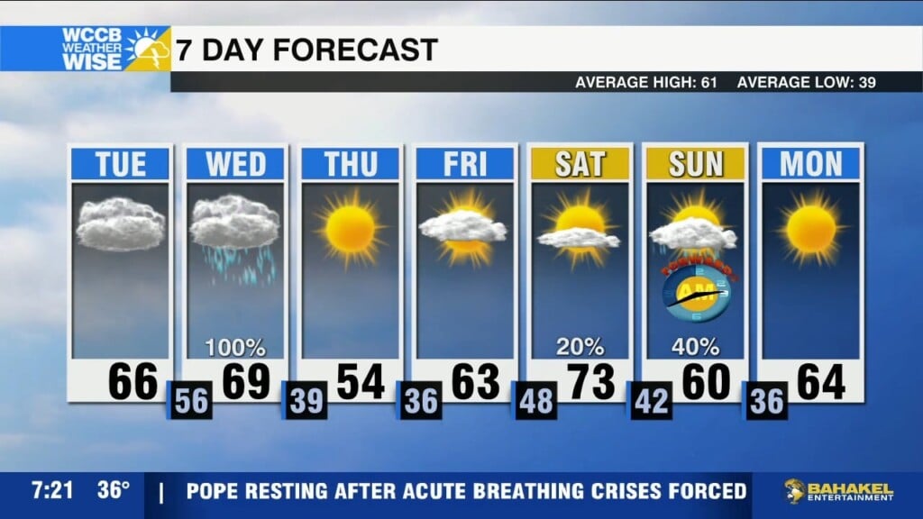
Active pattern over the next 48 hours with increased fire danger today due to dry, gusty winds and the threat of strong to severe storms Wednesday morning.
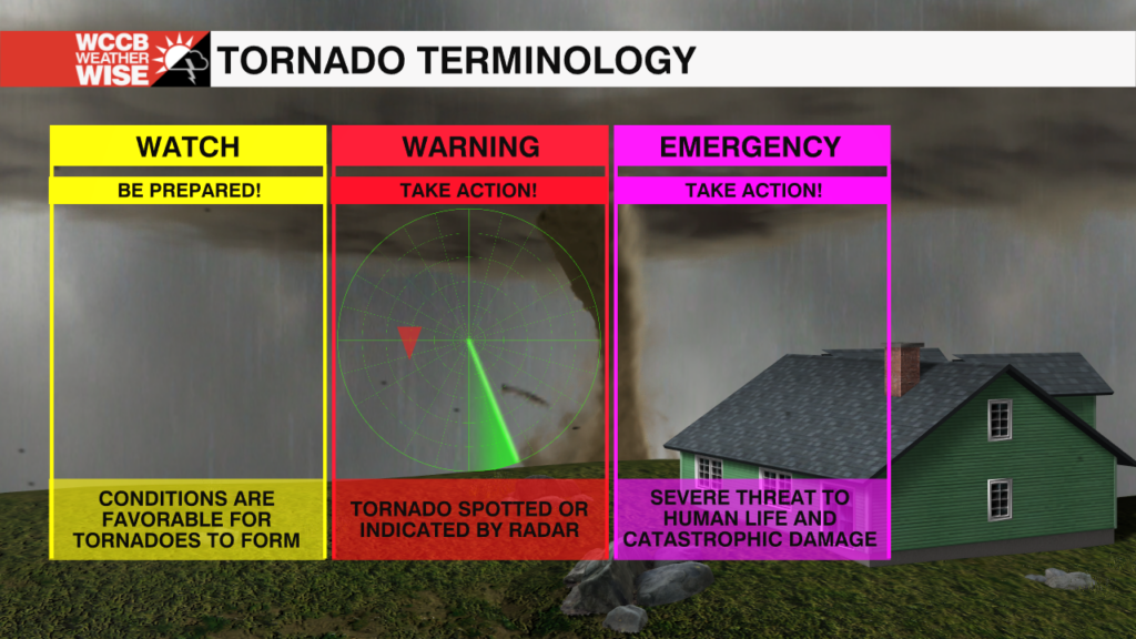
It's Day 2 of Severe Weather Preparedness Week - learn what makes a thunderstorm severe, how tornadoes form and the difference between watches and warnings.
 Formerly Twitter