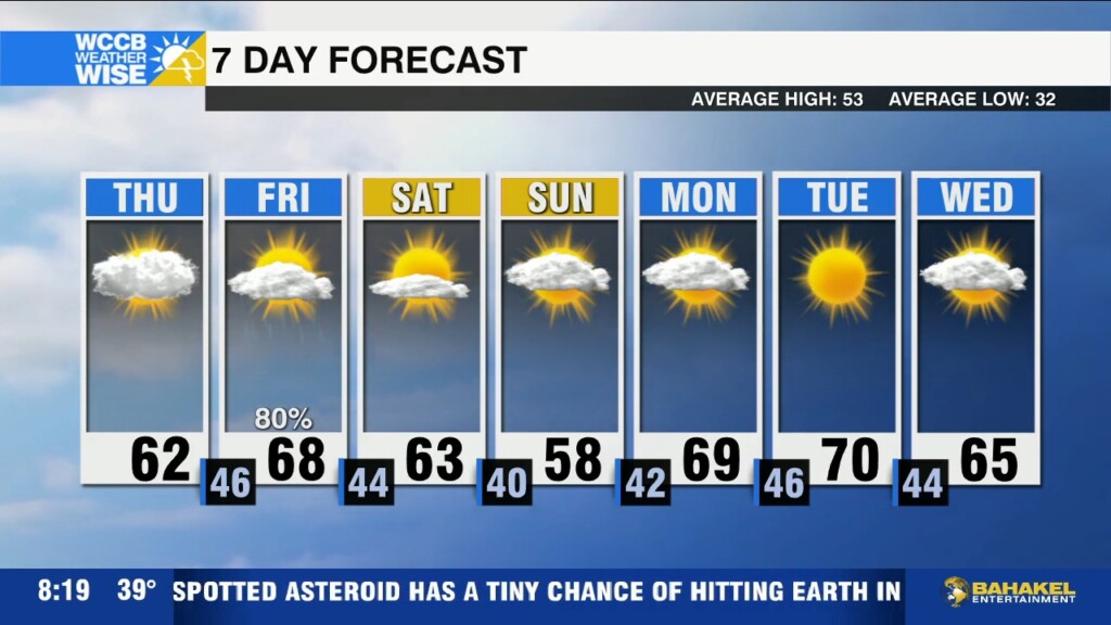
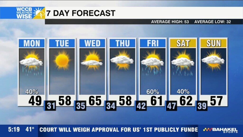
Much needed rain returns Friday
Clouds increase today with highs still reaching the low to mid 60s this afternoon. Widespread rain and gusty winds return tomorrow ahead of a cold front.

Clouds increase today with highs still reaching the low to mid 60s this afternoon. Widespread rain and gusty winds return tomorrow ahead of a cold front.
Gusty winds today will increase the fire danger across the region, as relative humidity levels drop and temperatures warm into the mid 60s this afternoon.
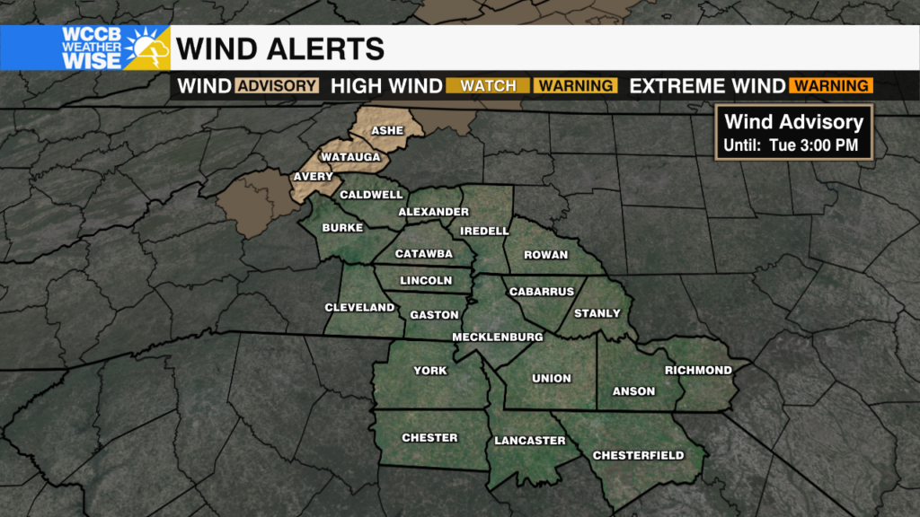
Strong winds with gusts up to 50 mph will be possible through Tuesday afternoon for the high country.
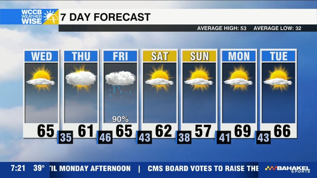
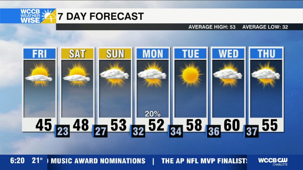
Breezy and mild today with highs near 60, with even warmer temperatures midweek before rain returns Friday.
Rain and mountain snow taper off by mid-morning,, but temperatures will remain cool today before a big warm up mid-week.
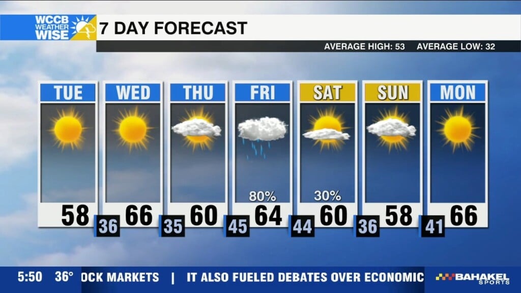
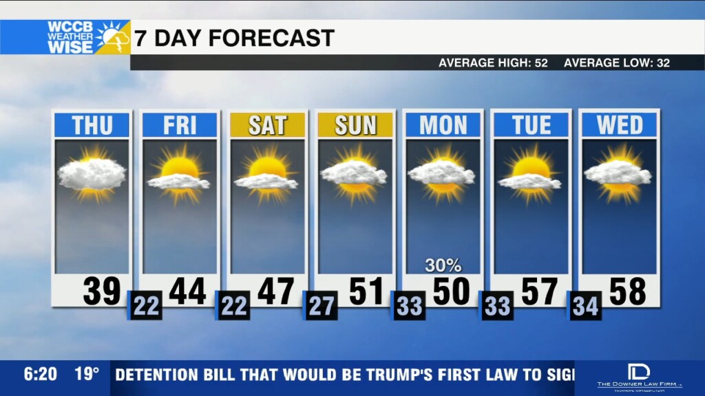
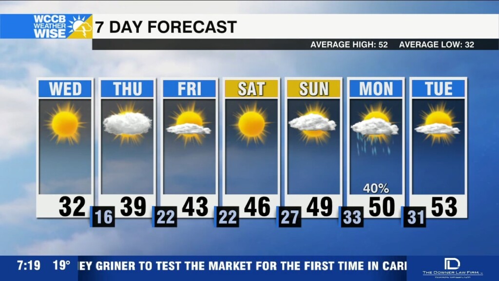
Today will remain chilly with highs in the mid 40s, but expect a gradual warm up this weekend with highs back near 50 by Sunday.
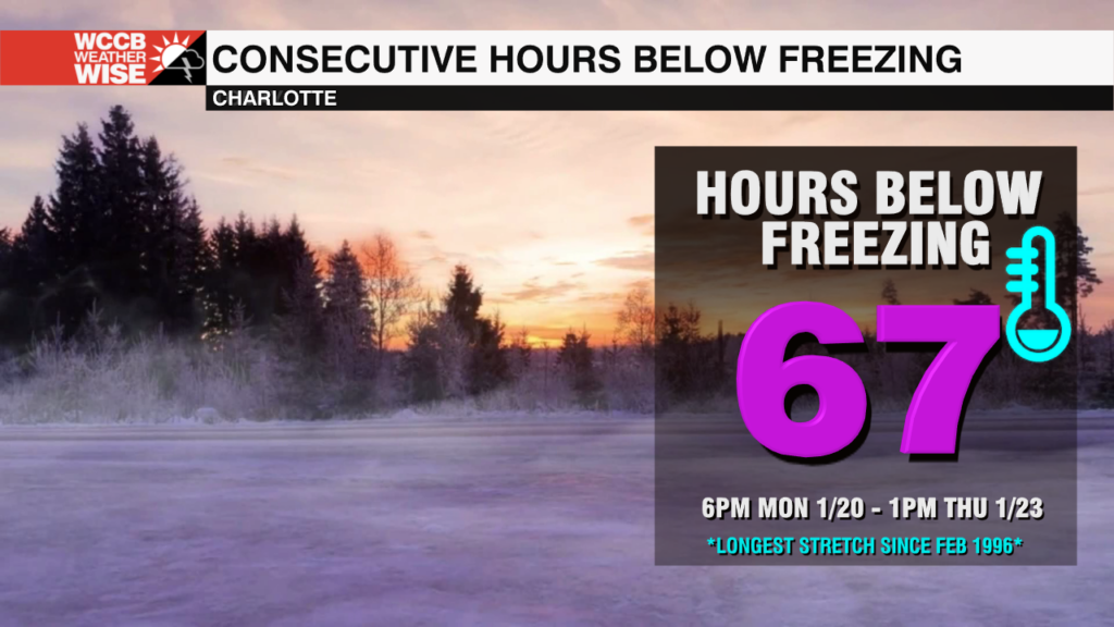
The Queen City spent 67 consecutive hours at or below freezing this week -- the longest streak since the mid-90s!
Black ice a concern for morning travel, but highs finally work their way back above freezing for the first time since Monday, topping out in the upper 30s this afternoon.
Travel could be difficult this morning with light snow accumulations leaving roads icy. Bitter cold temperatures linger with highs once again topping out near freezing.
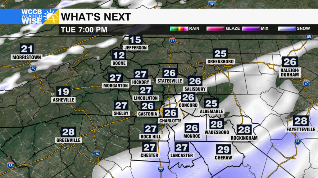
A winter storm will bring snow and potential travel disruptions for areas near and south and east of I-85 Tuesday.
 Formerly Twitter