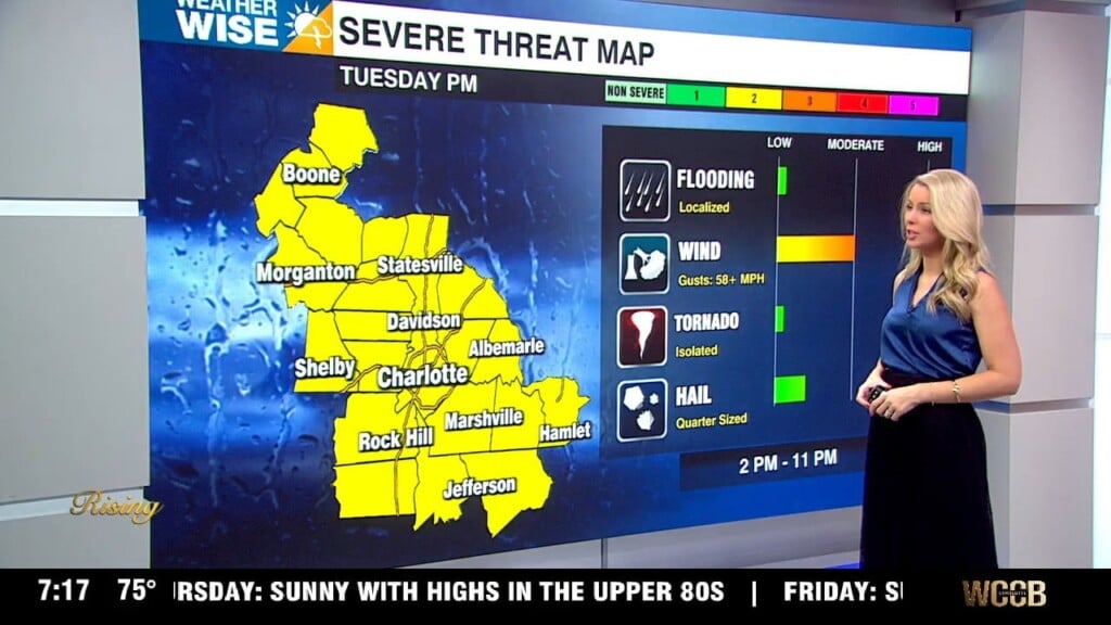
Stay WeatherWise: Isolated severe threat Tuesday
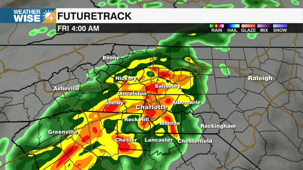
Scattered showers through the first half of the day with isolated severe storms possible late afternoon - evening.
Scattered showers through the first half of the day with isolated severe storms possible late afternoon - evening.
There will be no turning back the clock if the House has its way. The House passed a bill Tuesday that would make daylight saving time permanent. Proponents argue the bill would provide more daylight during the times that Americans are most active.
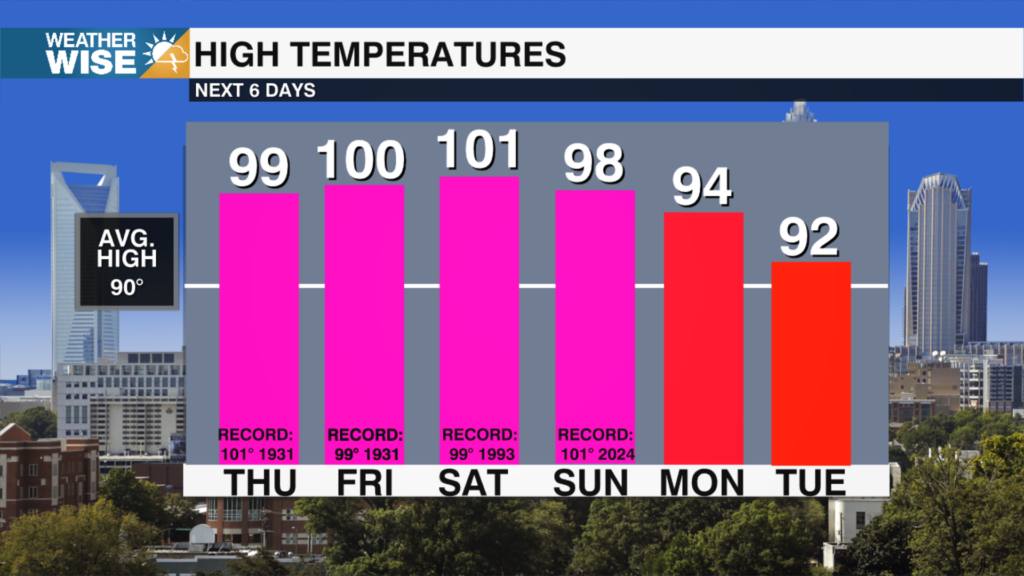
Heat Advisories are in effect from 12 PM until 8 PM Thursday with heat indices up to 106° expected.

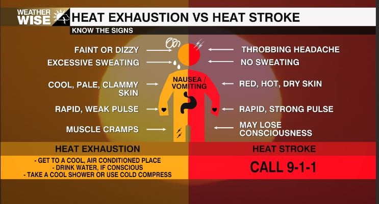
It's a hot one for millions of people in the Midwest and Great Lakes states. Intense heat and humidity are baking the regions with no immediate relief. The National Weather Service says conditions are “dangerous.” The heat index is exceeding 100 degrees in some areas.
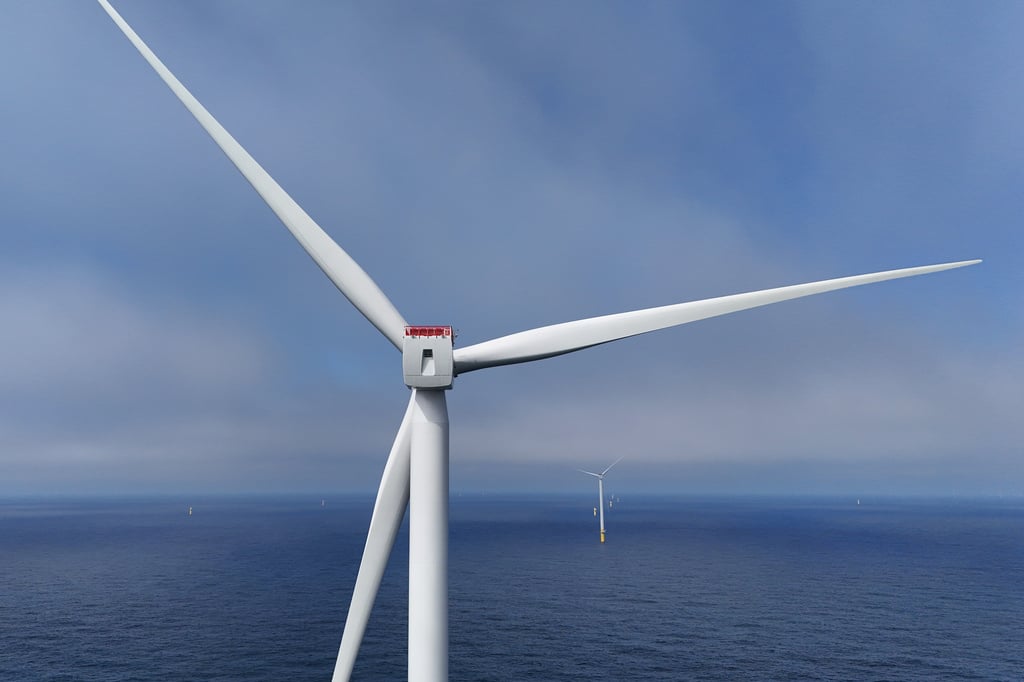
Duke Energy is the latest utility to bow to pressure from the Trump administration to cancel offshore wind leases in return for money.
The big story for the second half of the week is the heat. A strong ridge of high pressure will park itself over the Southeast beginning Wednesday, acting like a lid on the atmosphere and allowing the heat to build for multiple days. Afternoon temperatures will climb into the upper 90s to around 100 degrees through the holiday weekend, with Thursday, Friday, and Saturday coming very close to record highs. Add in the humidity, and it'll feel even hotter outside, so if you have holiday plans, be sure to take the heat seriously.

France has recorded its hottest day ever amid an exceptional heat wave in Europe. The national weather agency says France’s national thermal indicator—an average of temperatures measured at 30 weather stations— hit a new record of 85.6 F.
Rain chances increase overnight for the Carolinas as remnant tropical moisture moves in. Isolated spin-up tornadoes not out of the question.
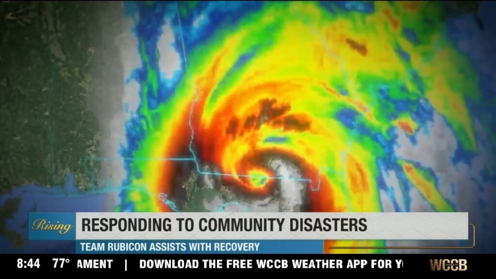
Team Rubicon, a veteran-led humanitarian organization, has been conducting training exercises to prepare for hurricane season.
 Formerly Twitter