Heavy rain moves in overnight as the remnants of Arthur move through
Isolated flooding possible
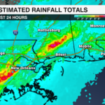
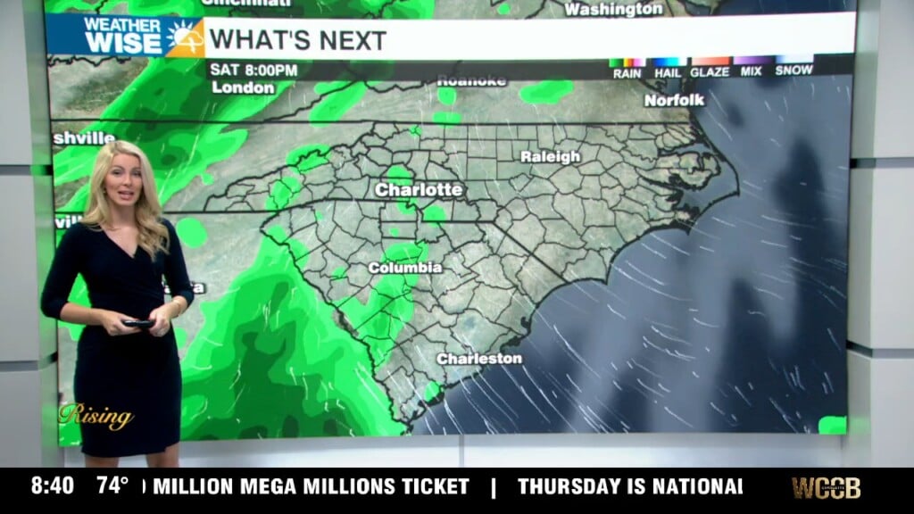
CHARLOTTE, N.C. — Rain from what was Tropical Storm Arthur has been relentless over parts of the Gulf Coast. As of Thursday afternoon, Flash Flood and Tornado Warnings continue across MS and LA. Locally, we will see impacts from the remnants of Arthur.
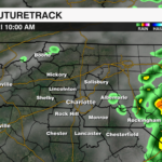
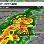
TIMING: Rain moves in around midnight tonight. The heaviest rain will occur overnight. Rain will clear early Friday morning.


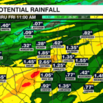
RAIN TOTALS: 1-2″ possible.


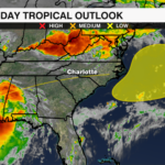
SEVERE THREAT: The tornado threat is not high, but it is not zero. We could see a few spin-ups especially south of I-85.
There is a Flash Flood Watch in effect for Ashe county until 2 AM. Isolated flooding is possible outside of the watch area – especially in low lying, poor drainage areas. Additional Flood Watches may get issued.
Damaging winds will also be a threat with gusty condition lingering even as the storm starts to pull back out of the region
Overall, this looks more like a heavy rain and gusty wind event than a major severe weather outbreak, but it’s definitely worth staying weather wise overnight. The National Hurricane Center is giving the remnants of Arthur a low chance of possible reformation once it moves into the western Atlantic. Stay tuned!