Tropical Depression Fred Rolls Through The Carolinas, Severe Weather Possible
While the Metro may be spared the worst of the impacts, places along the mountains and Foothills may see close to a half-foot of rain through Thursday.
Now Tropical Depression Fred has already dumped plenty of rain on Florida, Alabama and Georgia and is now taking aim at the Carolinas.
A FLASH FLOOD WATCH is in effect for Ashe, Watauga, Avery, Caldwell and Catawba counties until Wednesday morning. These are the areas where 4-8″+ could fall and landslides are possible.
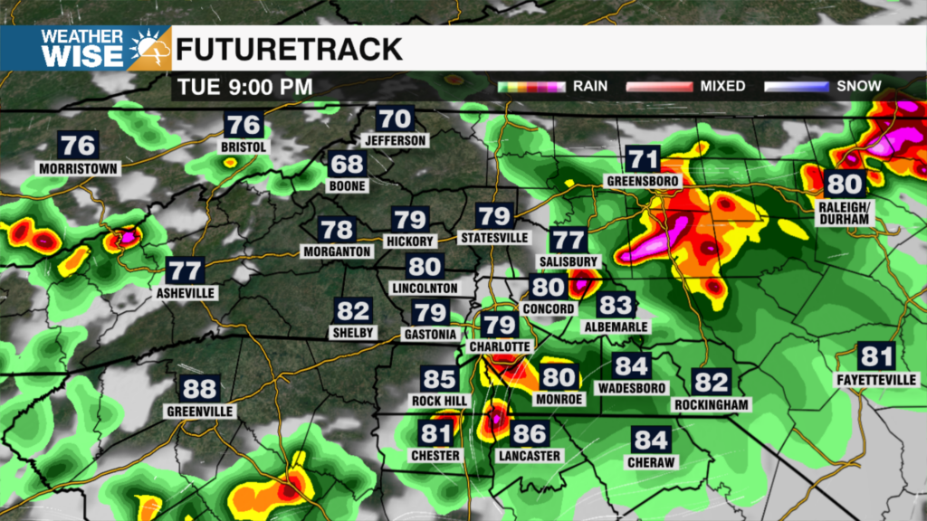
Rain will be the biggest threat for most of us on Tuesday, especially west of the Metro. 4-8″ of rain could fall in the Foothills and High Country, leading to flash flooding and potential mudslides. While the Metro and eastward should remain largely under 3″, flash flooding is still possible. The severe threat is also there mainly west of I-77, where quick spin-up tornadoes are a possibility Tuesday afternoon and night. The remnants of Fred should mostly sweep out of the area by 9am Wednesday morning. Expect a classic summertime pattern to arrive for the back half of the week, as rain chances return to a 20%-30% pop-up storm mode.
Tuesday: Heavy storms, especially west. Some may be severe including isolated tornadoes. High: 80°. Wind: SE 10-15. Gusts: 25+.
Tuesday Night: Strong storms early, then scattered showers. Low: 74°. Wind: SE 5-15.
Wednesday: Showers early, then some clearing. High: 87°.
Thursday: Partly cloudy. A few PM shower/Storms. High: 90°.