We Are All Clear From Severe Weather
CHARLOTTE, NORTH CAROLINA — All warnings and watches have been dropped for the WCCB Charlotte area
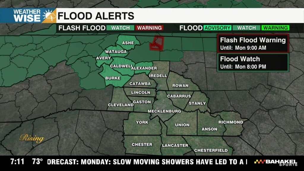
The worst damage was in Cherryville where there are multiple downed trees and thousands without power. As of 12 AM there are 11,000 customers without power in our area.
Four Cherryville schools are closed on Wednesday due to storm damage
Tap here for the latest on the school clourses in Gaston County.
Outdated Article Below:
WHAT:
Two waves of possible severe weather today.
Wave 1 will be isolated to widely scattered storms will begin to pop late this afternoon.
Wave 2 will be within a line of storms that will be ahead of a cold front.
TIMING:
Wave 1: 3pm – 9pm (severe threat from isolated cells will pick up after 5pm)
Wave 2: 8pm – 12am
WHERE:
Near and North of I-85

THREATS:
Damaging Straight-Line Winds
Quarter+ Sized Hail
Isolated Tornadoes
Localized FloodingLATEST THOUGHTS:
Breaks in cloud cover will increase instability going into the afternoon for the Foothills and Piedmont north of I-85. Isolated to widely scattered storms will begin to pop during peak daytime heating. Damaging wind, hail and an isolated tornado will be possible. A line of storms, ahead of the cold front will reach the mountains by 8-9pm. This is where we will have the highest threat of damaging wind, hail, embedded tornadoes and localized flooding. As this line moves south toward the Piedmont, the line will become more broken with a more isolated severe threat. Damaging wind gusts will be the main concern with any severe threat becoming more isolated after 10pm. Rain and storms will taper off after midnight.