Unsettled Weather Continues Into the New Year
AM Headlines:
- Line of showers and storms now east of I-77
- Scattered storms are still possible today south of slow-moving cold front
- Level 1 severe threat
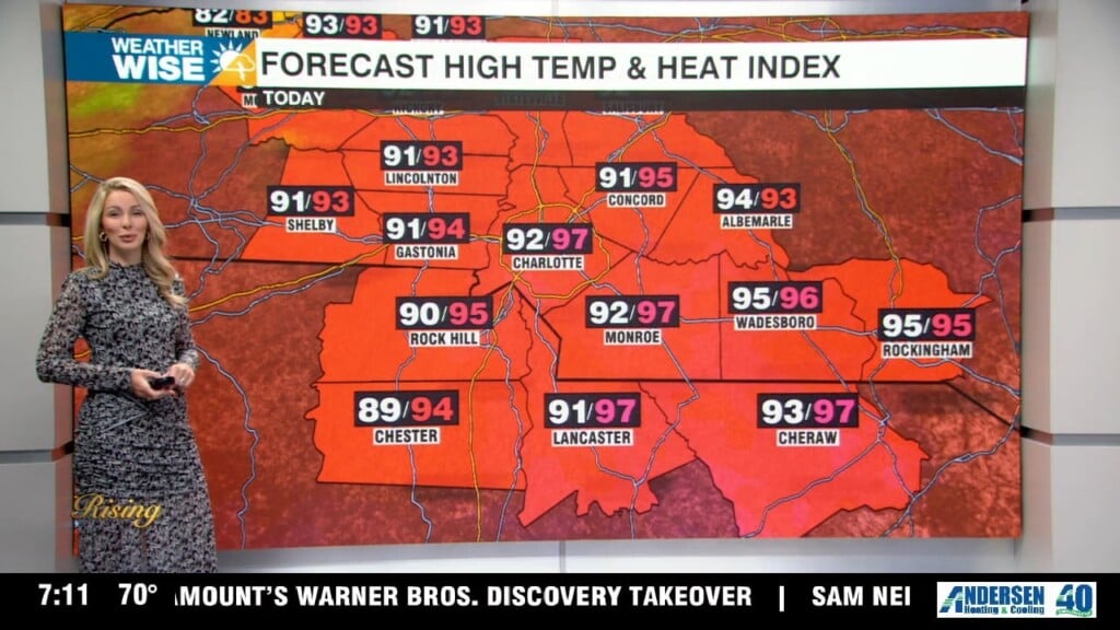
- Temps will remain well above average into the new year
- A strong cold front brings heavy rain, storms Sunday
Discussion:
You were probably woken up by the downpours and thunder as a line of showers and storms moved through the area overnight. That line is now east of I-77, but the severe threat isn’t completely over. A very slow-moving boundary still sits near the I-40 corridor and will slowly meander south through the day. Still a shot at a stronger storm or two early afternoons south of I-85 as temps remain warm, energy potential will be high and we have plenty of moisture to work with for potentially damaging wind or a short-lived tornado. We will get a chance to dry out for a bit Friday, but scattered showers return to the forecast New Year’s Eve night. Better rain and storm chances Saturday ahead of a much stronger cold front that will likely produce severe weather across parts of the south. For us in the Carolinas, this won’t reach us until early Sunday morning, once again limiting, but not totally eliminating the severe threat. 1-2″ of additional rainfall will be possible to help with our drought conditions. Much colder air will slide in behind this system. Highs won’t get out of the 40s Monday with lows falling below freezing Tuesday.