Hot & Stormy Start to Weekend
Heat index values will approach the triple digits in the afternoons for the foreseeable future.
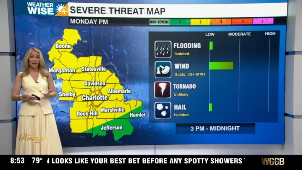
Happy Friday! We may have made it to the weekend, but the heat won’t be going on sabbatical anytime soon. Expect highs to clear the 90° mark for a fourth straight day in the Queen City, although scattered showers and storms in the afternoon will keep things from burning quite as hot they did on Thursday. A few cells that crop up later in the day may be on the strong side with gusty winds and small hail, but the overall severe threat remains low. The unsettled pattern continues into the weekend as a weak boundary approaches from the northwest. Expect highs in the 80s and 90s to continue through the weekend, despite increased cloud and shower coverage.
Rain chances take another dive by Sunday evening as a second front passes through the Carolinas. While rain chances will ebb and flow over the next five days, the heat remains constant. Highs may actually rise into the mid-to-upper 90s by midweek next week. Most will remain dry between the Monday-Wednesday timeframe as some of the hottest air we’ve seen in 2023 makes itself at home. It’s looking increasingly likely that we will see Tropical Storm Don by the end of this weekend, as well. Although the system, located in the central North Atlantic, has a 90% chance of developing tropical characteristics, it will remain out to sea without incident to the Carolinas.
Today: Variable clouds with PM storms. A few may be strong. High: 92°. Wind: SW 5-15.
Tonight: Storms early, then some clearing. Low: 74°. Wind: S 5-10.
Saturday: Hot and humid with PM storms. A few may be strong. High: 92°. Wind: SW 5-15.
Saturday Night: Scattered storms before midnight, then mostly cloudy. Low: 74°. Wind: SW 5-10.
Sunday: Variable clouds with PM isolated storms. Drying out in the evening. High: 94°. Wind: W 5-10.