WeatherWise Alert: Flooding Threat Monday
AM Headlines:
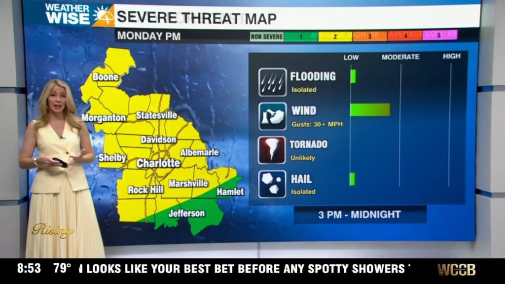
- Flood Watch in effect until midnight
- 1-2″ possible
- High Wind Warning for the mountains Tue 3am-3pm
- NW 25-35 mph Gusts 60+ mph
- Drying out and warming up late week
- Rain chances return this weekend
Discussion:
A cold front will trigger rounds of rain and the potential for a few stronger storms today. Although the severe threat remains low, a few storms will be capable of producing damaging wind and even hail. The biggest concern will be for heavy rain to produce flash flooding. Rainfall totals of 1-2″ are possible. A flood watch is in effect for areas south of I-40 through midnight. A low pressure system will be east of the mountains this evening before driving northeast toward the coast Tuesday. Winds will pick up this evening with gusts 30-35 mph possible across the Piedmont and Foothills. Strong winds could be dangerous in the mountains with gusts more than 60 mph possible through Tuesday afternoon. A High Wind Warning is in effect through 3pm for the mountains Tuesday. We will see a nice drying trend through the rest of the week. Temps will remain above average into the upper 50s Tuesday and Wednesday for Valentine’s Day before warming into the low to mid 60s through Friday. Rain chances return this weekend.