Wet & Foggy Wednesday Morning Commute
On and off showers mainly east of I-77 on Wednesday
Forecast:
Tonight: Cloudy skies. Scattered to numerous showers increase from west to east and continue overnight. Patchy fog. Lows: Mid 50s.
WeatherWise Alert Wednesday: Scattered showers for the morning drive. On and off rain will continue through the day mainly east of I-77. The front will stall to our south and east which will bring most of the rain across eastern North Carolina. It is possible the sun comes out through the afternoon west of I-77. Highs: Upper 60s.
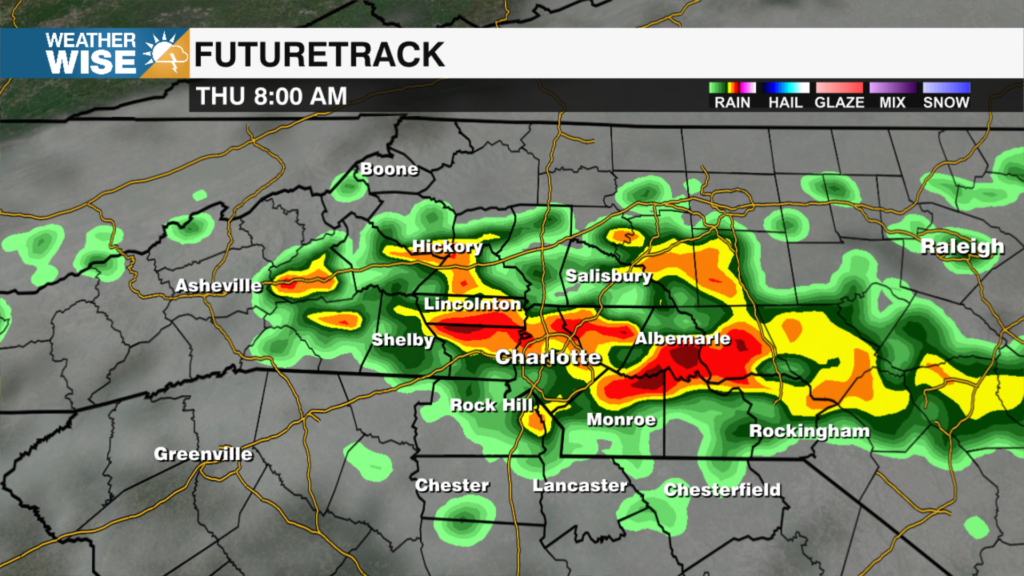
Thursday: Partly sunny. Scattered showers possible in the morning – again mainly southeast of I-85. Models are trending drier at this time. Highs: Mid 60s.
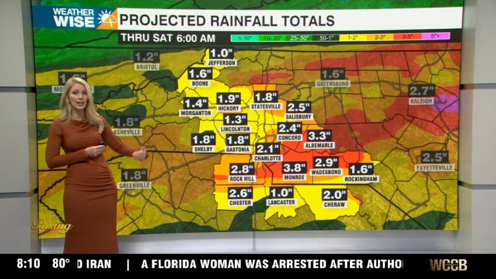
Rain totals: It is possible some of our far southeastern counties pick up 1-2” (it depends where the front stalls). Right now, the heaviest rain looks to stay toward the I-95 corridor and points east. Most of the Foothills and Piedmont will see roughly 0.25”.
Friday: Sunny, dry and nice! Highs near 70.
Saturday: Mostly sunny and warm. Highs: Mid 70s.
Easter Sunday: Very warm with high temperatures likely reaching 80 degrees.
Have a great evening!
Kaitlin