Winter Weather Advisory issued ahead of Wednesday’s winter storm
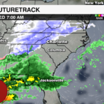

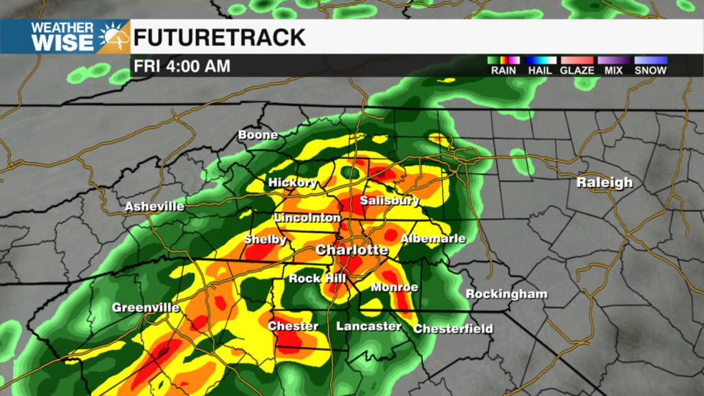
A fast moving winter storm will bring a mix of snow, sleet and ice to the region Wednesday. This will likely disrupt travel across the Carolinas with impacts beginning Wednesday morning near sunrise.

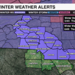
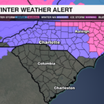
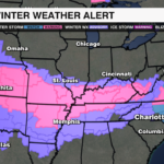
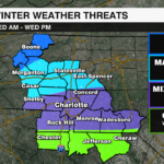
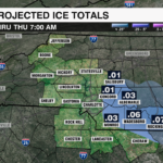
A Winter Weather Advisory will go into effect from 6 a.m. Wednesday until noon Thursday for much of the Piedmont and Foothills including: Alexander, Anson, Burke, Cabarrus, Caldwell, Cleveland, Catawba, Gaston, Iredell, Lincoln, Mecklenburg, Richmond, Rowan, Stanly and Union counties. A wintry mix is expected in the foothills and across the Piedmont with up to 2 inches of snow and sleet and a light glaze of ice possible.
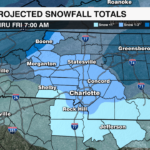
A Winter Weather Advisory is also in effect from 1 a.m. Wednesday until 1 p.m. Thursday for Ashe, Avery and Watuaga counties. Higher snow totals are expected across the mountains with 2-4 inches of snow and wind gusts up to 35 mph.

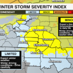
Regional Impacts:
Mountains – All Snow – 2-4″ of snow, gusty winds
Foothills toward the I-40 corridor – Mainly Snow/Wintry Mix – 1-2″ of snow/sleet, light glaze of ice
Piedmont – Wintry Mix – Up to 1″ of snow/sleet, light glaze of ice east of I-77
NC/SC Border & South – Cold Rain/Wintry Mix early – little to no accumulation
The low pressure system will likely be near the Florida/Georgia coast Wednesday evening, before moving off the Carolina coast Thursday morning. This means as now, there are not any major shifts in forecast snow/ice amounts as the moisture stream remains focused over the eastern Carolinas and Virginia.

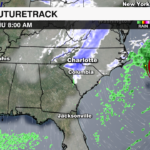
Travel impacts will begin with the Wednesday morning commute as snow and sleet may create slippery roads, especially north of I-85. Although surface temperatures will likely stay above freezing for the Piedmont, icing may occur on elevated surfaces like bridges and overpasses. The wintry weather will intensify by midday and taper off by Wednesday night outside of the mountains.

Overnight temperatures will quickly fall into the teens and 20s. This will likely lead to a flash freeze for any surfaces that remain wet. Black ice with one last burst of snow could lead to reduced visibility and slick morning travel. Bitter cold temperatures, but drier air will stick around through the end of the week.
Get the latest updates from the WeatherWise team by downloading the WCCB Weather App.