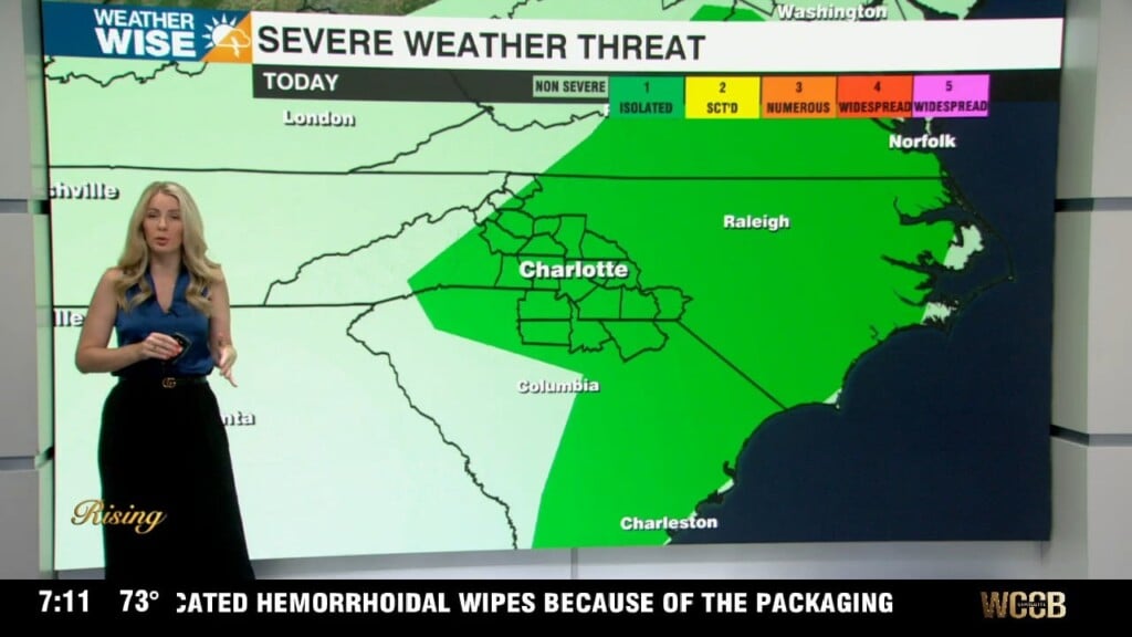
Storm threat increases Thursday
AM Weather Headlines
- Heat Builds Today
- Thursday Cold Front
- Low Severe Threat
- Damaging Wind Gusts Possible
- Slight Dip in Humidity Friday
- Steamy Weekend
- Dangerous Heat Next Week
Discussion
Today stays hot and muggy with highs topping out in the low 90s and heat index values near the triple digits. Despite the heat, most of the region will stay mainly dry – thanks to dry aloft and weak forcing for storms. A few isolated storms could still develop across the mountains and foothills this afternoon, where elevation provides some extra lift, but coverage will be limited.
A more robust cold front slides in from the northwest, arriving Thursday afternoon. This will trigger a band of organized thunderstorms, moving northwest to southeast across the area during the afternoon and early evening. Storms will begin to fire up in the mountains near noon and reach the Charlotte Metro area between 4-7 pm, which could cause issues for the evening commute. Damaging wind and heavy rain leading to localized flooding will be the primary concerns. Behind the front, drier air filters in, lowering humidity levels just a smidge. Highs will still top out near 90, but it’ll feel noticeably different – at least you won’t start sweating as soon as you step outside.
The humidity will build back in this weekend. Highs will top out in the low to mid 90s Saturday and Sunday, but it will feel like the triple digits as a ridge builds over the southeast. This will block out rain and storm chances, but dangerous heat will build in next week. Highs will reach hte mid to upper 90s with heat indices 103+.