Steady warm-up into weekend
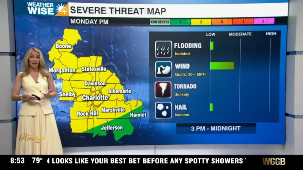
Most locations remain dry this weekend, but the clouds stick around.
Happy Friday! Charlotte just saw its coolest start to August on record – no previous August has seen a lower average temperature through the month’s first seven days than this one – but temperatures are on the rise this weekend. While highs will remain well below average, the Metro should see 80s for the first time since Monday. Rain chances largely remain at bay this weekend, but the clouds stick around as northeasterly winds continue to pump into the WCCB Charlotte viewing area. The taste of fall eventually comes to an end by the middle of next week as highs rise near 90°.
The National Hurricane Center (NHC) continues to monitor two areas in the Atlantic for potential tropical development as former Tropical Storm Dexter dissipates over the open ocean. The first region is located a few hundred miles east of the Outer Banks; the NHC gives this zone a 20% chance of spawning a named storm over the next several days. Regardless of development, any storm that forms here would head out to sea and away from the Carolinas. The second potential system, located between the Caribbean and the western African coast, has a 60% chance of becoming a tropical storm over the next seven days, according to the NHC. Most models keep this disturbance over open water, as well. While there are no direct tropical threats to the Carolinas in the near future, it’s important to stay weather-wise as we head into the peak of hurricane season.
Today: AM showers. PM mostly cloudy with patchy drizzle. High: 80°. Wind: NE 5-15.
Tonight: Mostly cloudy. Low: 67°. Wind: NE 5-10.
Saturday: Overcast early, then variable clouds. Warmer. High: 84°. Wind: NE 5-15.
Saturday Night: Partly cloudy. Nice. Low: 69°. Wind: NE 5-10.
Sunday: Variable clouds with scattered PM storms. High: 84°. Wind: E 5-10.