Soggy Start to Work Week
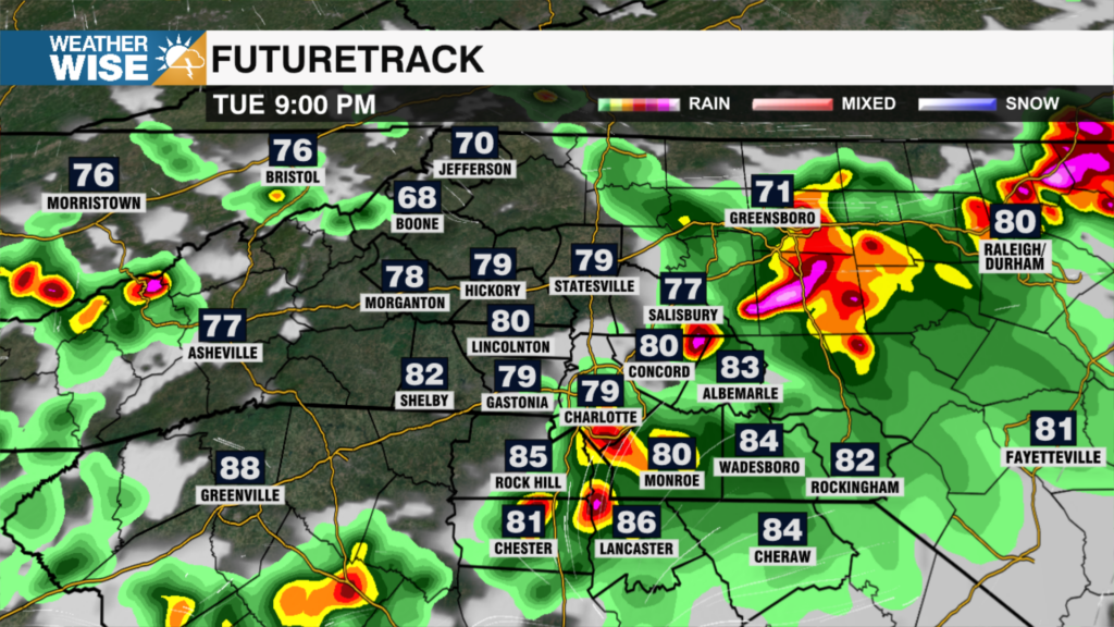
Waking up this morning to overcast skies, patchy fog and spotty showers. On and off showers will continue throughout the day with highs reaching the mid 50s. Overnight temps will remain steady with highs reaching the upper 60s to even low 70s on Tuesday. Rain will become more likely Tuesday as a strong cold front passes through the area. A changeover to snow will be possible overnight Tuesday into Wednesday for the higher elevations. However, after a few morning rain showers for the Piedmont on Wednesday, we’ll have a chance to dry out by Thursday. Much cooler to end the week with highs only reaching the mid 40s Thursday into Friday. As yet another weather maker moves in late Thursday night, there is a chance for a brief rain/snow mix for the Piedmont. No need to panic just yet, as timing could still change and ultimately impact this forecast by late week. Warming back up to mild temps by Saturday with a sunny end to the weekend.
Today: Chance Showers. High: 56 Wind: SW 5-7 mph
Tonight: P. Fog. Low: 55 Wind: SW 7-11 mph
Tue: Rain Likely. High: 69 Wind: SW 8-11; G20
Tue Night: Rain. Low: 43 Wind: SW 5 mph