Claudette Moves Out, Rain Chances Remain
A moisture-laden cold front will arrive by Tuesday, bumping up rain chances midweek.
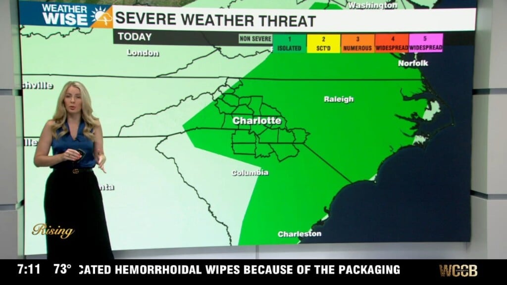
Tropical Depression Claudette is continuing its trek through the Carolinas this Sunday evening. Storms will continue to sweep into the southern half of the WCCB Charlotte viewing area through the early morning hours on Monday. While most storms will be non-severe, a few cells could pack gusty winds, frequent lightning, and even a quick spin-up tornado. As Claudette clears the Carolinas by Monday afternoon, mostly sunny skies take hold. Temperatures should cruise into the 80s and 90s across the board for the first day of the workweek as isolated storms pop up during the afternoon and evening.
Don’t get used to the sunshine. A strong cold front will sweep into the area from the northwest by Tuesday, bumping up rain chances once again for the middle of the week. Highs should fall in the 60s for the High Country and 70s and 80s everywhere else. More sunshine returns for the back half of the week as a steady warm-up arrives into next weekend. Rain totals should end up between 1-2″ for many through the workweek.
Tonight: Showers and storms taper off. Mostly cloudy. Low: 70°. Wind: W 5-10.
Monday: Hot and humid with pop-up storms. High: 94°. Wind: SW 5-15.
Monday Night: Variable clouds. A stray storm is possible. Low: 73°. Wind: SW 5-15.
Tuesday: Mostly cloudy with scattered storms. Locally heavy rainfall. High: 78°. Wind: SW 10-20. Gusts: 25+