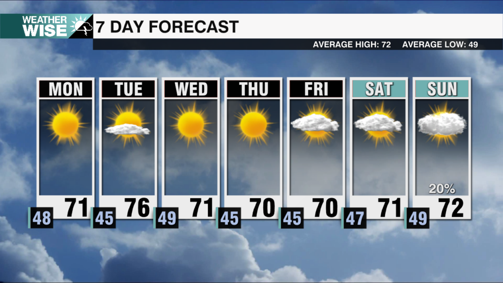
Big warm up this week
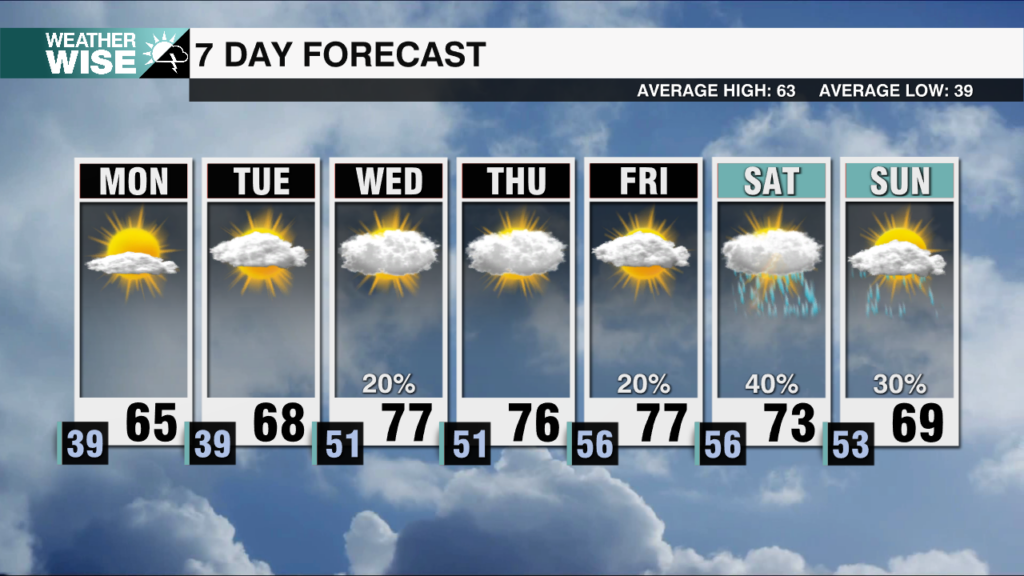
A cooler Monday won’t set the trend, as a big warm up follows later this week.

A cooler Monday won’t set the trend, as a big warm up follows later this week.
Above average temperatures dominate Sunday. Breezy conditions and dry air increase fire danger.
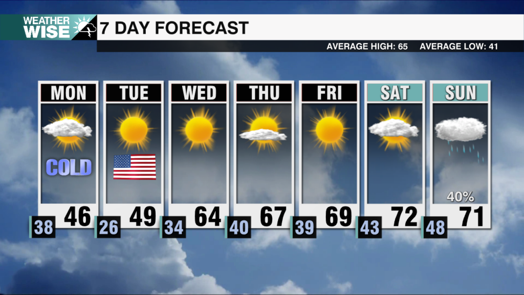
An Arctic front will cross the region tonight. The coldest air of the season, and High Country snow are likely.
Scattered storms tonight with some severe potential exit by tomorrow morning. Arctic air with NW flow snow works in Sunday night.
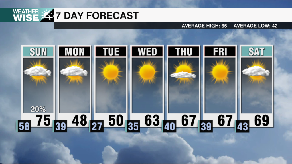
Scattered showers overnight east of I-77. Dry weather and sunshine return to start the new week.
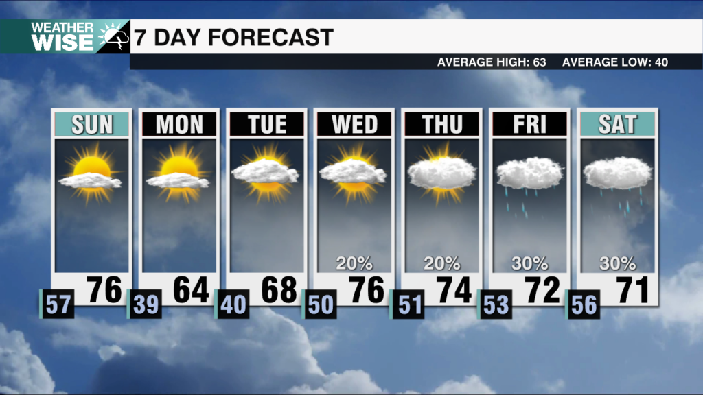
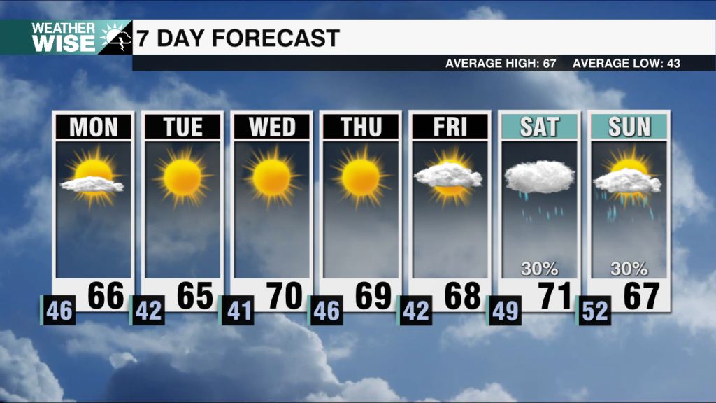
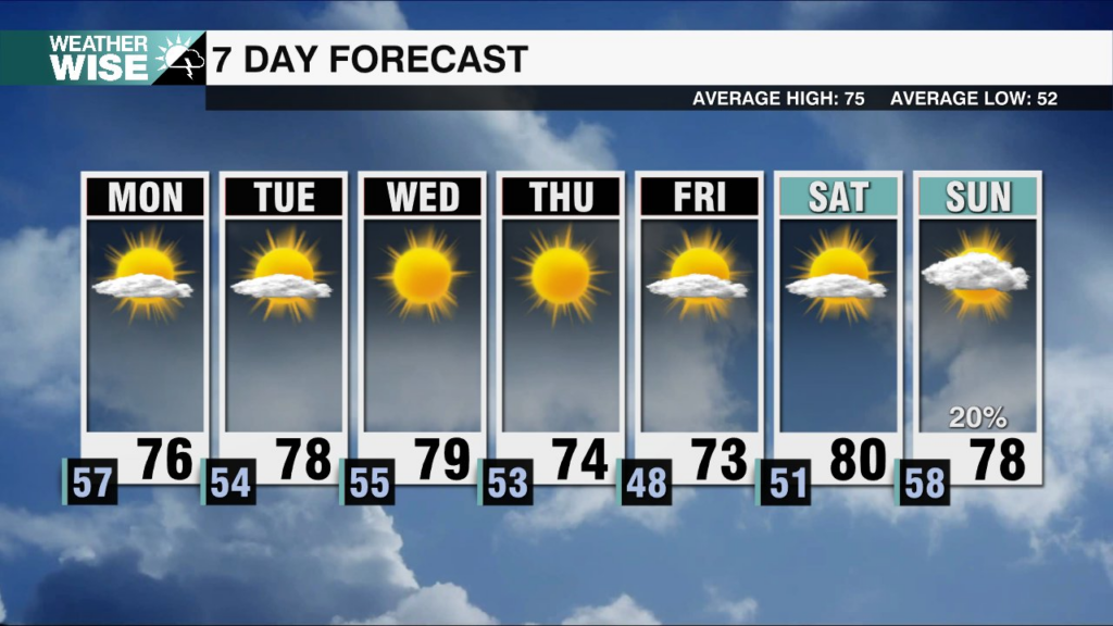
After scattered showers Sunday night, a picture perfect week of weather follows.
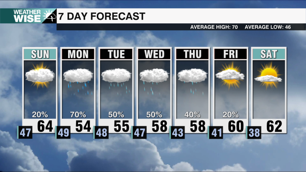
Isolated showers this evening become widespread by Monday evening. The cold and wet pattern holds for the first half of the week.
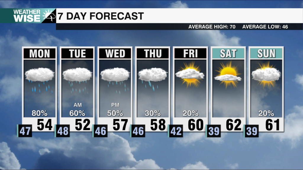
Multiple storm systems look to impact the area over the next 5 days. Increasing rain chances, and well below average temperatures lock in.
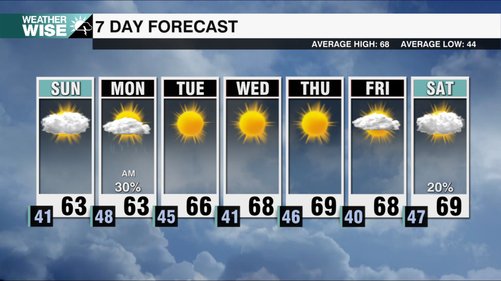
A few isolated showers with gusty winds for our Sunday evening. By Monday, a beautiful week sets up with plentiful sunshine and chilly mornings.
After scattered showers, and gusty winds for many this evening. Sunshine and dry weather return to start the new week.
 Formerly Twitter