Local News, North Carolina News, On The Road With James, Weather News and Information, Weird News, What's on Rising - Newsletter
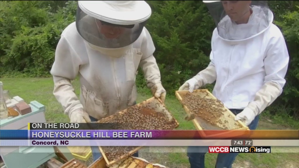
On the Road with James: Honeysuckle Hill Bee Farm
Come see what the buzz is all about!

Come see what the buzz is all about!
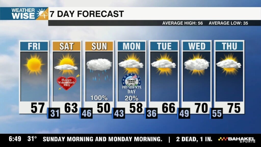
It won't be a beautiful close to the workweek by any means, but it'll be well worth our trouble for the weekend.
Officials are scrambling to control yet another early start to the fire season as all-time city and state highs have been broken across Washington, Oregon, and California.
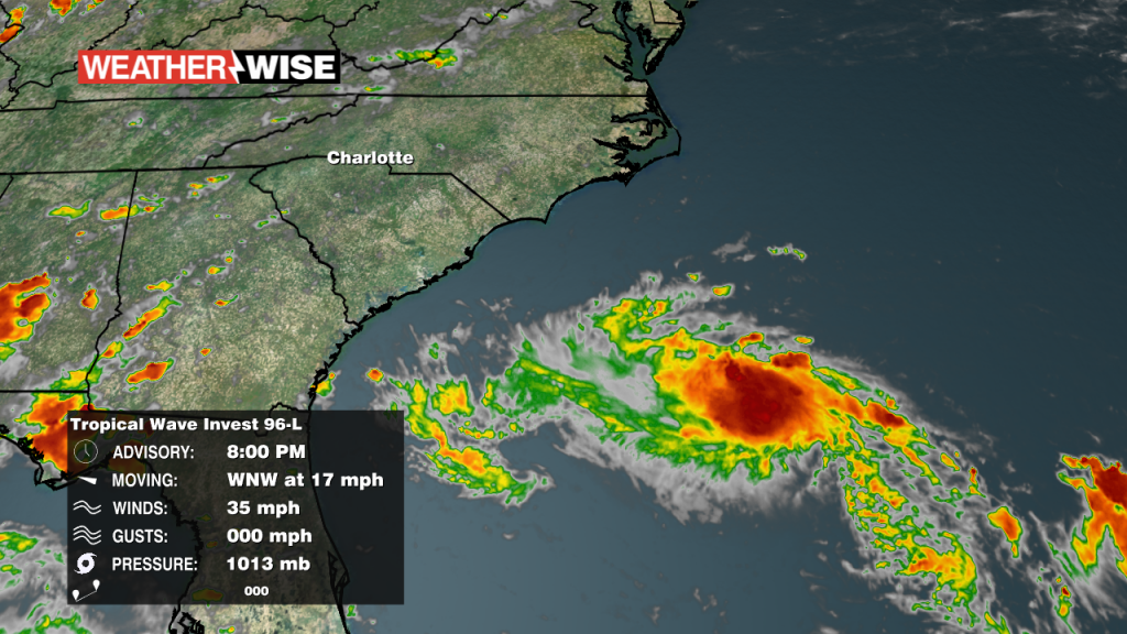
While the storm hasn't been given a name yet, there's a 50/50 shot it becomes Tropical Storm Danny shortly before landfall Monday evening.
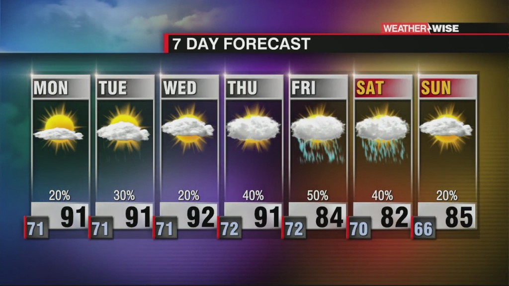
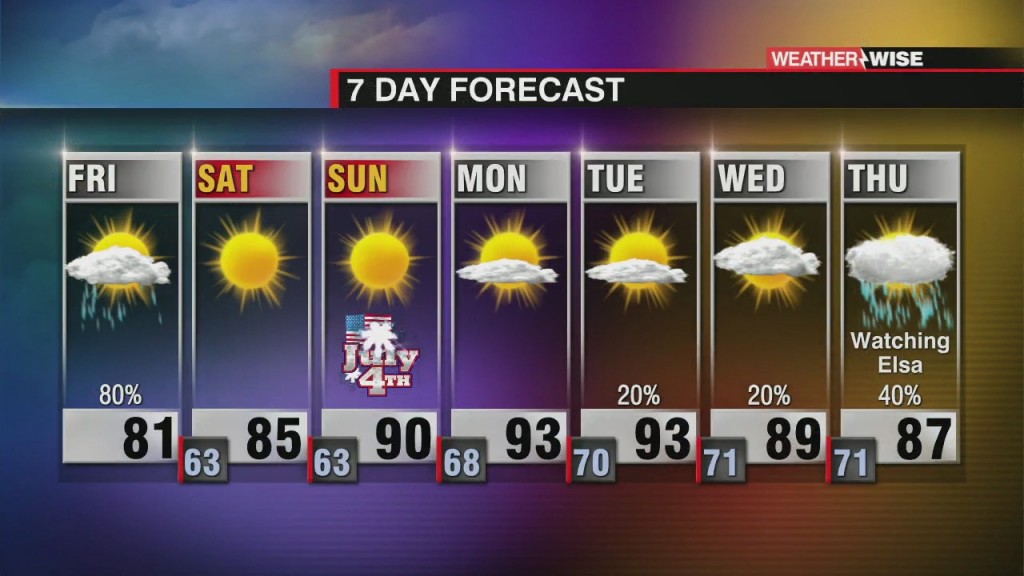
A sneaky homegrown tropical system may develop right in our backyard by Monday, but prepare for a hot and humid week ahead regardless.
The cooler weather has been nice, but it's back to business as usual for the week ahead.
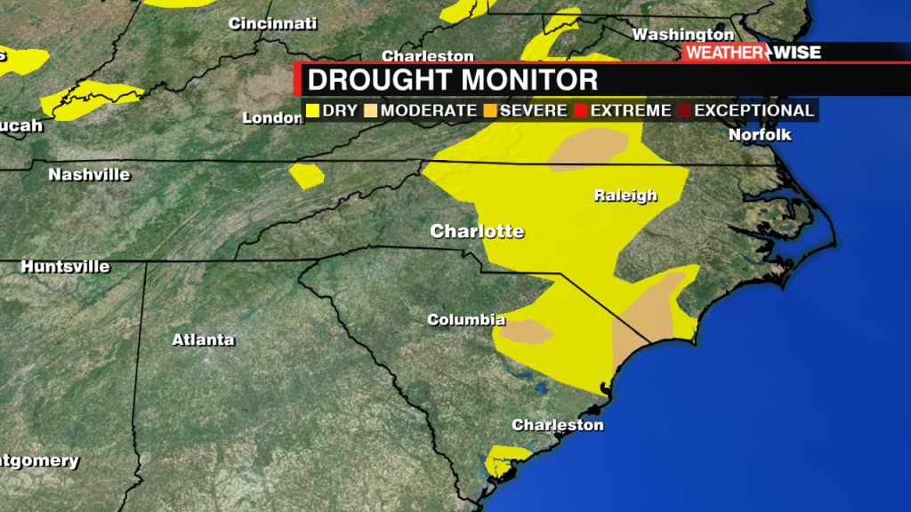
While severe drought has been completely flushed out of the Carolinas, wide swaths of moderate drought and abnormally dry conditions remain.

James goes on the road and visits some local mobile dining staples around the Queen City.
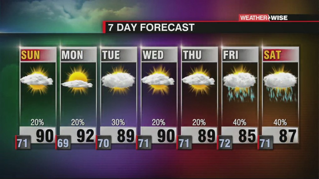
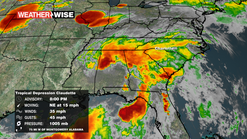
We'll have a hot and mainly sunny Monday on the tails of Tropical Depression Claudette, but that may be an exception to a rainy rule this week.
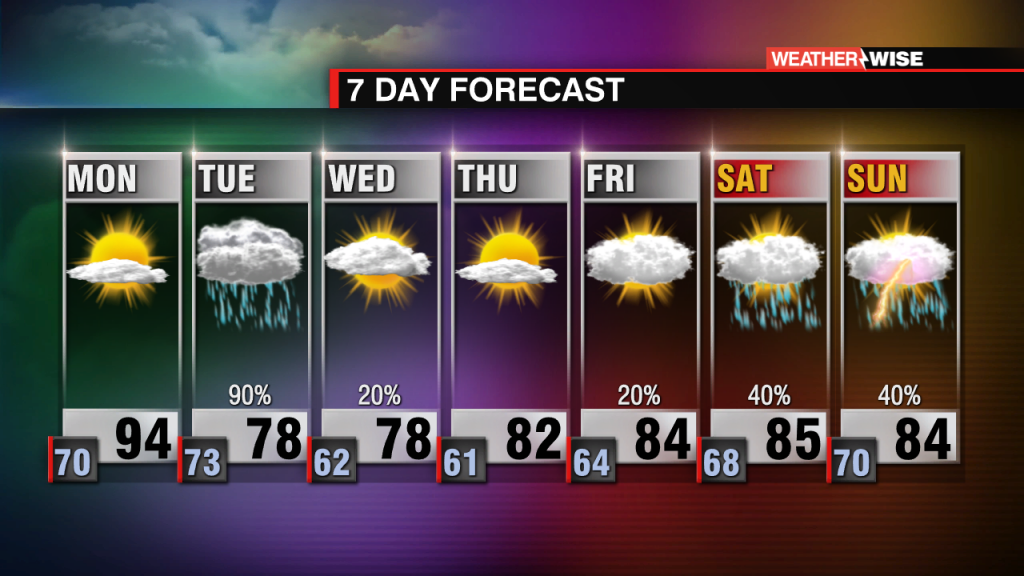
Heavy showers and storms arrive overnight and last through much of our Father's Day.
 Formerly Twitter