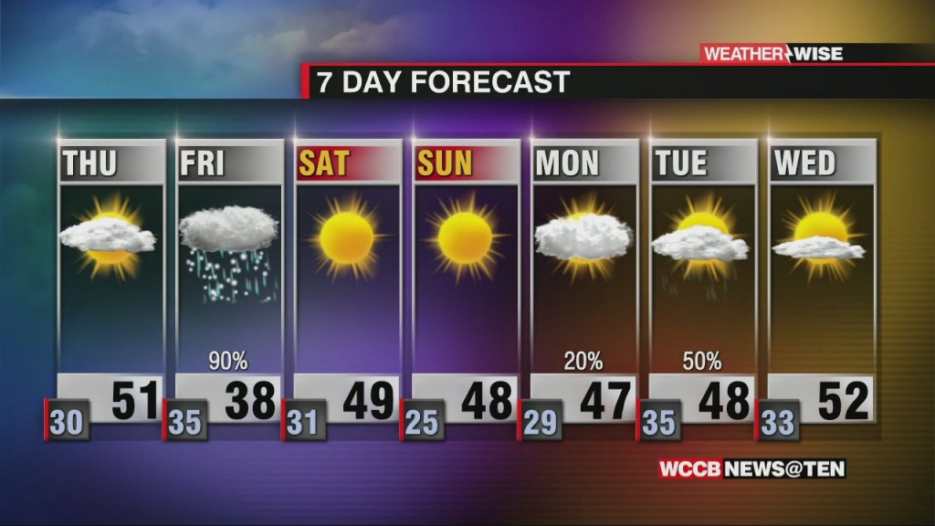
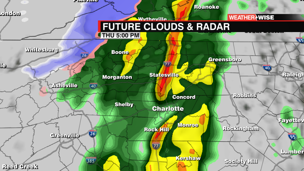
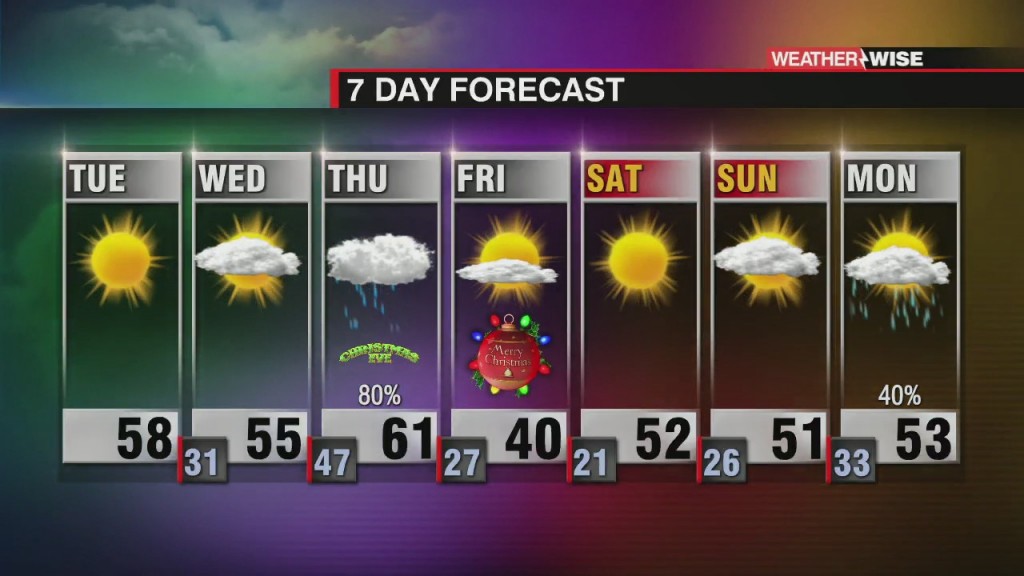
Cool & Cloudy Thursday with Rain & Snow Friday
Winter Storm Watches in effect Friday across the Mountains, Foothills and northwest Piedmont.

Winter Storm Watches in effect Friday across the Mountains, Foothills and northwest Piedmont.

A quiet next couple of days before a late week storm system
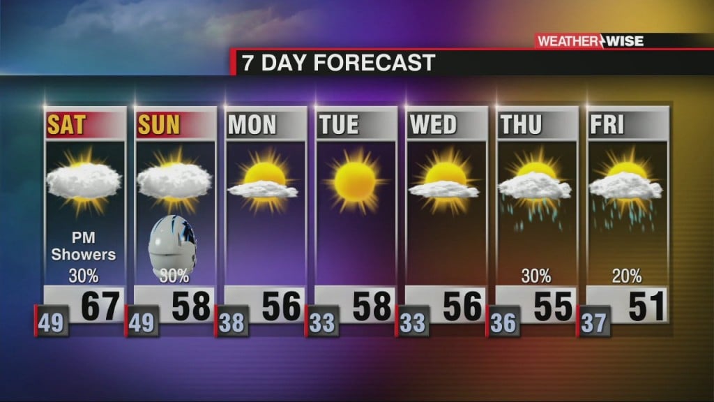
Saturday AM clouds try to break, but clouds dominate most of the day.
Increasing temperatures and rain chances through the remainder of the week.
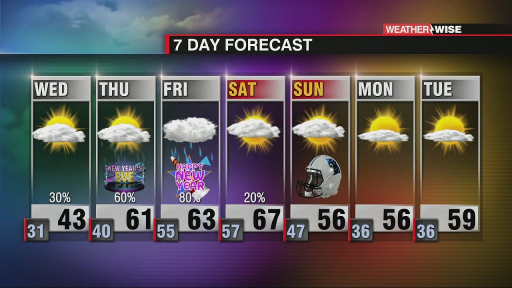
A temperature roller coaster dominates the week with increasing late week rain and storm chances.
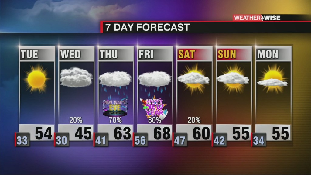
Temperature roller coaster this week with end of the week rain.
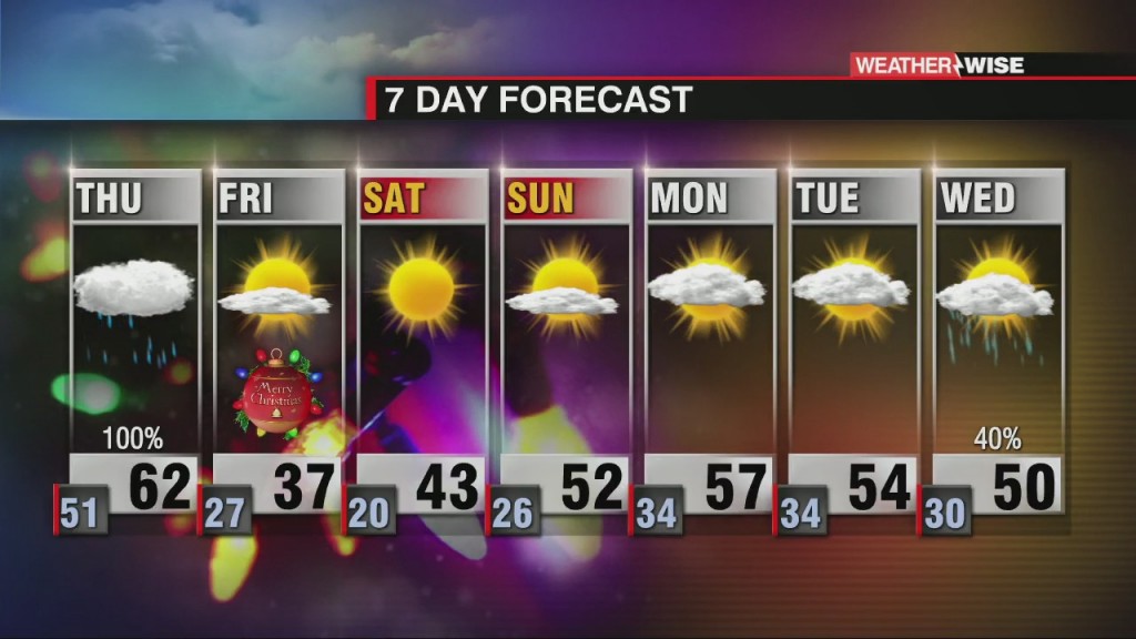
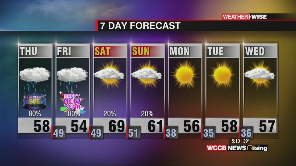
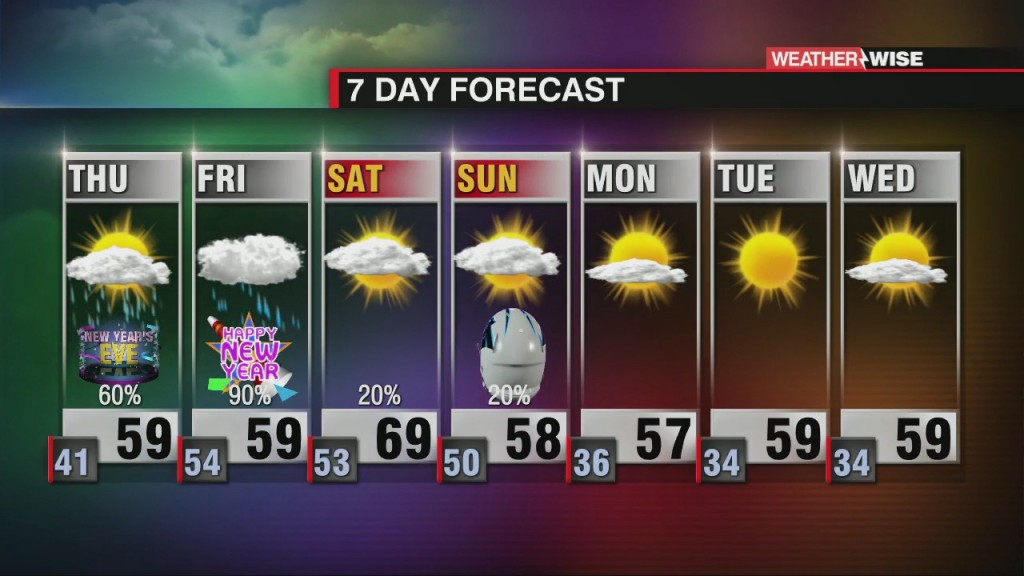
Christmas Eve rain with possible strong storms. Behind the cold front, expect a BIG cool down.
Widespread rain, strong winds, and snow will impact the region on Christmas Eve. Blustery Christmas to follow.
Christmas Eve rain with a big Christmas day cool down.
 Formerly Twitter