Showers and Storms Linger Into Saturday
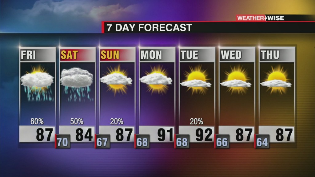
An unsettled Saturday ahead of slightly drier air on Sunday

Sections
WCCB
Extras

A Charlotte native, Kaitlin graduated from the University of North Carolina at Charlotte in 2015 with a Bachelor’s of Science in Meteorology. Before returning home, her broadcast career took her to Albany, New York; Myrtle Beach, South Carolina; and Pensacola, Florida. From hurricanes and tornadoes to excessive heat and snow – she is knowledgeable about and familiar with a variety of weather conditions.
Kaitlin holds the prestigious AMS Certified Broadcast Meteorologist (CBM) designation from the American Meteorological Society. The CBM is considered the gold standard in broadcast meteorology, recognizing excellence in meteorological expertise and effective communication of weather information to the public.
Kaitlin considers her greatest accomplishment to be motherhood. She and her husband, Ryan, are raising their three young boys, Reece, Holland and Rhodes who keep life busy, fun and full of adventure.
An unsettled Saturday ahead of slightly drier air on Sunday
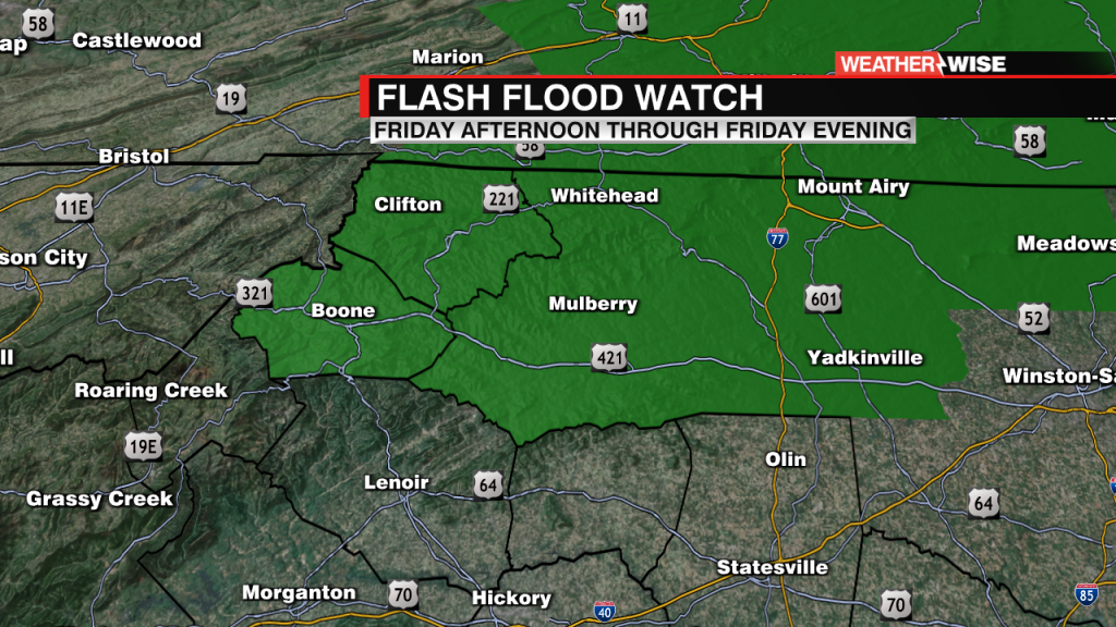
With more rain on the way, there is a Flash Flood Watch in effect for portions of the High Country.
Slightly improving drought conditions across the Carolinas due to recent rainfall.
Scattered showers continue with much drier air in the forecast
Hot and humid days ahead with the chance for showers and storms.
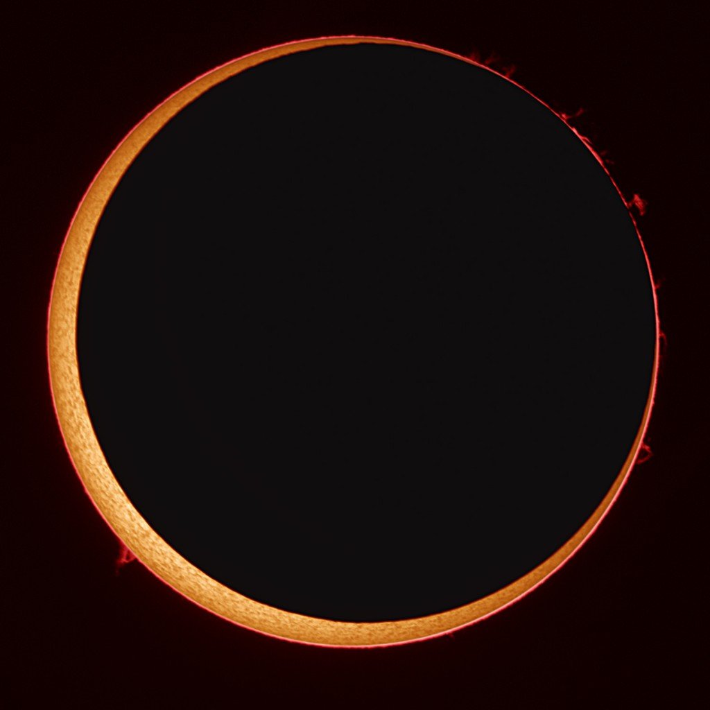
Rare "Ring of Fire" Eclipse will be visible in parts of North America on Thursday.
Rinse and repeat with a tropical air mass in control.
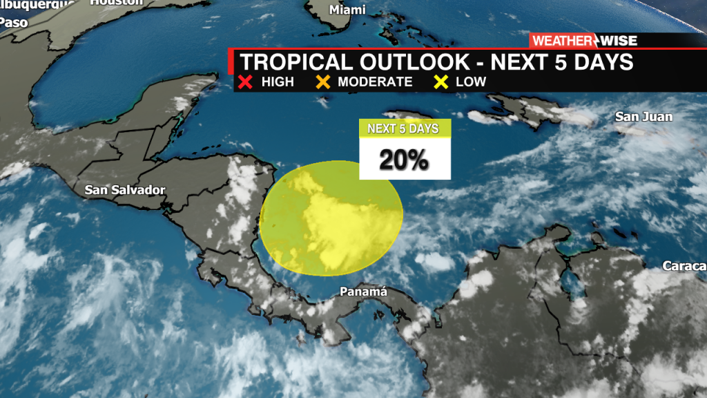
We are monitoring the southwestern Caribbean Sea for potential tropical development in the next 5 days.
Today was the wettest day at Charlotte Douglas International Airport (CLT) in 207 days!
Rinse and repeat! Hot and humid days ahead with the chance for showers and storms.
icons go here