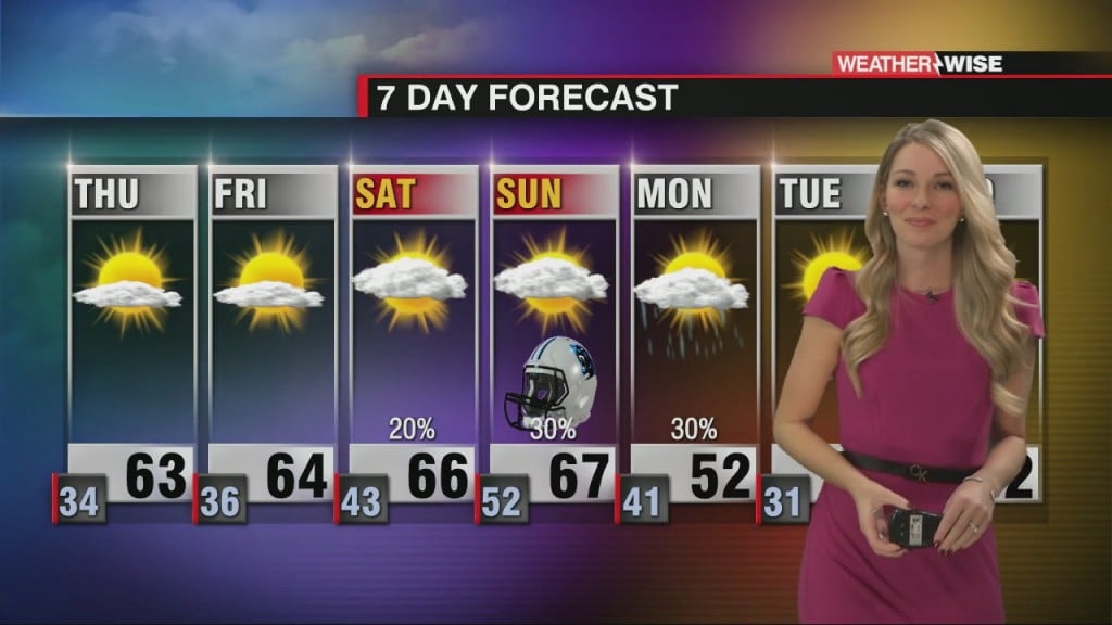
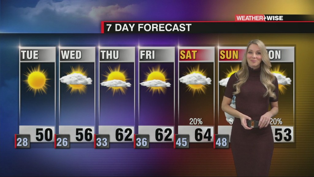
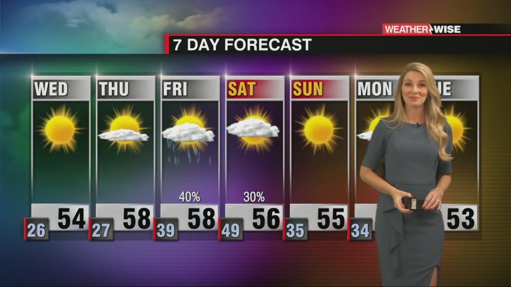
Warming Up Through the End of The Week
Expect frost Thursday morning as temperatures will flirt with freezing.

Expect frost Thursday morning as temperatures will flirt with freezing.
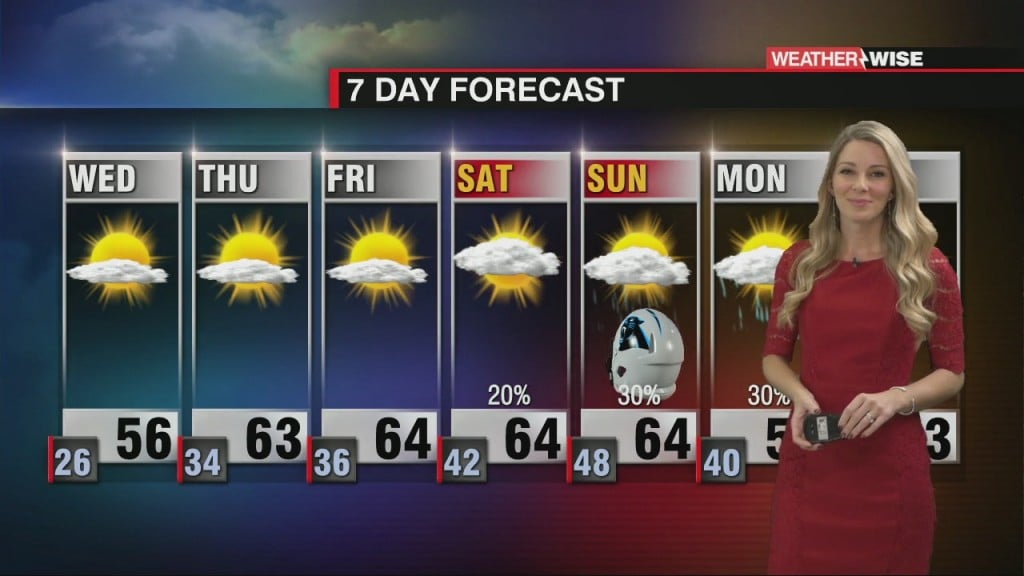
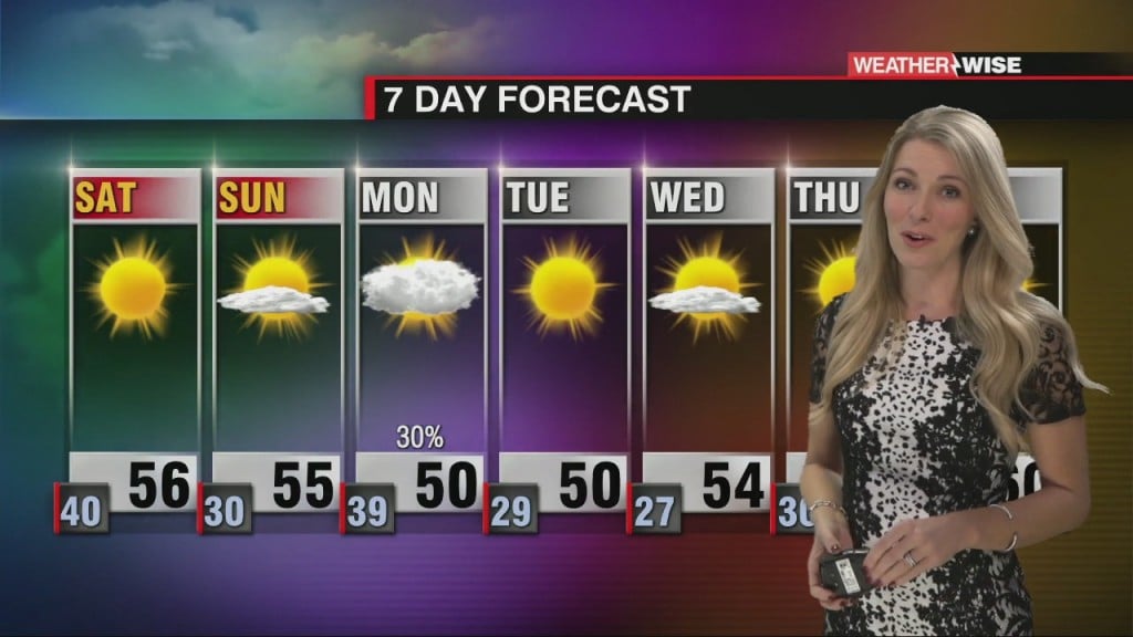
Another freezing night with gradual warming through the second half of the week.
Ridge of high pressure builds in for the remainder of the week.
Rain Friday night with clearing through the weekend.
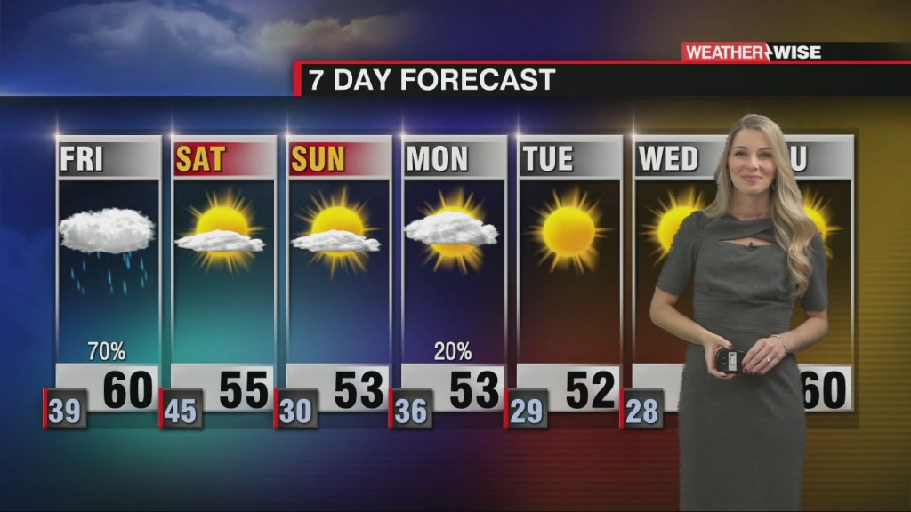
Warming up ahead of our next weather system along with increasing clouds and rain chances.
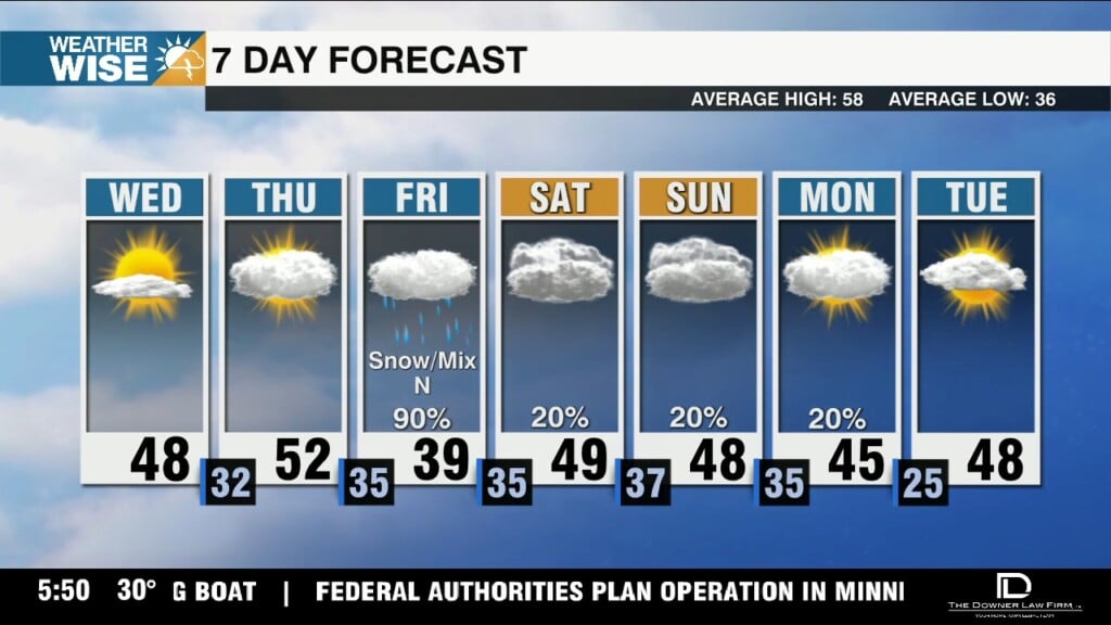
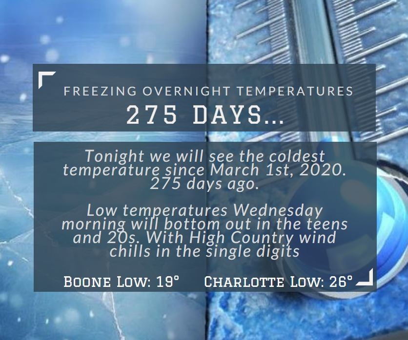
The coldest temperature since March occurred this morning as we dropped to 25° in the Queen City. Another widespread freeze is expected tonight.
Fireball flash plus a loud boom for some across the United States Wednesday afternoon.
Area Wide Freeze Across the WCCB Area Overnight Tuesday - Wednesday
Today was the coldest day in 284 days and tonight will be the coldest night since March 1st.
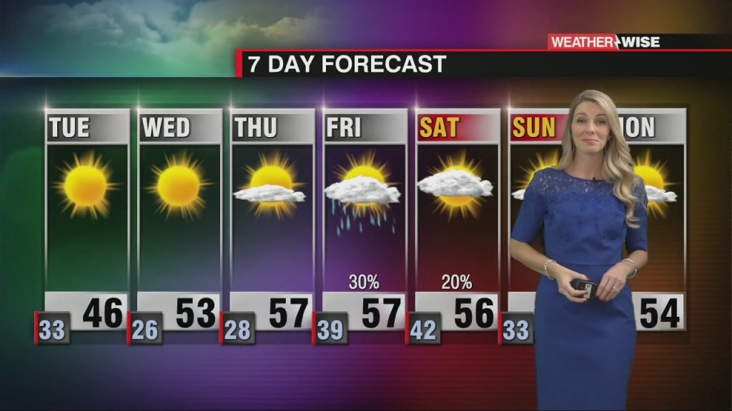
Snow for the mountains with wind chills in the single digits for some this evening into Tuesday morning.
 Formerly Twitter