
Widespread rain with isolated flooding possible through Thursday
Flash Flood Watch in effect for parts of the Carolinas ahead of widespread rain. Isolated flooding is possible through Thursday.
Sections
WCCB
Extras

A Charlotte native, Kaitlin graduated from the University of North Carolina at Charlotte in 2015 with a Bachelor’s of Science in Meteorology. Before returning home, her broadcast career took her to Albany, New York; Myrtle Beach, South Carolina; and Pensacola, Florida. From hurricanes and tornadoes to excessive heat and snow – she is knowledgeable about and familiar with a variety of weather conditions.
Kaitlin holds the prestigious AMS Certified Broadcast Meteorologist (CBM) designation from the American Meteorological Society. The CBM is considered the gold standard in broadcast meteorology, recognizing excellence in meteorological expertise and effective communication of weather information to the public.
Kaitlin considers her greatest accomplishment to be motherhood. She and her husband, Ryan, are raising their three young boys, Reece, Holland and Rhodes who keep life busy, fun and full of adventure.
Flash Flood Watch in effect for parts of the Carolinas ahead of widespread rain. Isolated flooding is possible through Thursday.
An area of low pressure in the Gulf will soon strengthen to Tropical Storm Bertha
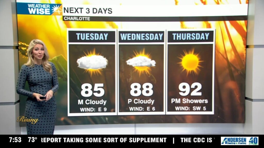
Hot, humid and mostly dry Tuesday ahead of a midweek washout. Widespread rain could lead to isolated flooding Wednesday night through Thursday.
Hot and muggy start to the week with isolated severe storms possible. Rain chances increase late Wednesday into Thursday as a cold front moves in.
A hot, humid and hazy close to the work week with an Air Quality Warning in effect. Showers will be scattered through the weekend with isolated severe storms possible.
The heat cranks up today with highs in the mid to upper 90s. The high heat and hazy skies will stick around through Friday.
An Air Quality Warning is in effect for Mecklenburg County until 8 PM Wednesday due to high concentrations of ground-level ozone.
After a couple of days with below average temperatures, the heat returns. An Air Quality Warning is in effect until 8 PM Wednesday.
Mostly cloudy skies today with highs in the mid 80s. The heat builds through the second half of the week.
Cooler and cloudy Monday with an isolated flooding threat through the day. The heat will build by midweek.
icons go here