15 Breathtaking Hiking Trails Within 50 Miles Of Charlotte | PHOTOS


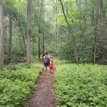
With temperatures on the rise, it’s time to get outside. WCCB has compiled a list of 15 trails you need to hike before the summer ends.
All trails are open from dusk to dawn and allow pets, as long as they remain leashed.
You don’t need to travel too far out of the Charlotte area to enjoy all the nature that the Carolinas have to offer, with some greenways and parks just miles from the city center.
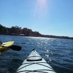
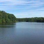
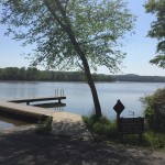
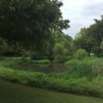
1.) Catawba River Blueway – Lake Norman Section (31 miles)

Lake Norman
This trail brings visitors 31 miles of hiking along the Catawba River.
Officials say this particular section will bring hikers past Lake Norman State Park and Latta Plantation Preserve.
Fees: No
Parking: 8400 Long Island Road, Catawba, N.C. 28609
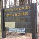
2.) Catawba River Blueway – Mountain Island Lake Section (6.1 miles)

P.C. Mil Aerial
Visitors to this trail will follow Lake Norman south for 6.1 miles.
Officials say the upper section is good for paddling and is mostly underdeveloped due to the large number of parks and natural areas bought to help protect the drinking water for Charlotte and surrounding towns.
Fees: No
Restrooms: No
Parking: Mountain Island Lake, North Carolina, Huntersville, N.C. 28078 (off of Sample Road), Huntersville, N.C. 28078
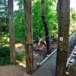
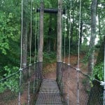
3.) McAlpine Creek And Campbell Creek Greenway (6.2 miles, one-way)

P.C. Amy Moore
McAlpine Creek Greenway is the southern portion of the greenway and is constructed mainly of crushed gravel.
Campbell Creek Greenway is the paved, northern portion and with numerous trees, this part of the greenway offers visitors shade on both sides for nearly its entire length.
There are also several ways to access the greenway, which makes it a convenient hike for all fitness levels.
Officials say the Campbell Creek Greenway was recently extended to Lockmont Drive, making the greenway measure close to 6.2 miles.
Fees: No
Restrooms: Yes
Parking: 8711 Monroe Road, Charlotte, N.C. 28212.
300 Boyce Road Charlotte, N.C. 28211
110 Old Bell Road Charlotte, N.C. 28270.
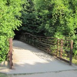
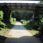
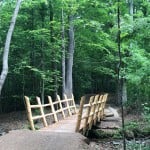
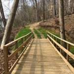
4.) Mountain Island Park Trail (1.6 miles, one-way)

Mountain Island Park Trail Extension
This trail, entirely shaded in the spring and summer, follows the Catawba River and has recently been extended south by the City of Mount Holly.
Officials say the trailhead, parking, playground, and viewing are are next to Mountain Island Lake Dam.
There are several fishing sites nearby (including a handicap fishing site perfect for catfish and bass fishing).
Fees: No
Restrooms: No
Parking: 400 Mountain Island Rd, Mt Holly, N.C. 28120
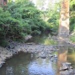
5.) Buffalo Creek Preserve Trail (2.1 miles, one-way)

P.C. Nancy Pierce
Located in Mount Pleasant, N.C. in rural Cabarrus County, this picturesque hike takes you through farm fields to a young forest and ends by a small, rounded cliff overlooking Adams Creek.
At the trailhead, visitors will walk through a piedmont oak savanna in the process of restoration by the Catawba Lands Conservancy (CLC).
CLC officials say this habitat type, which is home to numerous ground-nesting birds and prairie species, is in decline throughout the piedmont of the Carolinas.
The 393-acre preserve also protects several streams, ponds and wetlands that aid in enhancing water quality and is part of the Butterfly Highway.
Fees: No
Restrooms: No
Parking: Near 7911 Malibu Road, Mt Pleasant, N.C. 28124
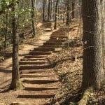
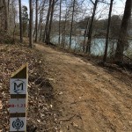
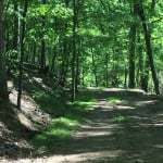
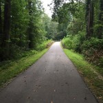
6.) Rocky Branch Trail (1.2 miles, one-way)

Rocky Branch Trail
Connecting the city of Belmont and Cramerton, this trail weaves through forests and offers over four miles of mountain bike trails for cyclists of all experience levels.
Fees: No
Restrooms: No
Parking: 103 Sacco Street, Belmont, N.C. 28012
7.) Overmountain Victory Trail – Lake Whelchel Segment (6.7 miles, round trip)

Lake Whelchel Segment
This trail encircles the city of Gaffney, S.C.’s primary water source, Lake Whelchel.
The trail is part of the Overmountain Victory National Historic Trail, which traces the route used by patriot militia during the Kind Mountain campaign of 1780.
Currently, visitors are encouraged to hike the scenic route both though the woods and around the lake.
Fees: No
Restrooms: Yes
Parking: 198 Concord Road, Gaffney, S.C. 29341
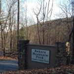
8.) Bakers Mountain Park (6 miles)

Bakers Mountain Park
This park offers six miles of trails for hikers and runners that reach the highest elevation of 1780 feet in Catawba County.
Fees: No
Restrooms: Yes
Parking: 6680 Bakers Mountain Road, Hickory, N.C. 28602
9.) Morrow Mountain State Park (30 miles)

Morrow Mountain State Park
This park offers over thirty miles of hiking and bridle trails for horse riders.
The Bridal Trail section called the Long Loop is the 16-mile trail that encircles Morrow Mountain.
A family campground also exists nearby with over 106 sites for tents, trailers, and RVs.
Fees: No
Restrooms: Yes
Parking: 49104 Morrow Mountain Road, Albemarle, N.C. 28001
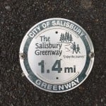
10.) Salisbury Greenway (4.1 miles, one-way)

Salisbury Greenway
Visitors can enjoy all that nature has to offer on this 5.2 mile loop.
The greenway provides easy connections between recreational areas, parks, and natural areas.
Fees: No
Restrooms: Unknown
Parking: Overton Elementary School, 1825 W Park Road, Salisbury, N.C. 28144
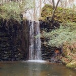
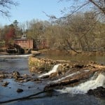
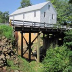
11.) Murray’s Mill Trail (1.4 miles, one-way)

P.C. Amy Moore
This trail starts north of Murray’s Mill Road and begins at an information board and picnic area.
The trail is narrow with a number of exposed roots and runs through a heavily wooded area, providing a lot of shade in the spring and summer months.
Fees: No
Restrooms: Yes
Parking: 1489 Murrays Mill Road, Catawba, N.C. 28609
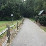
12.) Kings Mountain Gateway Trail ( 5 miles, one-way)

Kings Mountain Gateway Trail
This trail ultimately connects downtown Kings Mountain to Kings Mountain National battlefield, Kings Mountain State Park, Crowders Mountain State Park, and the Overmountain Victory Trail.
Hikers and bikers can use the 8-miles of trail compromised of crushed stone, boardwalk, and sidewalk.
Fees: No
Restrooms: Yes
Parking: 807 S. Battleground Avenue, Kings Mountain, N.C. 28086
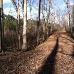
13.) South Fork Rail Trail (1.8 miles, one-way)

South Fork Rail Trail
This trail runs along the South Fork of the Catawba River in the 324-acre Rhyne Preserve .
The trail is a combination of natural surfaces and crushed gravel.
Bikers and hikers can enjoy two miles of trail on the preserve.
Fees: No
Restrooms: No
Parking: Near 2677 Laboratory Road, Lincolnton, N.C. 28092
14.) Crowders Mountain Trail (2.5 miles, one-way)

Crowders Mountain Trail
This is a popular hike through Crowders Mountain starting at the Linwood Road Access to the Sparrow Springs Access.
The trail wanders through the natural habitat of numerous plants and wildlife.
At an elevation of 1,625 feet, Crowders is pretty steep.
The mountain is also a registered natural heritage area.
Fees: No
Restrooms: Yes
Parking: Sparrow Springs Access, Crowders Mountain State Park, 522 Park Office Lane, Gastonia, N.C. 28052
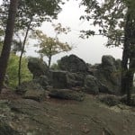
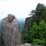
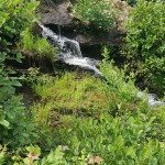
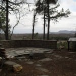
15.) Pinnacle Trail (1.7 miles, one-way)

Crowders Pinnacle
This trail at Crowders Mountain State Park connects the Ridgeline Trail to the Crowder’s Trail.
The trail leads hikers to the highest point in Gaston County at 1,705 feet called King’s Pinnacle.
Although steep, the panoramic views are well worth the hike.
Fees: No
Restrooms: Yes
Parking: Sparrow Springs Access, Crowders Mountain State Park, 522 Park Office Lane, Gastonia, N.C. 28052
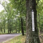
- Special thanks to Carolina Thread Trail for additional photos and information.


