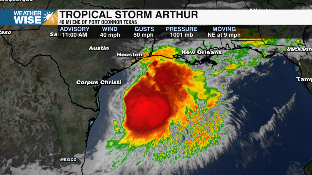
The storm has prompted Tropical Storm Warnings along portions of the Texas and Louisiana coast, where residents are dealing with periods of heavy rain, strong wind gusts, and deteriorating coastal conditions.
What to expect for North Carolina
We’ll also be keeping an eye on a few stronger storms. Not everyone will see severe weather, but a handful of thunderstorms Thursday afternoon and evening could pack some punch. The main concern would be strong, potentially damaging wind gusts. There is also a very small tornado risk, especially Thursday evening into the overnight hours, but that threat depends on whether enough energy can build. At this point, the wind threat appears to be the more likely scenario.
Even if you don’t see a thunderstorm, you’ll probably notice the wind. Thursday afternoon through Friday morning will be breezy, with gusts reaching 20 to 30 mph. A few stronger gusts between 35 and 45 mph are possible late Thursday night into early Friday, especially as the center of the system passes nearby. The good news is that the strongest winds should be fairly isolated.
Overall, this looks more like a heavy rain and gusty wind event than a major severe weather outbreak, but it’s definitely worth staying weather wise as we head into Thursday evening and overnight. Stay tuned!