Warmer Through Tuesday, Cold Stretch Sets in Mid-Week
AM Headlines:
- Chilly start; breezy for the mountains
- Warmer through Tuesday
- Mid-week cold front
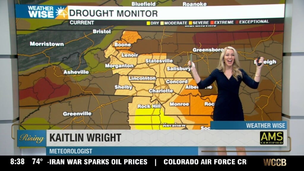
- Lacks Moisture
- Much Colder Temps
- Monitoring Friday/Saturday for more winter precip..
Discussion:
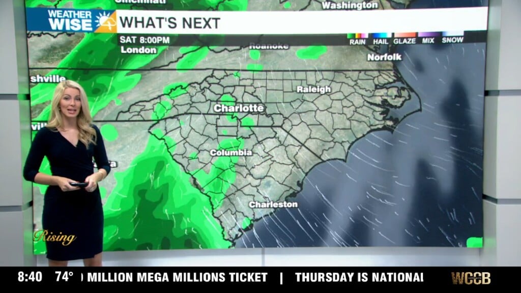
High pressure will keep it generally sunny today with highs reaching the low 50s this afternoon. Highs will climb back above seasonable Tuesday with highs reaching the upper 50s. Clouds build in ahead of a cold front. A brief wintry mix will be possible for the mountains Tuesday afternoon, otherwise moisture will be lacking anywhere outside of the mountains. Temps Wednesday will be 15 degrees colder than the day before, and 10 degrees below average reaching the low 40s. Freezing nights are ahead to end the week with lows falling to the low 20s Thursday morning. It will be a struggle to get out of the 40s the rest of the week. Friday will be a day to watch as yet another system could bring more snow to the region. As with the last storm and this general setup, there is a lack of uncertainty with the model trends. As of now, looks like the moisture will reach the area before the front, which would keep precip mainly rain outside of the higher elevations. But, it will be something to watch as things are likely to change over the next few days.