Warming Up, Late Week Storms
AM Headlines
- Freezing start
- Dry and seasonable Tuesday
- Warmer through Thursday
- Rain and a few stronger storms are possible Thursday into Friday
Discussion
Dry and Mild Through Mid-Week
Dry and mild pattern continues for a few more days before a strong cold front barrels through the Carolinas. Temps will warm into the mid-50s today after a chilly start this morning with sunny skies in the forecast. Overnight lows will fall to the mid-30s. Clouds begin to fill in late tomorrow, but rain chances will remain minimal with highs reaching the low 60s.
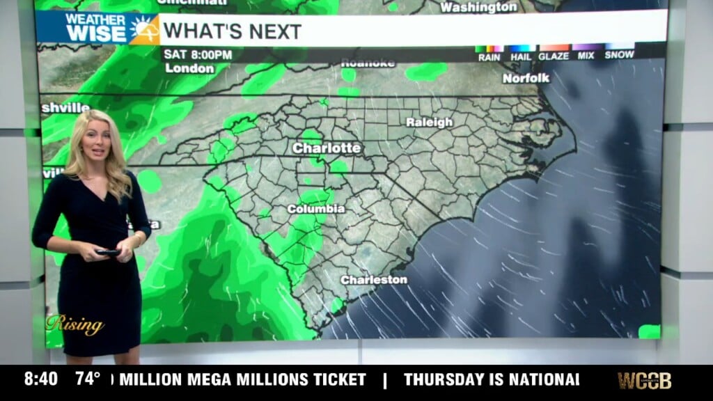
Heavy Rain, A Few Stronger Storms Thursday into Friday
As of now, the area is highlighted under a level 1 severe threat from the SPC for Thursday evening. This front will likely bring strong to severe storms across parts of the south and even into the southeast through Thursday. Temps will climb in a hurry Thursday afternoon into the low to mid 70s across the region. Although the overall severe threat looks low for the region, can’t totally rule out a stronger storm or two along the front edge of the line. It will get very windy Thursday night into early Friday and with plenty of moisture to tap into from the gulf, localized flooding is still a concern with 1-1,5″ of rainfall possible within a short window Thursday into Friday.
Pleasant and Dry Weekend
Drier air will filter in for the weekend with highs still above average – reaching the upper 50s to low 60s Saturday and Sunday. The next shot at rain will return early next week.