Unsettled and Cooler Remainder of The Week
Tuesday will be nice and dry for most of the day ahead of increasing PM showers
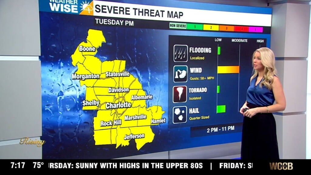
The front that will cross the area this evening will stall to our south. Most of Tuesday looks dry, but the front will lift north late Tuesday which will push rain back into the area. Showers will be numerous to widespread late Tuesday through Wednesday. This front will bring on and off rain chances to the area through the week. A stronger front will move through late Friday into early Saturday bringing rain to the Piedmont, snow likely to the mountains, gusty winds and much cooler temperatures. We wake up to low temperatures in the 20s on Sunday morning. Our 5-day rainfall totals are 1-3”.
TONIGHT:
Mostly cloudy. Low to mid 50s. Winds will be shifting 10-20 mph with gusts up to 25 mph.
TUESDAY:
Nice, but not as warm as Monday. Staying dry for most of the day with rain coverage increasing through the evening. Highs top out in the mid 60s.
WEDNESDAY:
Widespread rain. Cooler. Highs only in the low to mid 50s.
THURSDAY:
Scattered AM showers. Still below average with highs in the mid 50s.
FRIDAY:
Warmer with highs in the mid 60s. Rain increases in the evening.
WEEKEND:
Saturday AM strong cold front will push through bringing a few showers to the Piedmont, Mountain snow and a reinforcing shot of cold air. We top out near 60 on Saturday with clearing through the day. Sunday morning will be very cold with a widespread freeze. Lows bottom out in the 20s. Sunday looks dry and cold with highs in the 50s.
NOTES:
– It is severe weather preparedness week across the Carolinas. The WCCB weather team will have daily topics and information on how to stay safe when severe weather strikes here: https://www.wccbcharlotte.com/weather/
– Spring forward on Sunday morning.
Have a great week and keep your rain gear handy!
Kaitlin