Rain & Storms Continue, Much Colder Weekend
AM Headlines
- Flood Advisory for Mallard Creek near Harrisburg until 8 am
- 1-2″ of rainfall fell overnight
- Rain will pick back up after daybreak
- Wedge will keep temps much cooler Thursday
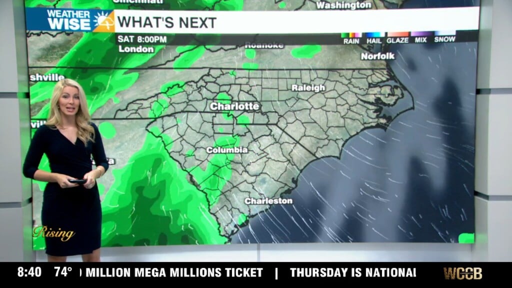
- More heavy rain late Friday-Early Saturday
- Mountain Snow Saturday Morning
- COLD weekend
Discussion
Soggy Wednesday
Heavy rain overnight has caused minor flooding after 1-2″ fell across the region. We’ll have a break from the rain through daybreak, but the morning commute will likely be messy with a thunderstorm or two near lunch time. Localized flooding could be a problem for flood prone and poor drainage areas. Rain will wrap this afternoon after a front pushed east across the area.
Thursday Wedge, Friday Night Storms
This front will stall close to the coast with a wedge building on Thursday. Light misty rain and colder temps Thursday. It will be a struggle to break out of the 40s. Temps will warm back to the mid 60s Friday ahead of yet another cold front. This could bring strong storms closer to the coast, but severe threat remains low locally outside of strong gusts.
Freezing Weekend, Mountain Snow
Temps will drop rapidly behind this boundary with temps in the 50s Saturday morning, falling to the 30s and 40s through the afternoon. We’ll likely get a quick dusting to 1″ of snow for the highest elevations. Overnight lows will to the teens and 20s Sunday morning. Temps will only warm to the low 50s during the day.
Warmer Next Week
Warmer outlook next week with temps near 70 by Tuesday. Isolated rain chances return mid-week.