Stalled Front Brings A Few Thursday Showers
Unsettled pattern continues through the weekend
Discussion:
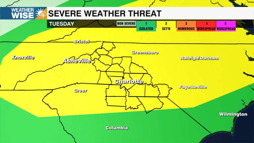
A cold front will continue to slowly meander south across the Foothills today before stalling over the Piedmont through Thursday. The severe weather risk on Wednesday will be marginal across most of the region with the risk focused on those south of I-85 on Thursday – mainly south and east of the WCCB Charlotte area. The weekend will feature a typical July pattern with scattered showers and storms.Forecast:
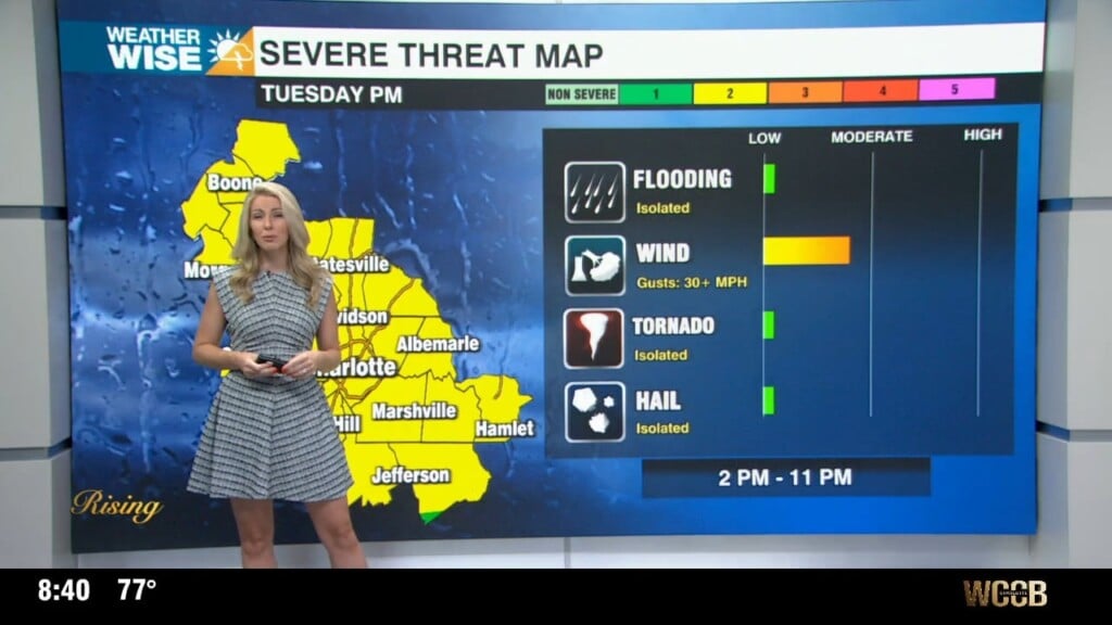
Tonight: A watch is not likely at this time, but we will continue to monitor scattered storms that have the potential to become severe. Damaging wind, localized flooding and frequent lightning are our primary threats. Lows near 70.
A cold front will continue to slowly meander south across the Foothills today before stalling over the Piedmont through Thursday. The severe weather risk on Wednesday will be marginal across most of the region with the risk focused on those south of I-85 on Thursday – mainly south and east of the WCCB Charlotte area. The weekend will feature a typical July pattern with scattered showers and storms.Forecast:
Tonight: A watch is not likely at this time, but we will continue to monitor scattered storms that have the potential to become severe. Damaging wind, localized flooding and frequent lightning are our primary threats. Lows near 70.
Thursday: Highs in the upper 80s. Scattered showers and storms, but the coverage will not be as high as Wednesday. There is a marginal risk (level 1 of 5) for those south of I-85.
Friday: Partly sunny. Highs in the mid to upper 80s. Scattered showers and storms.
Weekend: Unsettled with highs in mid to upper 80s. Scattered showers and storms.
Tropics:
Nothing to report in the tropics.
Notes:
– There are 2 more lightning fatalities to report making the 2022 total now 6 in the United States.
Have a great week!
Kaitlin